Ticker for March 26, 2014
MESONET TICKER ... MESONET TICKER ... MESONET TICKER ... MESONET TICKER ...
March 26, 2014 March 26, 2014 March 26, 2014 March 26, 2014
They're gathering the animals 2X2 in Hollis
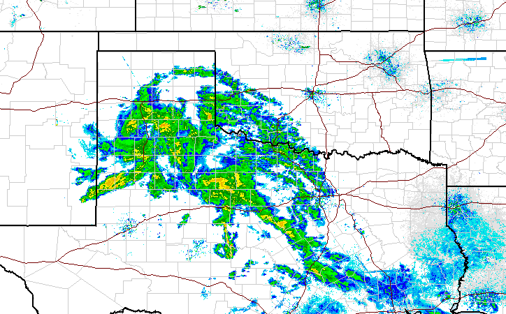
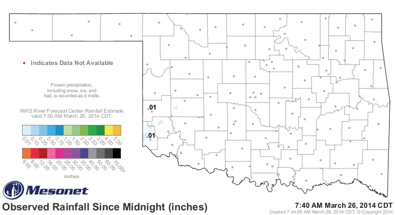
Okay, so it isn't a gully-washer, nor a toad-strangler. In fact, it hasn't even
started reaching the ground yet in most places, but Hollis and Erick have a
hundredth! But there is moisture falling from the sky out that way. Trust me!
We have to saturate those lower layers so it will stop evaporating before it
reaches the ground. I doubt it lasts 40 days and 40 nights, either. After all,
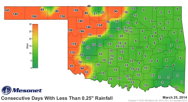
it has been at least 94 days since Altus has seen at least a quarter-inch of
rain in a single day. Folks up in the northwest are saying "that's not very
long," unfortunately, as they've seen as many as 166 days (Goodwell) go by
without that amount.
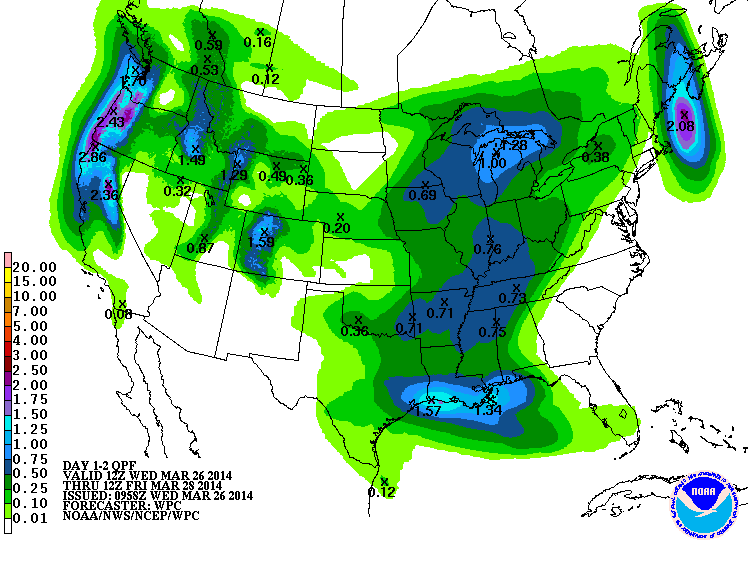
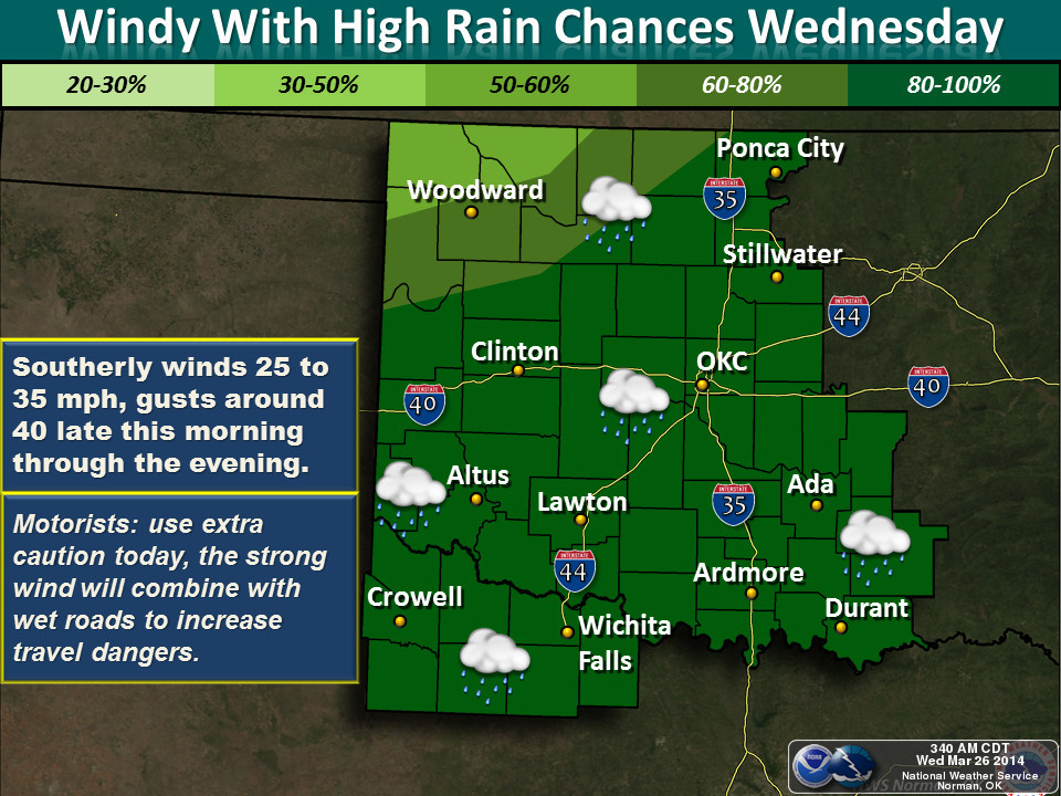
The total amount of moisture expected from this storm today and a little bit
into tomorrow ain't much, but we'll take "ain't much" right now. The next few
days after that don't exactly look wet either.
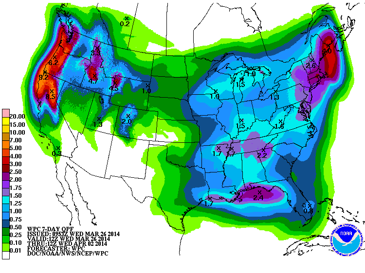
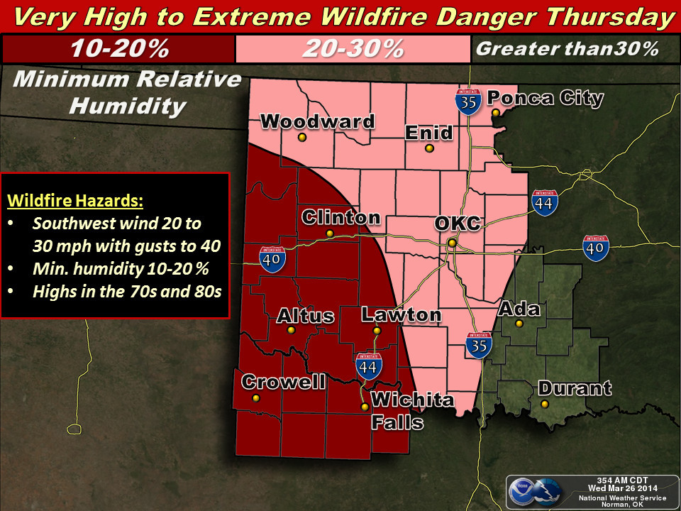
Another "unfortunately" ... after today's moisture, we're going to go right
back into high fire danger tomorrow across the western two-thirds of the state,
and the eastern third might see severe storms. Quite the grab-bag tomorrow!
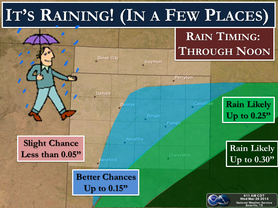
Here are some graphics from the NWS that will help us sort things out. Click
through for embiggination.
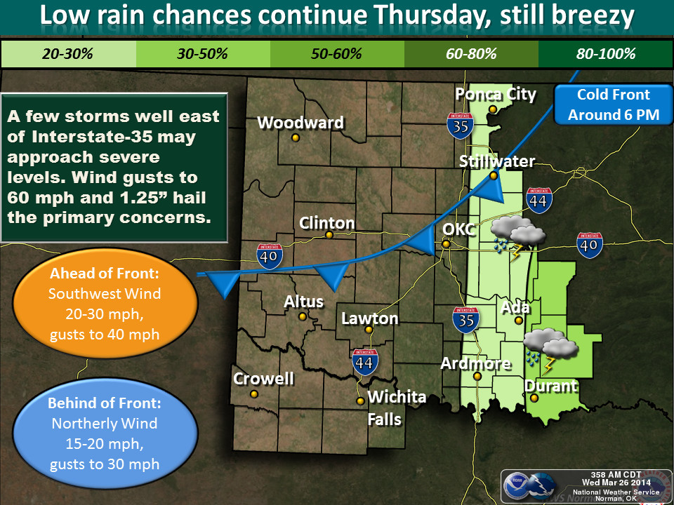
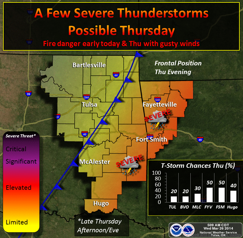
Right now it appears the main severe threat tomorrow will damaging winds and
large hail.
Enjoy the moisture today! Seriously, it's coming your way. I have radar-verified
proof!
Gary McManus
State Climatologist
Oklahoma Climatological Survey
(405) 325-2253
gmcmanus@mesonet.org
March 26 in Mesonet History
| Record | Value | Station | Year |
|---|---|---|---|
| Maximum Temperature | 100°F | HOLL | 2020 |
| Minimum Temperature | 11°F | BOIS | 2024 |
| Maximum Rainfall | 2.35″ | BYAR | 2018 |
Mesonet records begin in 1994.
Search by Date
If you're a bit off, don't worry, because just like horseshoes, “almost” counts on the Ticker website!