Ticker for December 23, 2013
MESONET TICKER ... MESONET TICKER ... MESONET TICKER ... MESONET TICKER ...
December 23, 2013 December 23, 2013 December 23, 2013 December 23, 2013
Winter Storm Tango Charlie ... the aftermath
You thought the Ticker was on Christmas break? You WISH the Ticker was on
Christmas break. Actually, the Ticker wishes it was on Christmas break somewhere
down in Florida right now
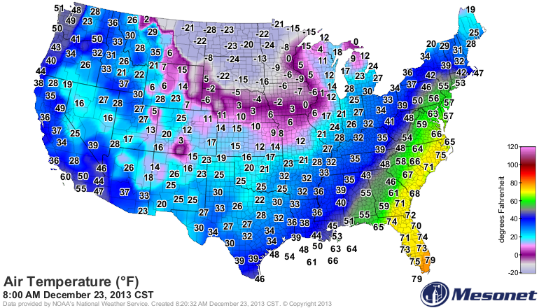
instead of this frozen wasteland out of some bad 1990s Kevin Kostner movie we're
living in now.
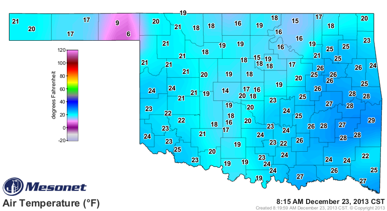
The winter storm is gone, leaving much of Oklahoma encased in ice and snow. At
least parts of the state will have a chance of a white Christmas (if you go by
the somewhat accepted criteria of at least 1" of snow on the ground Christmas
morning).
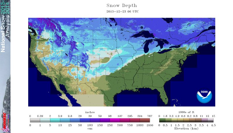
That snow depth analysis from the NWS shows 47% of the country covered by snow
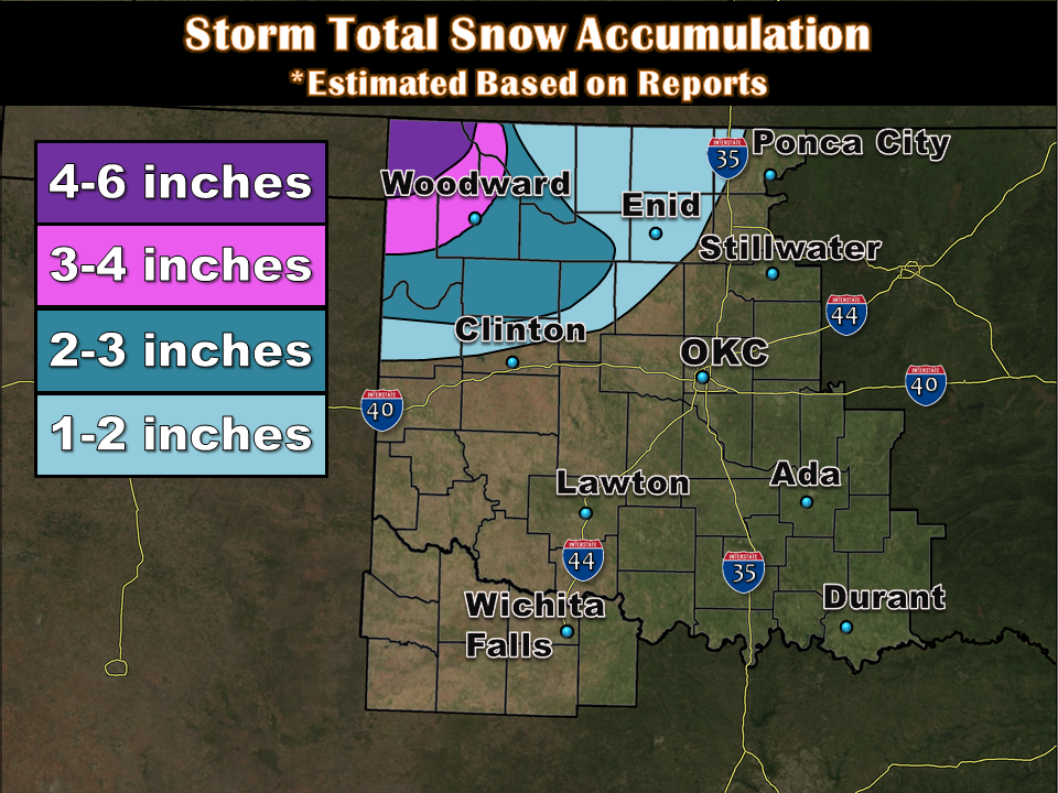
at an average depth of 3.9 inches. For Oklahoma looks like the northwestern
half of the state has from a dusting to 3-4 inches, maybe. But much more of the
state is encased in ice, at least for a bit longer, until we start to rise
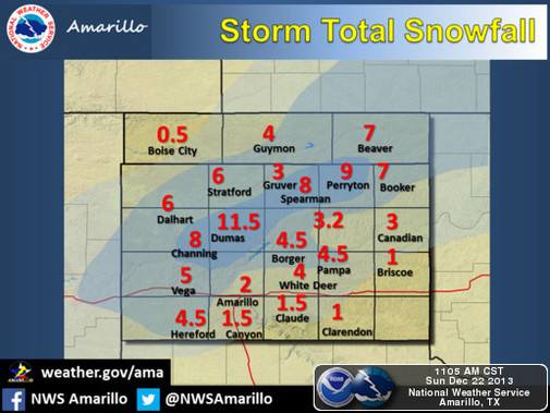
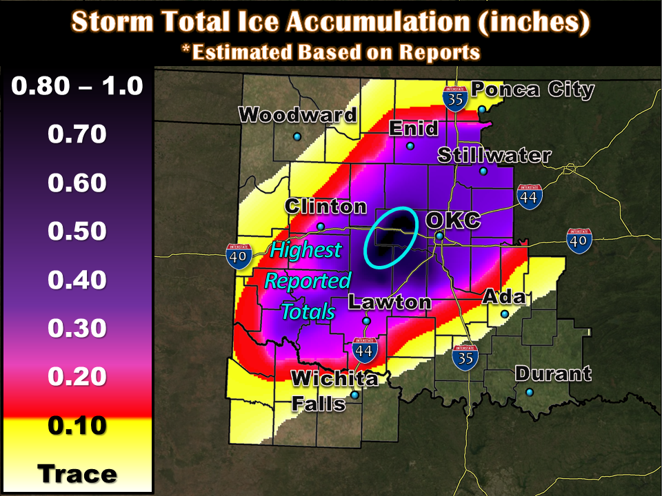
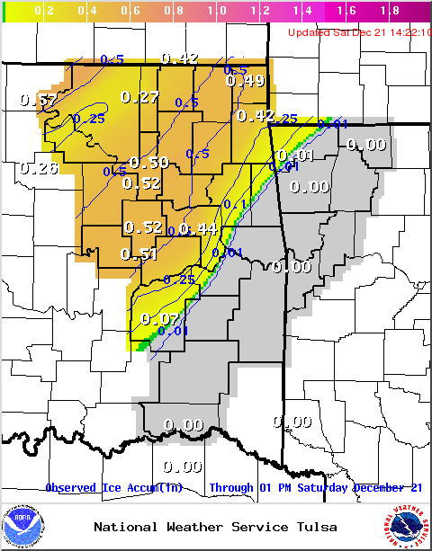
above freezing again. Here are the reports of ice (and snow) from the local
NWS offices. Some of these totals have no doubt been lost to meltage and
whatnot.
I have yet to find a complete estimate, but OG&E and PSO estimated a total of
30,000 customers without power at one point. There were undoubtedly many more
than that associated with the Electric Cooperatives scattered throughout the
state. So this was not a December 2007 type event, which had nearly 700,000
without power up and down the I-44 corridor, but it only lacked the wind to
make it so.
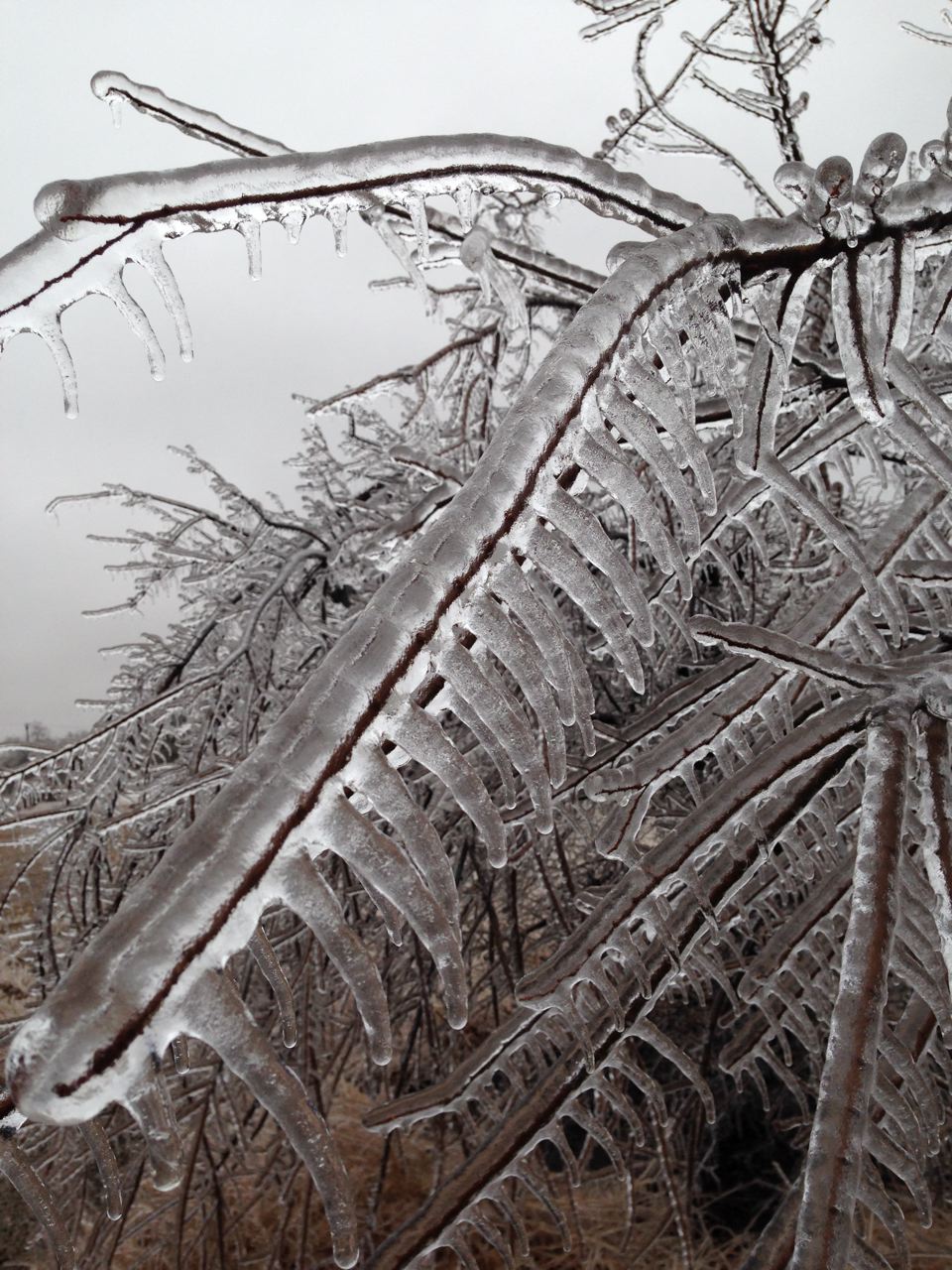
As this picture from a Ticker reader near Dibble shows, it could have been a
lot worse if the wind had picked up. That's a load of ice!
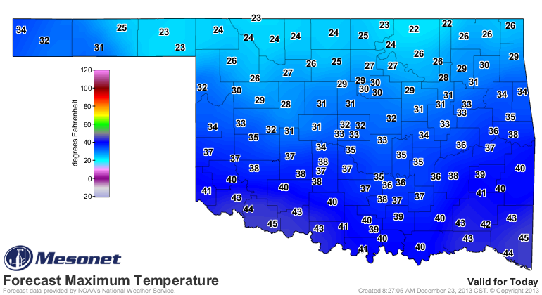
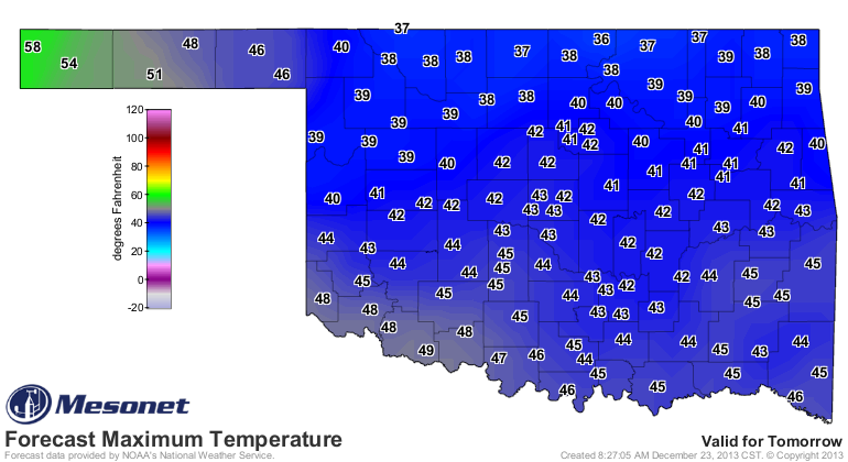
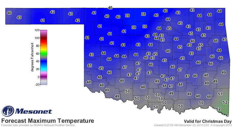
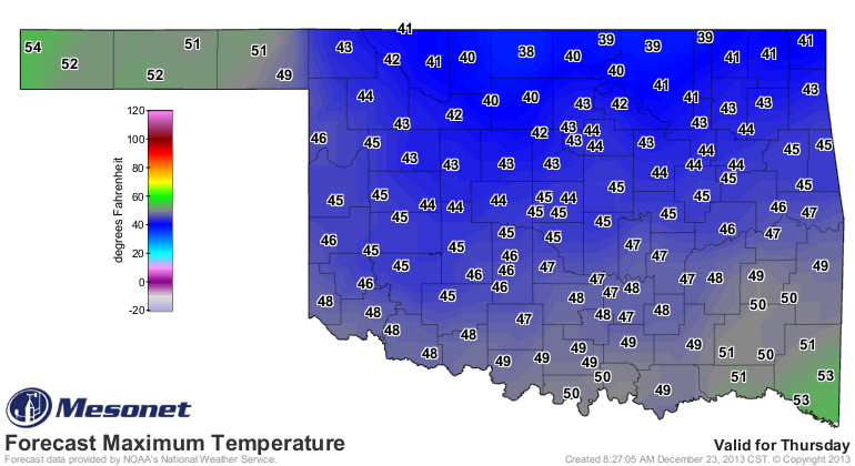
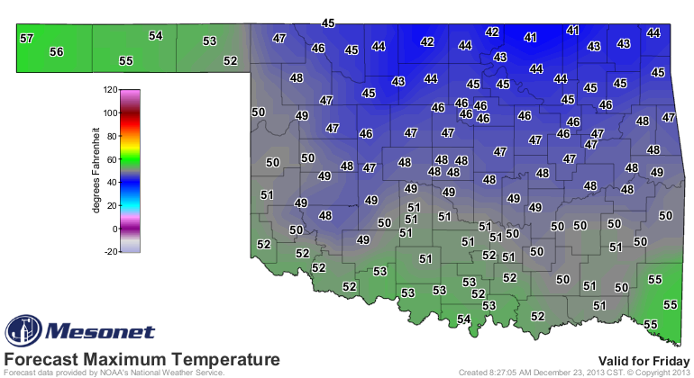
Now we await a slowwwww warm-up, which could allow those areas up north to
experience the aforementioned white Christmas. Highs over the next few days
should eventually climb into the 40s and maybe a few 50s! The warm-up starts
in the Panhandle as the shallow layer of cold air starts to pull away to the
northeast.
One good thing from this storm is the amount of moisture it contained. We're
still awaiting some melting into the Mesonet rain gauges, so ignore the printed
totals on this storm total moisture map where things have remained frozen, but
you can get a good idea of the amounts from the radar-generated fields.
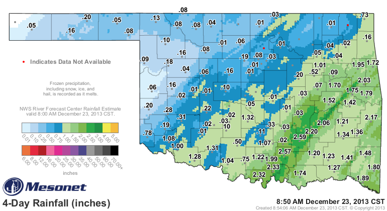
Now unfortunately, the best totals were again across eastern Oklahoma, where
it's needed, but not as much as in western Oklahoma. That area received from a
tenth of an inch to maybe three-quarters. Not bad, and Altus recorded at least
1.08 inches! Wow, a great total for that area. That will do little to help
Lake Altus-Lugert and Tom Steed, which remain at 12% and 29% of capacity,
respectively, but it will moisten that soil a bit. So the next rainstorm will
maybe run off a bit more instead of soaking in. But, they need a good "soaking
in" as well, so all is good!
The Ticker is not going to get its wish of a balmy Christmas (75 degrees,
anyone), but we have not lost our Holiday cheer. Merry Christmas to you and
yours, from the entire Ticker staff!
Gary McManus
Associate State Climatologist
Oklahoma Climatological Survey
(405) 325-2253
gmcmanus@mesonet.org
December 23 in Mesonet History
| Record | Value | Station | Year |
|---|---|---|---|
| Maximum Temperature | 85°F | ALTU | 2025 |
| Minimum Temperature | -11°F | GOOD | 2004 |
| Maximum Rainfall | 2.48 inches | IDAB | 2009 |
Mesonet records begin in 1994.
Search by Date
If you're a bit off, don't worry, because just like horseshoes, “almost” counts on the Ticker website!