Ticker for December 19, 2013
MESONET TICKER ... MESONET TICKER ... MESONET TICKER ... MESONET TICKER ...
December 19, 2013 December 19, 2013 December 19, 2013 December 19, 2013
Drought advances again in Oklahoma
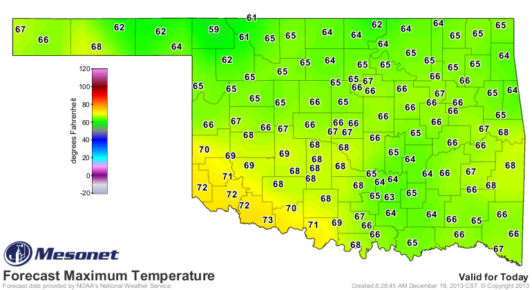
Before we get to drought, who's enjoying these lovely October-ish temperatures?
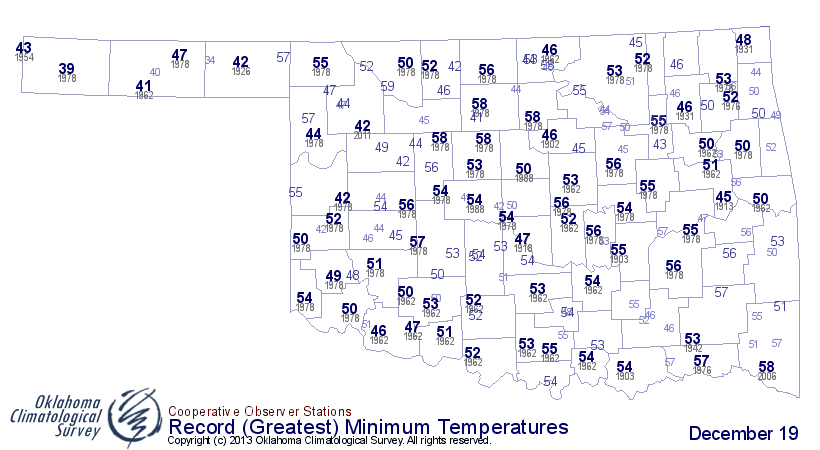
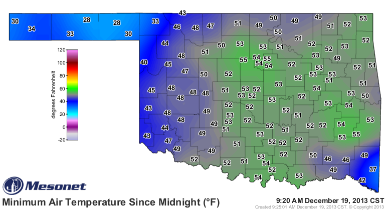
ME ME!! Minimum temps this morning were at near record levels for being so high
across much of the eastern two-thirds of the state with lots of 50s thrown around
on the map. Looks like Dec. 19, 1978, was a warm day across much of western
Oklahoma.
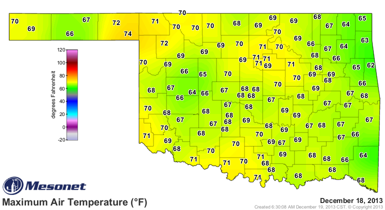
And that's after yesterday's lovely highs in the 60s and 70s.
The bottom's about to drop out (that's what's going to happen to mine with all
this holiday food popping up everywhere), so enjoy it while you can.
This moisture we are about to receive comes at a very opportune time, regardless
of the form in which it falls from the sky. Totals are looking generous, and
more importantly, generous in all the right places.
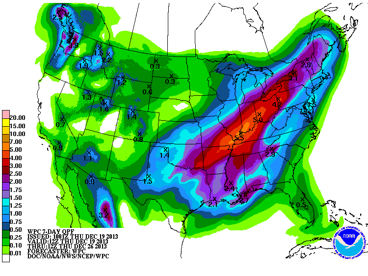
While that might be a lot of snow and ice (if things work out in that fashion),
it's also much needed, as you can see from the rainfall maps over the last 30-60
day time frame.
30-day Mesonet rainfall maps
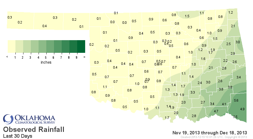
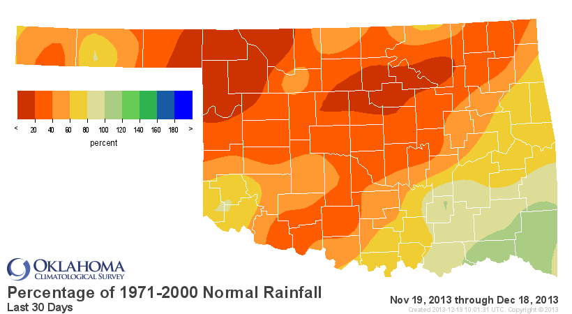
60-day Mesonet rainfall maps
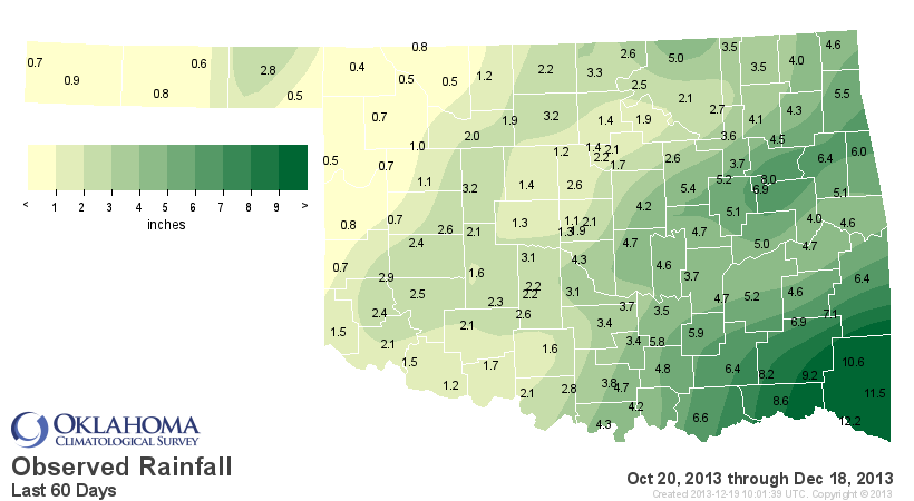
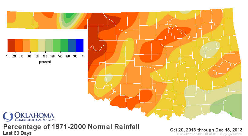
And these maps are even more telling:
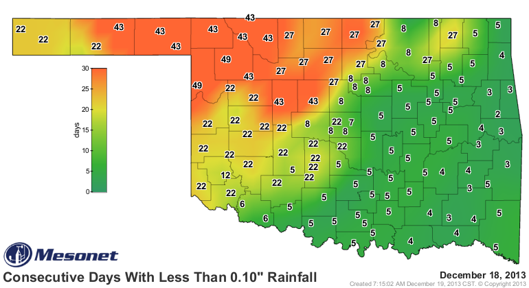
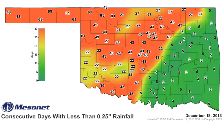
And yes, the dry times go back even further (120 days):
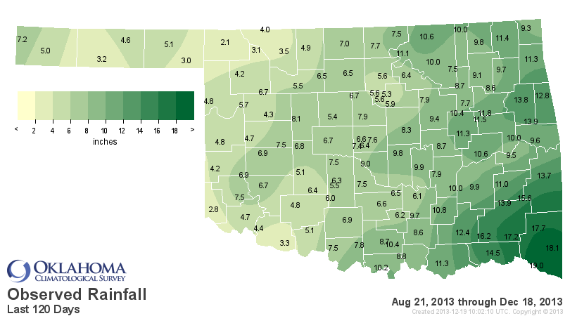
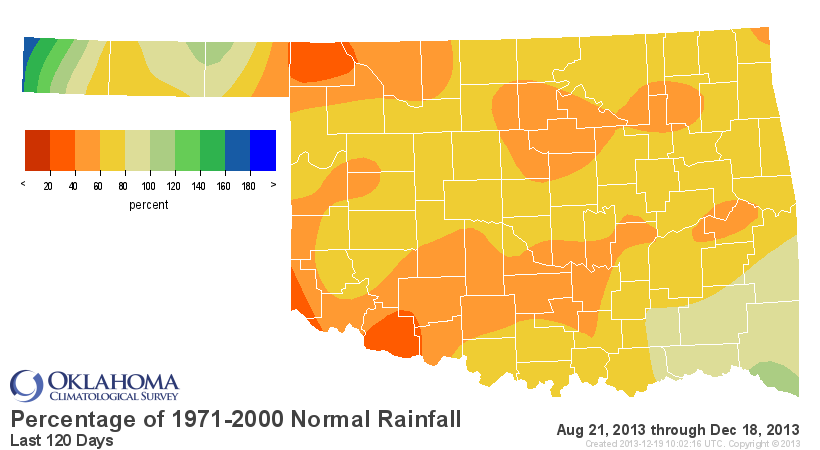
All that leads up to even more drought intensification across far western
Oklahoma, as you can see from this morning's U.S. Drought Monitor map.
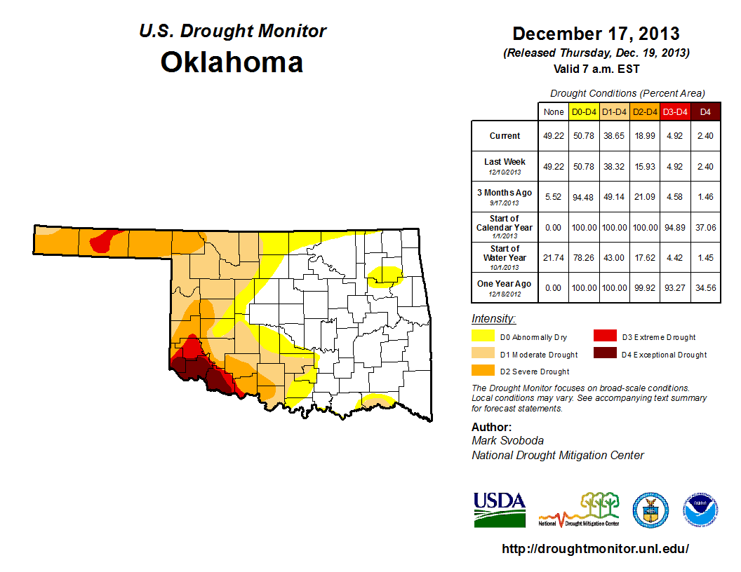
The statistics table in the upper right tells the story. The amount of the state
in drought really didn't increase much (from 38.32% in D1-D4 last week to 38.65%
this week), but the amount in that D2-Severe drought category went from 11%
to 14%. Nothing major, of course, but still an intensification (which isn't easy
to do during the cool season).
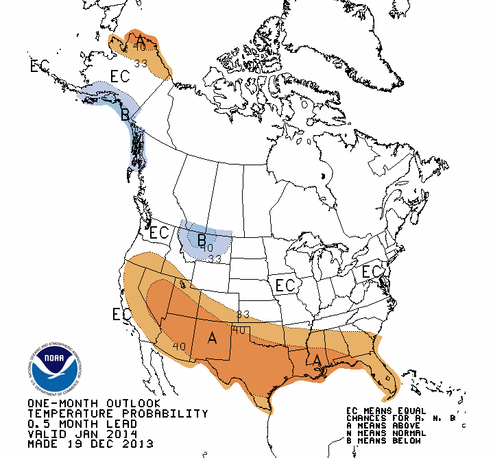
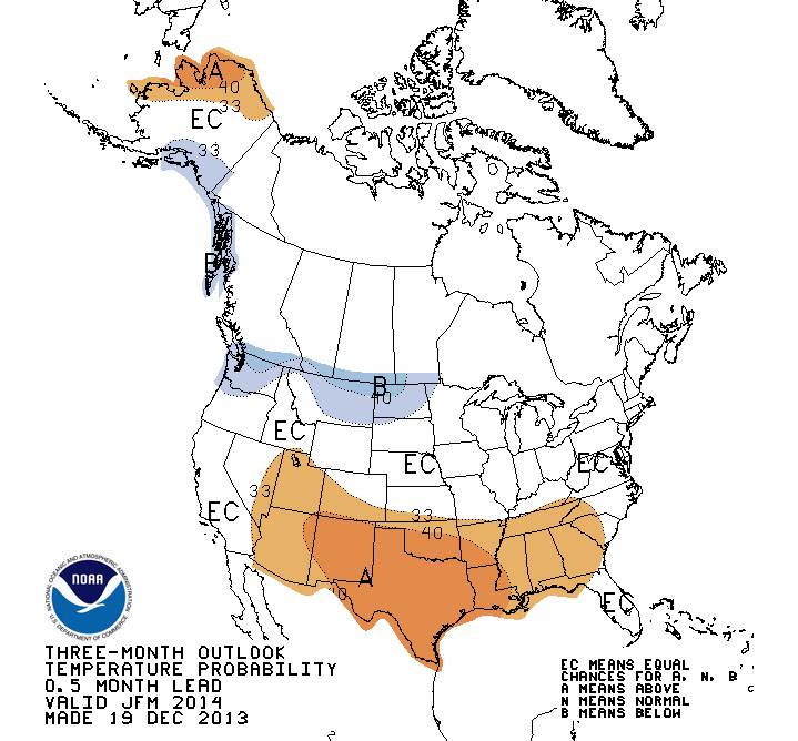
Let's look into the future for the next few months, courtesy of the NWS' Climate
Predication Center. They are still calling for increased odds of a warm January
and January-March period across the entire state.
CPC temperature outlooks
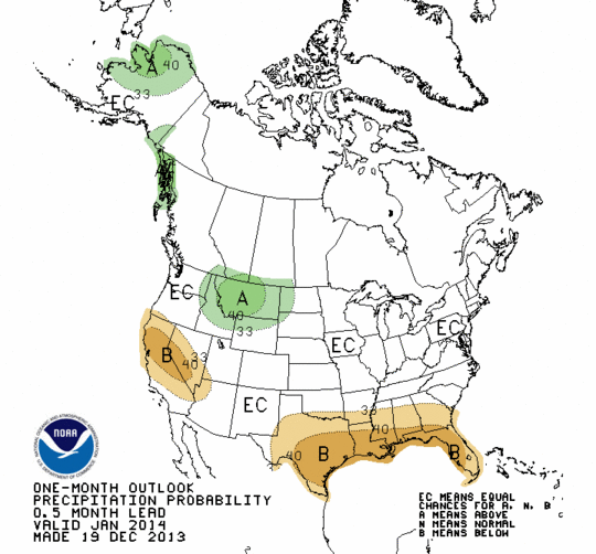
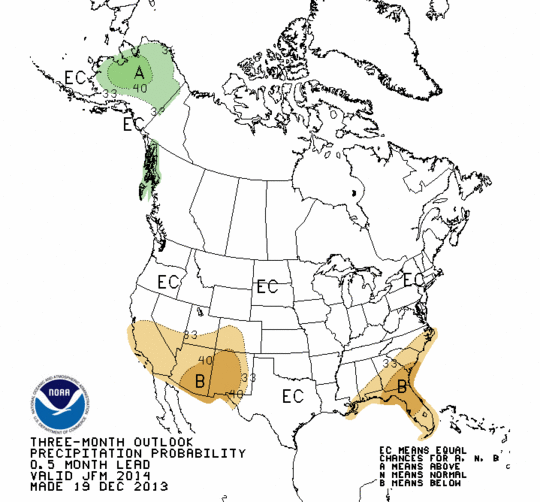
No real definite forecast with the precipitation side of things, although for
January, they do see increased odds of below normal precip across far southern
OK. Other than that, the dreaded "EC" (Equal Chances of above-, below- or near-
normal) for both maps. REMEMBER, EC IS NOT A PREDICTION OF NORMAL!
CPC Precipitation outlooks
Those maps translate into a U.S. Seasonal Drought outlook that has not changed
much, because they don't think the drought is going to change much. Meaning,
not much relief where drought is in place across the western Southern Plains,
but also not much development across the eastern either.
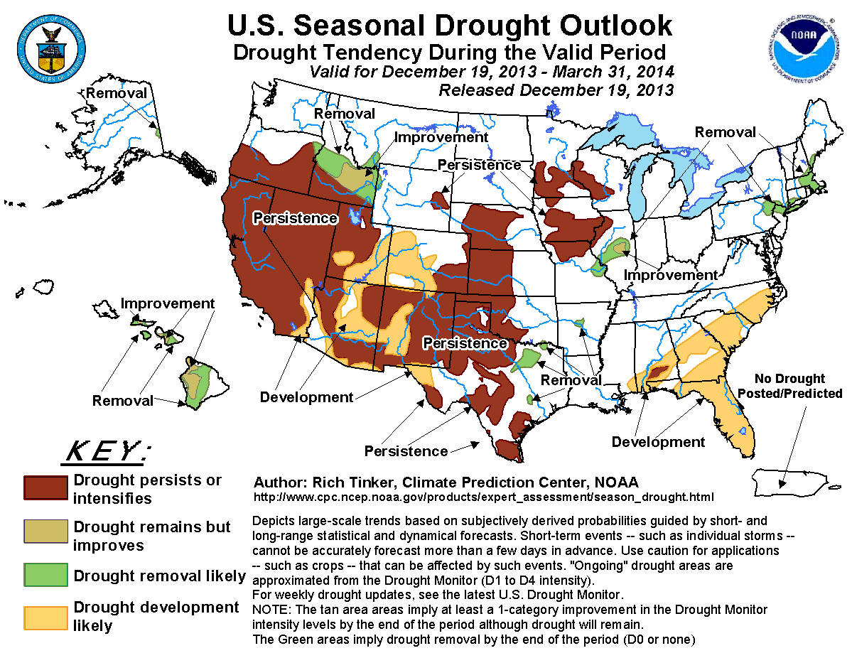
It's winter, so drought has a tough time moving one way or another without much
of the water stress more prevalent in the warm season.
Okay, I've bored you enough. Go out, be merry, and watch out for those lines
at Braum's today. One nice day left for most!
Gary McManus
Associate State Climatologist
Oklahoma Climatological Survey
(405) 325-2253
gmcmanus@mesonet.org
December 19 in Mesonet History
| Record | Value | Station | Year |
|---|---|---|---|
| Maximum Temperature | 75°F | IDAB | 2012 |
| Minimum Temperature | -10°F | EVAX | 2016 |
| Maximum Rainfall | 2.94″ | BUTL | 2006 |
Mesonet records begin in 1994.
Search by Date
If you're a bit off, don't worry, because just like horseshoes, “almost” counts on the Ticker website!