Ticker for December 17, 2013
MESONET TICKER ... MESONET TICKER ... MESONET TICKER ... MESONET TICKER ...
December 17, 2013 December 17, 2013 December 17, 2013 December 17, 2013
I pity the fool...
that doesn't get their Christmas shopping done by this weekend!
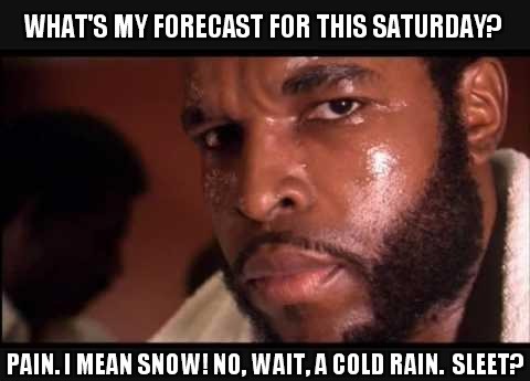
Why? Well, another arctic blast, of course. I mean, why wouldn't Mother Nature
allow a weekend around here without some sort of wintry weather? That would
mean she was a decent sort, and all that. Harrumph!
Am I poking the bear with a stick there? Maybe, but I defy any of you cold
weather aficionados to look at these high temperature forecast maps for
Wednesday and Thursday then praise the cold weather to come this weekend. Go
ahead ... I dare ya! And this was after temperatures in the 60s (and a few that
reached 70) yesterday.
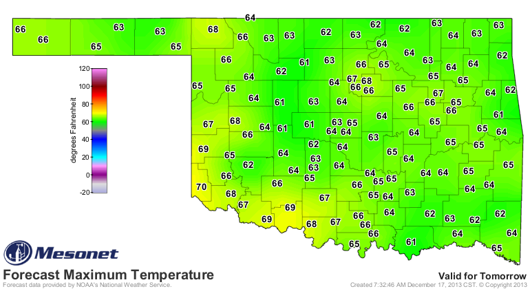
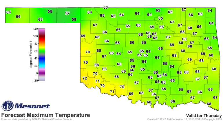
But here's the kicker about this weekend's wintry outburst ... there's still a
lot of uncertainty about what type of precipitation is going to fall, and where,
and how, and so forth and so on. The storm system that's bringing us our
pre-Christmas chill is still hanging out over the ocean near Alaska, so it's
not being sampled too well by any weather instruments just yet. The cold air
that's coming is certain, but the vertical profile of the atmosphere that
determines winter precipitation type (remember this) ...
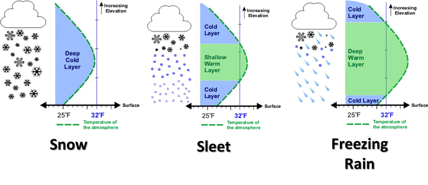
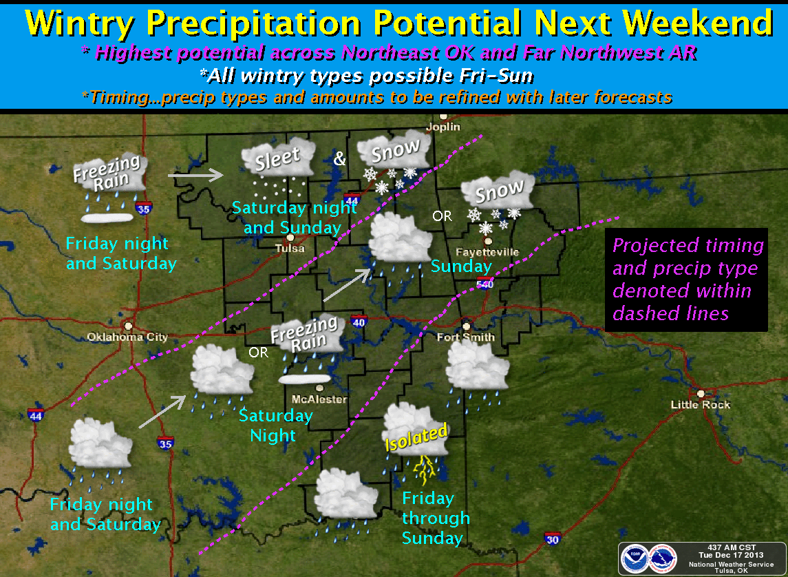
is still up in the air (get it?). Let's see how the local NWS offices are
portraying it with their computerized crayons. They're federal ... they get
the 64-count box, with sharpener!
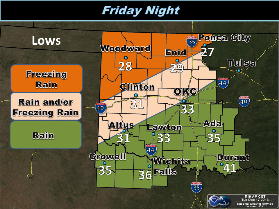
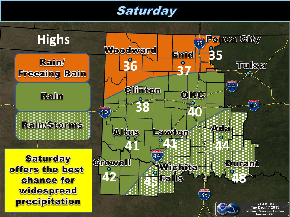
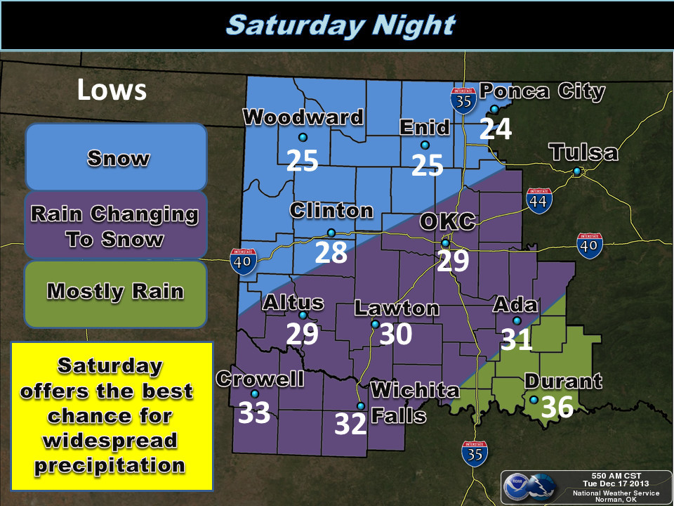
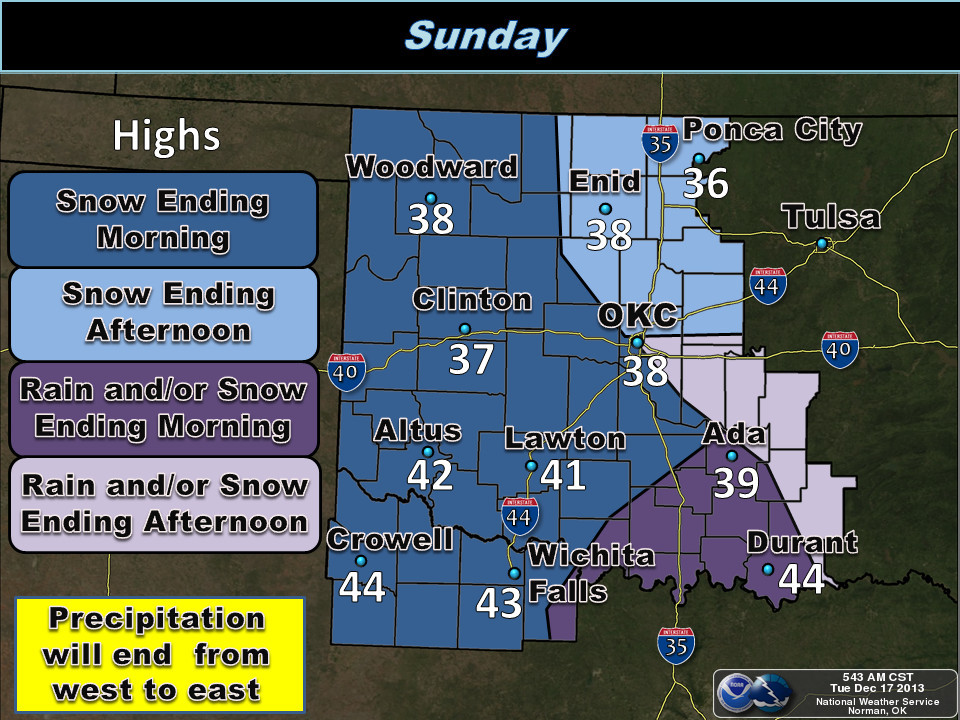
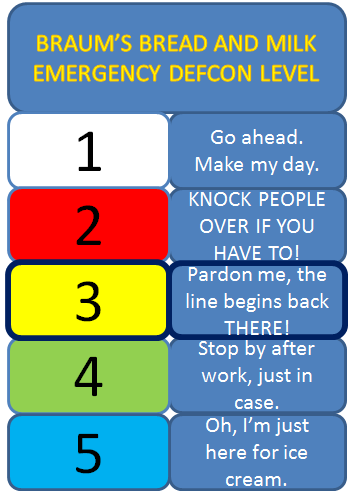
Due to all this uncertainty, we're gonna go ahead and set the Bread and Milk
Emergency DEFCON Level at DEF-BRAUM'S 3 (Pardon me, the line begins back
THERE!).
This system will apparently have plenty of moisture to work with, and if the
amounts being forecast by the WPC are correct, this could be a bounty for
water-starved western Oklahoma (remember, these are liquid amounts, but they
might not fall in the form of liquid).
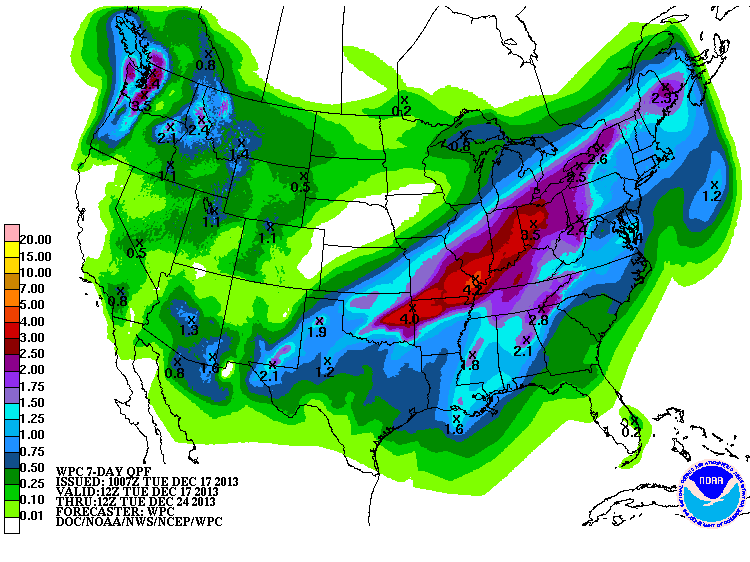
1.50-1.75 inches out across the NW? Not too shabby. Sort of horrible thinking
of that all falling as freezing rain and snow, but again, remember ...
uncertainty! As I said though, the state desperately needs moisture. I know
plenty of you are full up for awhile, but many aren't. Check out these rainfall
maps from the Mesonet tallying amounts from October 1st for example.
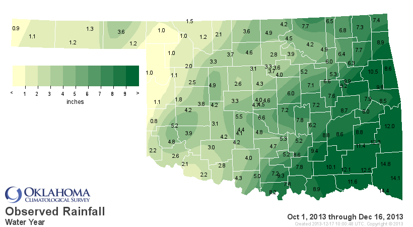
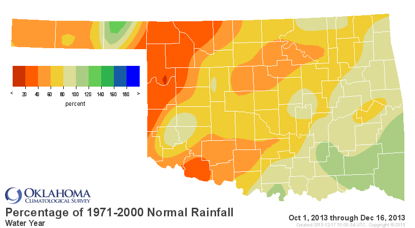
That's a statewide average of 5.38 inches for that period, malnourished by 1.86
inches, but that's also contaminated by a fairly wet SE OK. They've had an
average of 12.41 inches over that period, the 28th wettest Oct. 1-Dec. 17 on
record (since 1921). For the state as a whole ... the 39th driest.
As many faithful Ticker readers are aware, I have been using the date of August
17th as sort of a cutoff point from our wet spring/summer and when Mother
Nature became a bit more stingy with the wet stuff. The maps look even worse if
we start on that date.
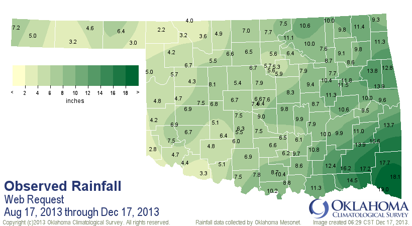
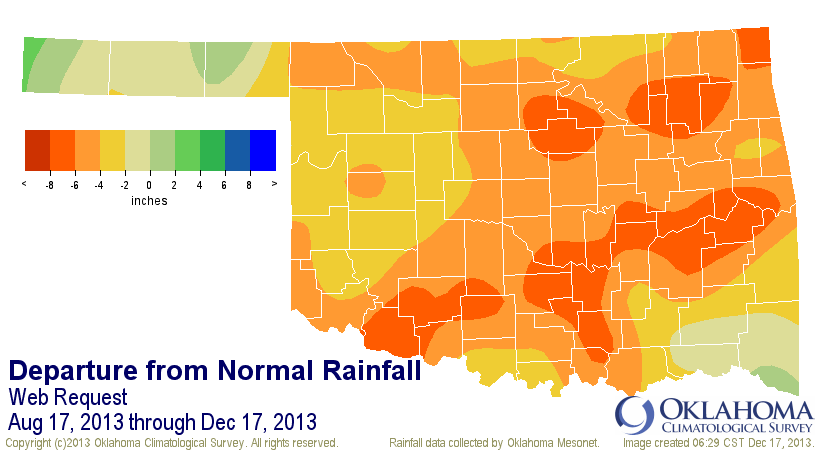
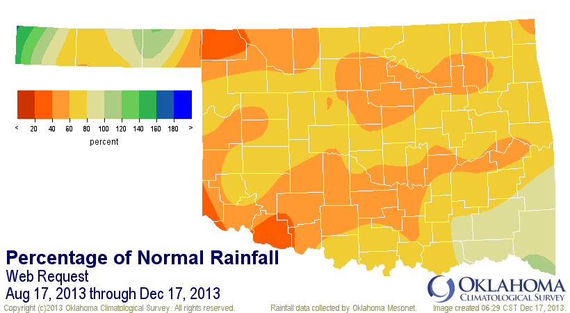
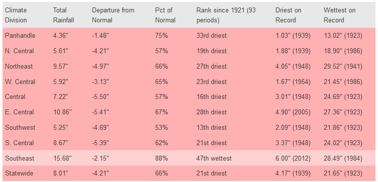
And check out the statistics from across the state. The 13th driest last 120
days or so on record for southwestern Oklahoma, which is why much of that area
is still covered by Extreme-Exceptional drought. And the statewide average of
8 inches is more than 4 inches below normal (21st driest on record).
I know! It sneaks up on ya, right?
So we're once again at that dilemma, teetering on the edge of worsening drought,
needing moisture, but having it possibly come in unwelcome forms. What else is
new for Oklahoma? So let's get this moisture in here and just deal with it,
because we need it desperately.
Eye of the tiger, man. Eye of the tiger.
Gary McManus
Associate State Climatologist
Oklahoma Climatological Survey
(405) 325-2253
gmcmanus@mesonet.org
December 17 in Mesonet History
| Record | Value | Station | Year |
|---|---|---|---|
| Maximum Temperature | 79°F | RING | 2021 |
| Minimum Temperature | -14°F | EVAX | 2016 |
| Maximum Rainfall | 3.06″ | COOK | 2021 |
Mesonet records begin in 1994.
Search by Date
If you're a bit off, don't worry, because just like horseshoes, “almost” counts on the Ticker website!