Ticker for October 10, 2013
MESONET TICKER ... MESONET TICKER ... MESONET TICKER ... MESONET TICKER ...
October 10, 2013 October 10, 2013 October 10, 2013 October 10, 2013
Drought ... give and take
This week's U.S. Drought Monitor map was a toughie, both because the rains we
had to work with were pretty streaky:
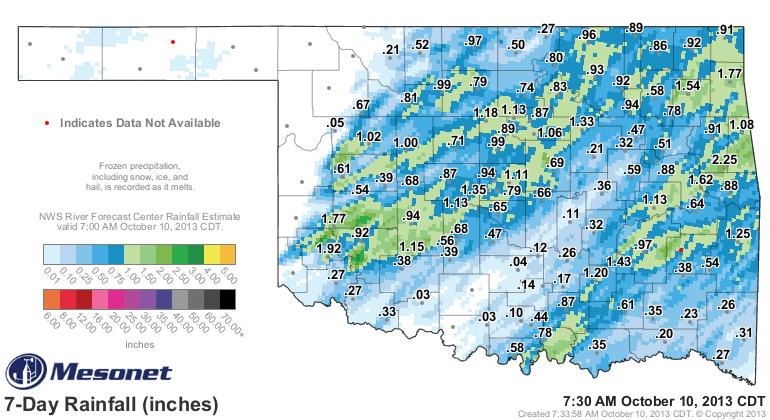
and the author this week is a federal employee dealing with Furlough Madness 2013!
Regardless, the DM process continues, and here's the map we came up with for this
week. Another note, the new Drought Monitor maps don't include the statistics
table anymore, so I've included that as well.
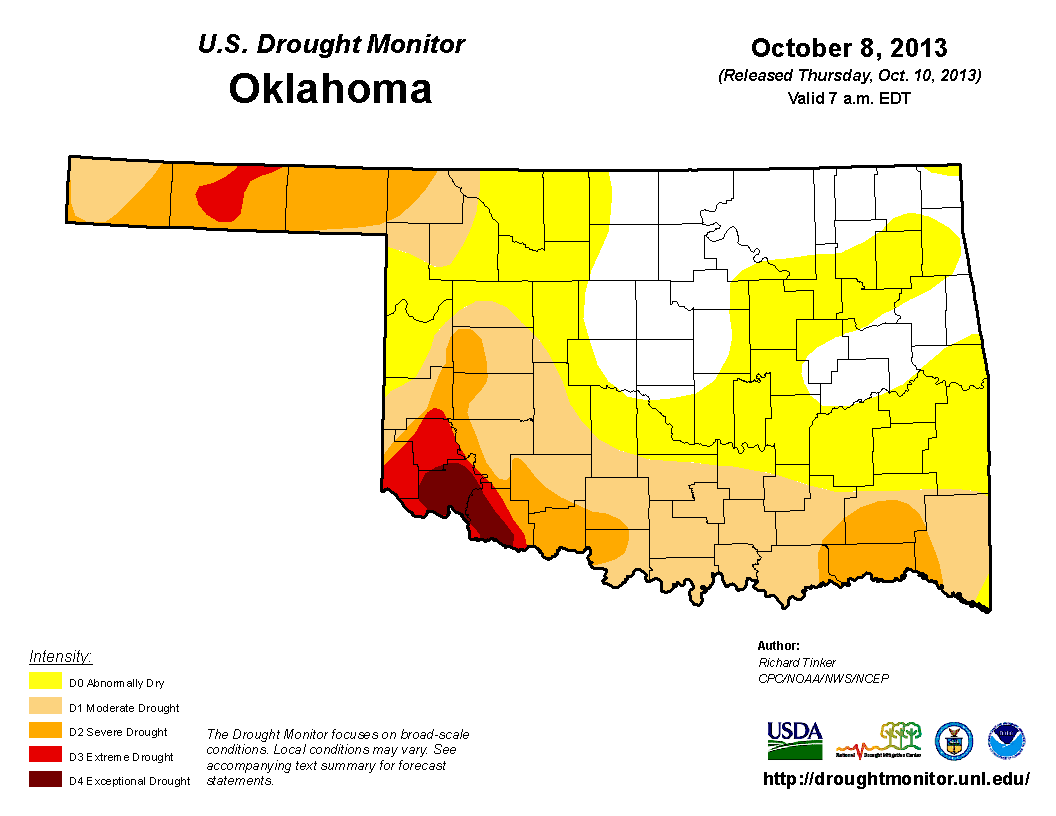

The most significant changes included a bit of a lessening across southwestern
Oklahoma around the Lawton area as well as in the northwest around Gage, but an
intensification in the southeast. We also lost a big of our D0 here and there,
but that is not an actual drought designation. So we've gone from 43% of the
state covered by at least moderate drought to 42.81%.
At that rate, we should be out of drought by March 13, 2047.
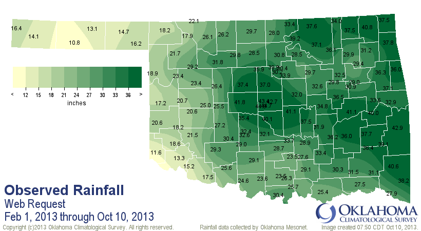
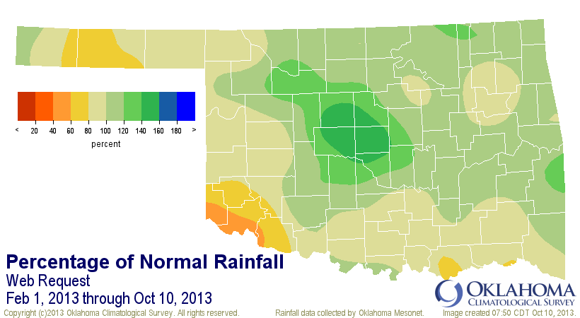
But, we have made significant progress in the last year. Remember at this time
last year we were in the grips of our driest May-December on record, a bout of
dry weather that would continue through early February 2013. Since then,
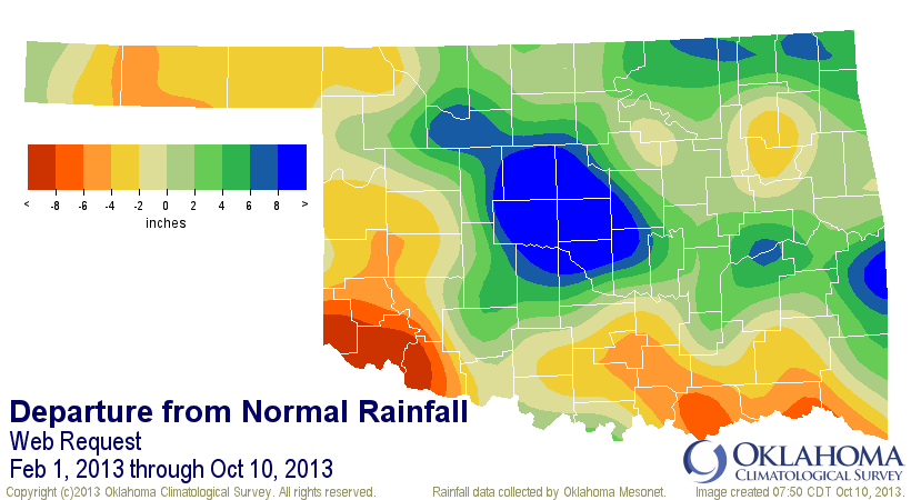
however, we have had significant relief, as you can see from these Mesonet
rainfall maps since Feb. 1, 2013.
And here's a look at the changes in the Drought Monitor map in the 2012-13
water year (Oct. 1, 2012-Sept. 30, 2013 defines that water year). Lots of 5-cat
improvements across the Great Plains, including Oklahoma. A 5-cat improvement
signifies an area going from D4 to D-nothing.
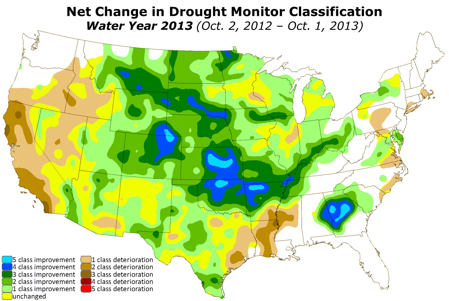
Hmmmm, odd that all the orange and yeller areas on that departure map are the
same areas that see the more significant drought continue? Nope, those regions
of the state are still missing those great rainfalls we saw through the summer
and into early fall. For southwestern Oklahoma, the drought has now stretched
on for more than three years.
We no longer need to ask when Oklahoma will see its next long-term 1930s or
1950s style drought. Unless we've suddenly ceded the Panhandle (perish the
thought!) and southwestern Oklahoma (perish that one, too) to Texas, WE ARE IN
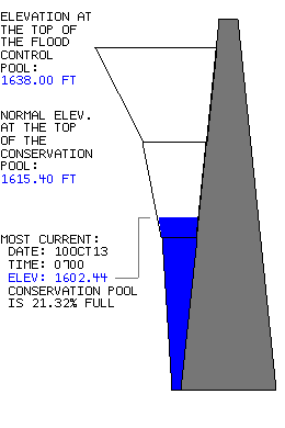
ONE NOW! Look no further than Altus, currently under a veritable water emergency
as their lakes continue to go down into dangerous territory.
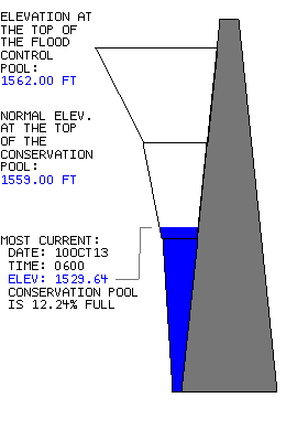
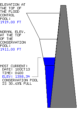
Don't worry, I still see you struggling, Canton!
The good news is that rain still looks imminent for most of the state, and it
could be a soaker!
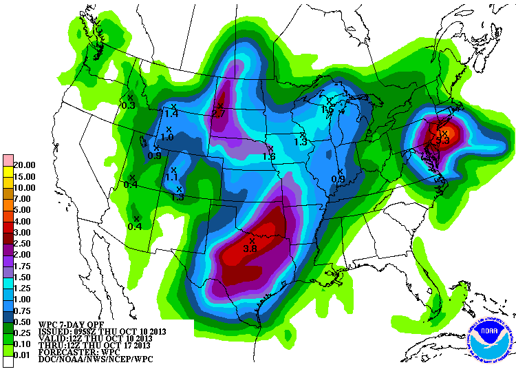
I'd say 2-4 inches across the southeastern half of the state would wipe out
some of those nasty Drought Monitor colors. A very nice start to the new
water year indeed!
Gary McManus
Associate State Climatologist
Oklahoma Climatological Survey
(405) 325-2253
gmcmanus@mesonet.org
October 10 in Mesonet History
| Record | Value | Station | Year |
|---|---|---|---|
| Maximum Temperature | 97°F | GRA2 | 2024 |
| Minimum Temperature | 21°F | BRIS | 2000 |
| Maximum Rainfall | 4.52″ | ANTL | 2004 |
Mesonet records begin in 1994.
Search by Date
If you're a bit off, don't worry, because just like horseshoes, “almost” counts on the Ticker website!