Ticker for September 25, 2013
MESONET TICKER ... MESONET TICKER ... MESONET TICKER ... MESONET TICKER ...
September 25, 2013 September 25, 2013 September 25, 2013 September 25, 2013
Looking for 32
Anytime now, we're gonna get a freeze. Probably in the Panhandle, or possibly up
in the far northeast. Or heck, maybe out around Cheyenne. Check out this map
for the date of earliest fall freeze. This is based off of the "normal" 1981-2010
data from NCDC.
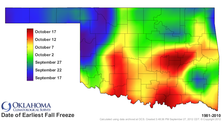
We're already past the earliest fall freeze dates for a good portion of the
northwest, and other smaller areas. You have to go out to mid-October to find the
earliest freeze down across parts of southern Oklahoma (and again, a bit to the
north of there as well). Remember, this is based off of the 1981-2010 data. The
actual earliest fall freeze in state history occurred at El Reno AND Fort Reno
back on September 13, 1902, when both those stations dropped down to 30 degrees.
The average first freeze, again based off the 1981-2010 data, is right around the
corner (if around the corner in your mind matches up to the dates on this map).
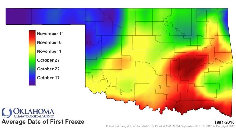
By Halloween, about half the state has had a scary encounter with the dreaded
32 degrees hobgoblin. And, per usual, if you want to stretch that out to November,
head south or east.
I think it's safe to say we've had out last 100 degree reading in the state this
year. Stranger things have happened, of course, and many of those in just the
last three years. Regardless, no triple-digits are showing up at the moment.
So here's your final tally for 2013 (probably!), and how it compared to average.
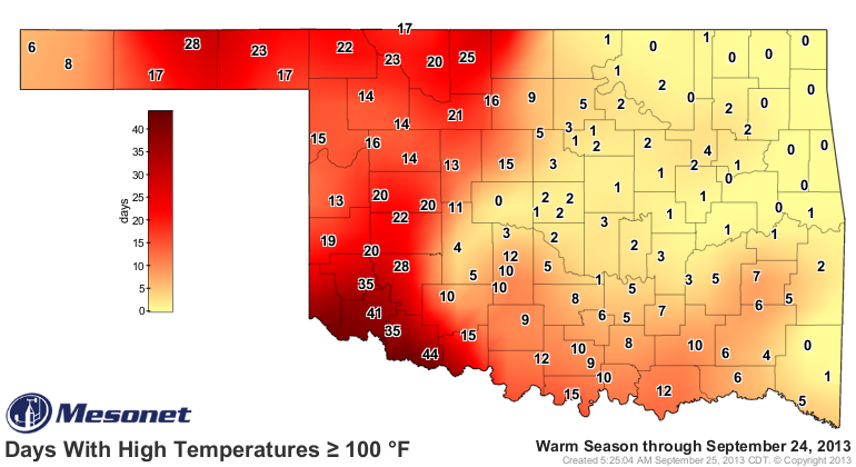
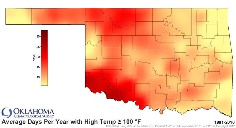
Those numbers ranged from ZERO days with triple digits with quite a few stations
across eastern Oklahoma (AND El Reno), to 44 at Grandfield. Not bad as far as
summers go, but you can definitely tell where folks got rain and where they
didn't. And to make those folks across western Oklahoma feel better, I will
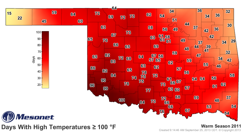
show them the 2011 map, just for comparison. The old adage held true again this
summer ... summer heat goes as the rain goes. Get rain, you will have a milder
summer. Don't and you won't. Pretty simple, usually.
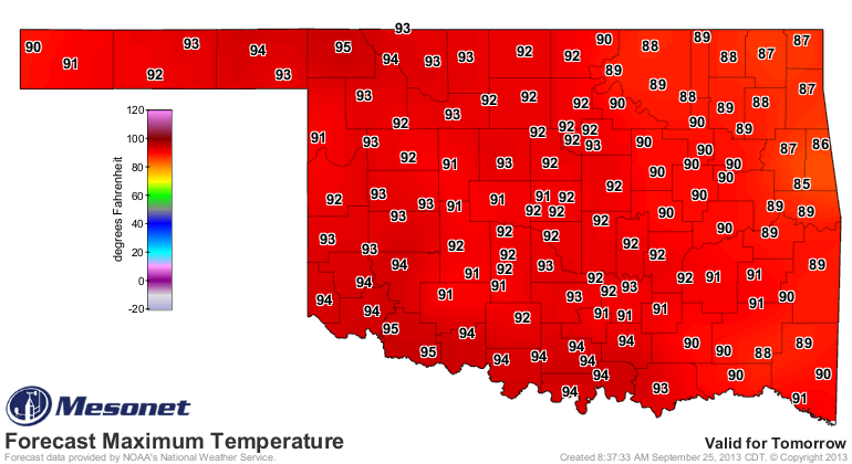
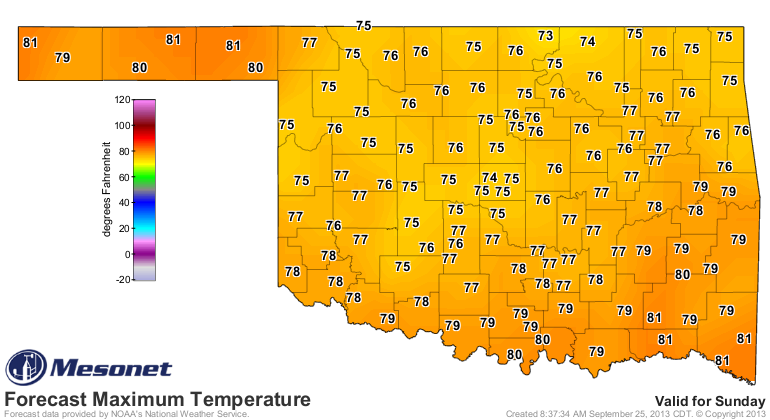
We will have a few more warm days before that cold front arrives this weekend,
bringing us some decent rains, hopefully. Heck, at this point, I'd take some
indecent rains for some parts of the state! And watch out for Thursday. It might
ruin everything I said about the triple-digit stats for this year.
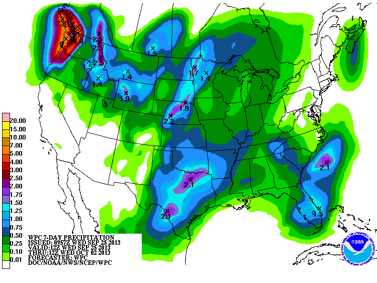
So lots of stuff still around the corner ... a cold front, some rain, the first
freeze, the first snow, the first lament for warmer weather.
Wait, I had that one already this morning!
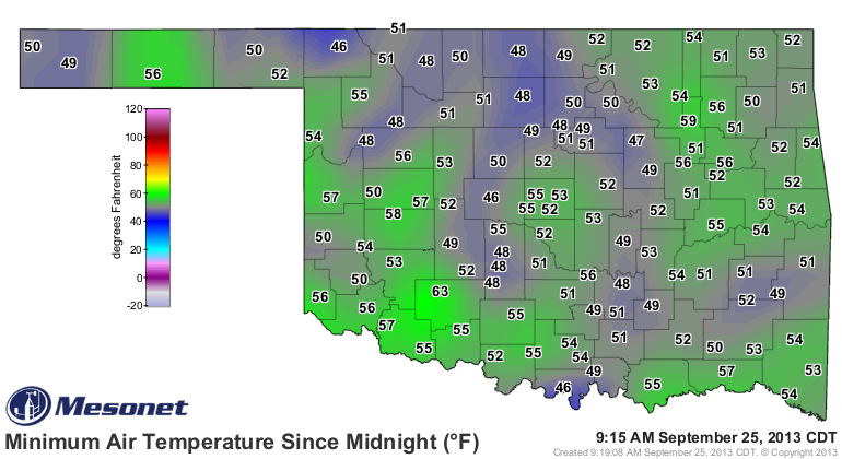
Let me be the first to say ... man, I hate winter!
Gary McManus
Associate State Climatologist
Oklahoma Climatological Survey
(405) 325-2253
gmcmanus@mesonet.org
September 25 in Mesonet History
| Record | Value | Station | Year |
|---|---|---|---|
| Maximum Temperature | 102°F | SLAP | 2020 |
| Minimum Temperature | 29°F | BOIS | 2000 |
| Maximum Rainfall | 4.95″ | TISH | 2016 |
Mesonet records begin in 1994.
Search by Date
If you're a bit off, don't worry, because just like horseshoes, “almost” counts on the Ticker website!