Ticker for September 5, 2013
MESONET TICKER ... MESONET TICKER ... MESONET TICKER ... MESONET TICKER ...
September 5, 2013 September 5, 2013 September 5, 2013 September 5, 2013
Uh oh
Yeah, that don't sound good, does it? Take a look at the new Drought Monitor map.
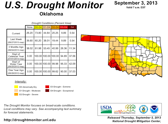
More and more color showing up in that map, and now we're up to 45% of the state
covered by drought, a rise from 38% last week. We saw moderate drought spread
across southern Oklahoma and the non-drought status of "abnormally dry" also
spread up into central Oklahoma, as well as northern Oklahoma. So the amount of
the state covered by D0 (abnormally dry) to D4 (exceptional drought) rose from
60% to 74%.
What's driving this? Well, that's obvious, I reckon, and I've been tracking the
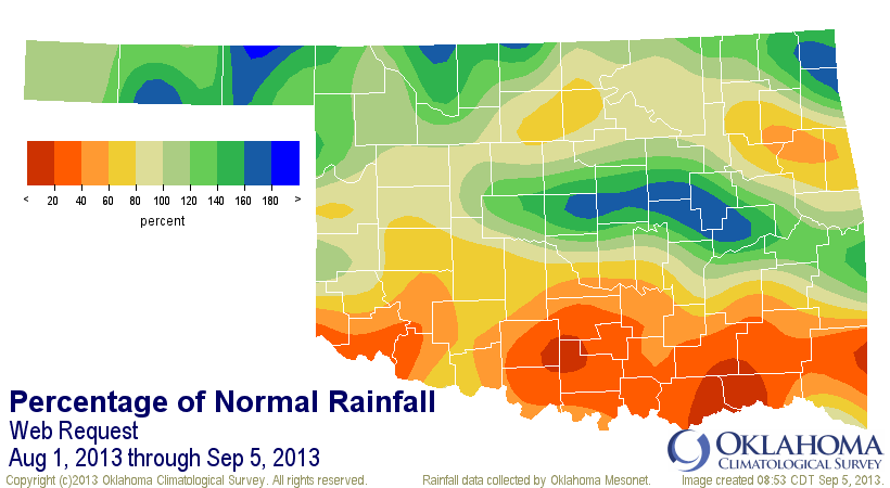
current dry spell on the Ticker. But since August 18, almost no rain has fallen
in the state.
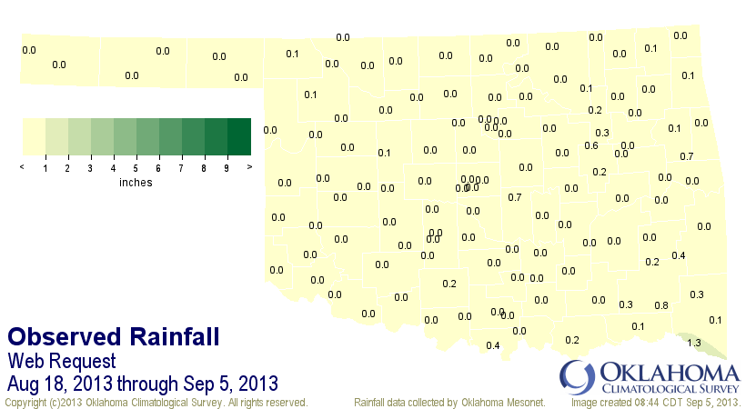
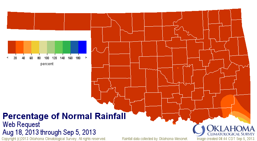
I say "almost no rain" because the statewide average for that period was 0.07",
1.81" below normal (or about 4% of normal). That's the driest August 18-September
5 since 1921. Southwestern Oklahoma has not recorded a drop of moisture during
that time.
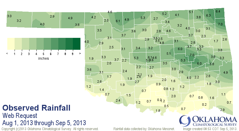
Southern Oklahoma has had a rough time even farther back, however. While the
northern two-thirds of the state was getting decent rains during the first 17
days of August, the southern third was going largely without.
Temperatures have been mostly on the hot side since the rains went away on the
18th, especially on the high temps side. The statewide average temperature
from the Mesonet since the August 18 was 80.6 degrees, 1.3 degrees above normal.
The maximum temperatures, however, averaged 93.6 degrees, 2 degrees above
normal.
So you take the sudden but extended lack of rainfall coupled with above normal
temperatures and you have the makings of a flash drought situation (i.e.,
rapidly developing drought). Now for those areas across the western third of
the state, this is not a flash drought, it's nearly the culmination of a three
year drought episode, which can trace its beginnings back to October 2010. If
we look at the 36th month period from August 2010-July 2013, southwestern
Oklahoma has had an area averaged total of about 64 inches of rain, which is
about 20 inches below normal for that three year period, and ranks as the 4th
driest since 1895.
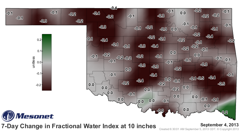
The dry conditions are starting to impact Oklahoma's soils, as shown by the
latest Mesonet soil moisture measurements.
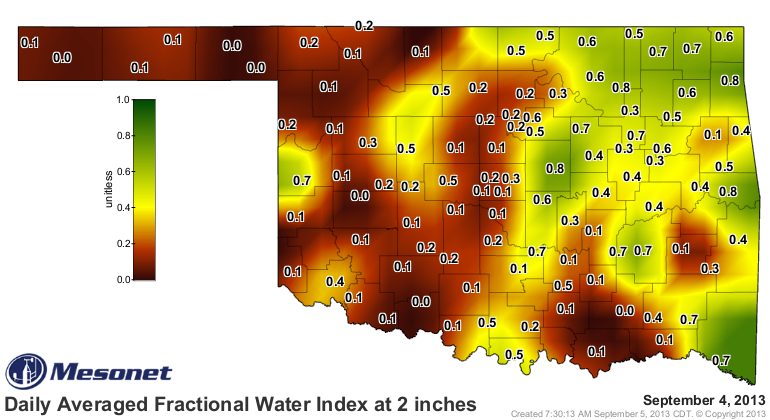
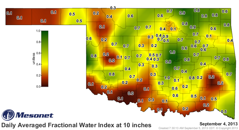
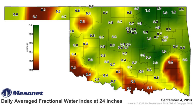
And we can see how that 10-inch soil moisture has fared just in the last week.
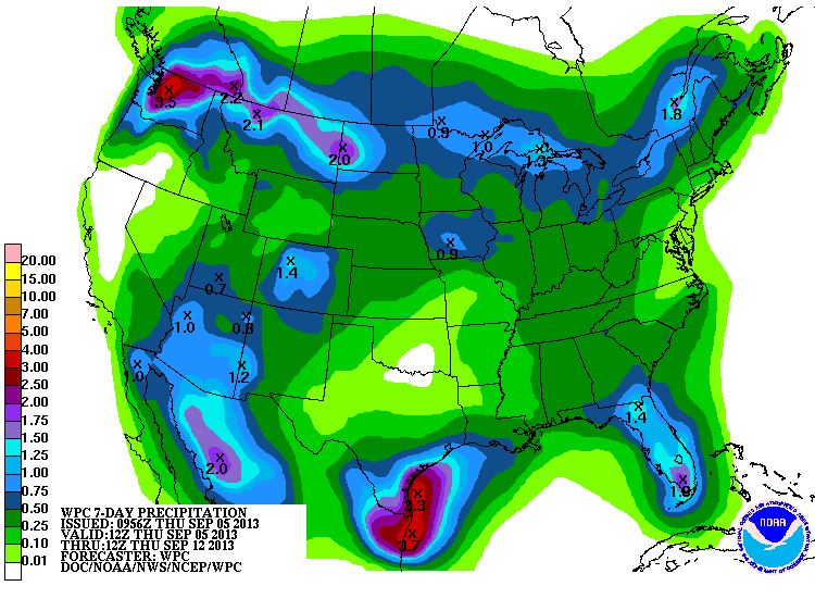
Things still look fairly dry for the next 7 days, especially for southern
Oklahoma.
So we once again are dealing with a flash drought situation, which for parts of
the state is building upon long-term drought. Mother Nature has been pretty
kind to us precipitation-wise this year, so hopefully we're looking at a flash
in the pan here.
Well, maybe "flash" wasn't the word to use there. Luckily, fall is just around
the corner (well, technically, for us weather types it began Sept. 1). With that
we'll start to see more cold fronts, more chances for rain, and less water
water stress.
I hope. If not ... UH OH!
Gary McManus
Associate State Climatologist
Oklahoma Climatological Survey
(405) 325-2253
gmcmanus@mesonet.org
September 5 in Mesonet History
| Record | Value | Station | Year |
|---|---|---|---|
| Maximum Temperature | 110°F | WALT | 1998 |
| Minimum Temperature | 43°F | BOIS | 2011 |
| Maximum Rainfall | 3.34″ | PERK | 2018 |
Mesonet records begin in 1994.
Search by Date
If you're a bit off, don't worry, because just like horseshoes, “almost” counts on the Ticker website!