Ticker for July 10, 2013
MESONET TICKER ... MESONET TICKER ... MESONET TICKER ... MESONET TICKER ...
July 10, 2013 July 10, 2013 July 10, 2013 July 10, 2013
Drought approachething?
Hey, so I make up new words. What's the big deel? Okay, sometimes I misspell too.
We talked on Monday about the lack of rainfall in the last 30 days or so (those
maps aren't getting any better).
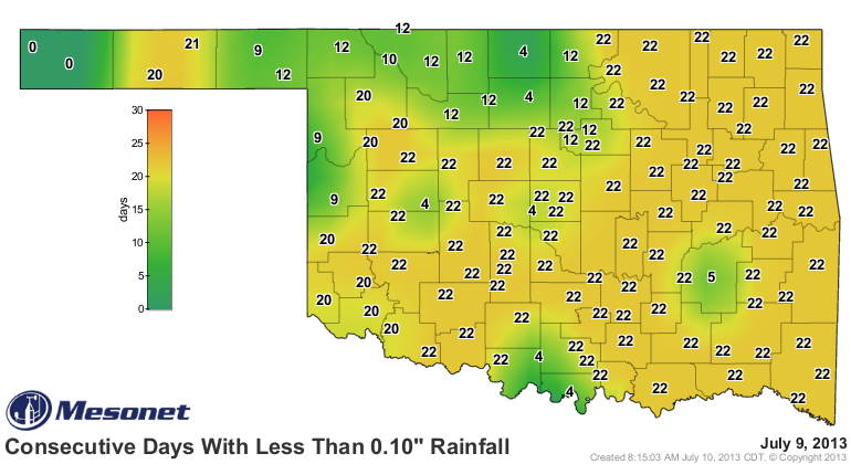
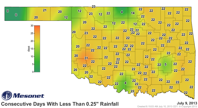
And as more and more of the June rainfall falls off the stats, the 30-day is
looking worse everyday. The statewide average since June 10 is now 1.59 inches,
2.2 inches below normal and the 9TH DRIEST such period since 1921.
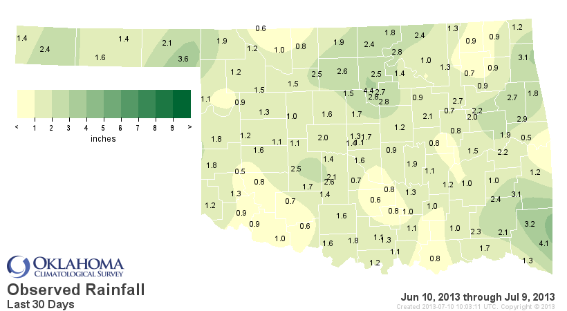
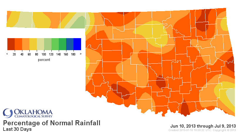
That's basically from less than 20 to around 60 percent of normal for that period
over much of the state (count your lucky stars, Slapout!). So how is that impacting
the impacts? Well, our friends at NASS have compiled the stats and we can see
the view from the field is beginning to reflect the dryness even more.
These maps of topsoil moisture from the USDA show that Oklahoma's soils are
starting to go downhill pretty fast at 64% being rated as either short or
very short.
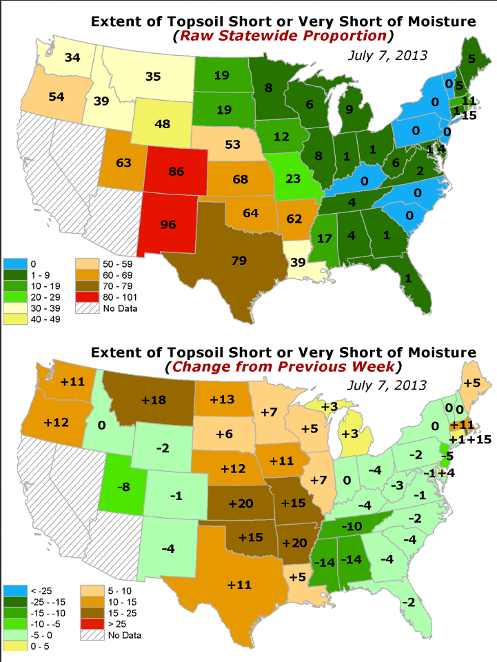
But we also have to remember we're in the middle of summer, and so some dryness
is expected. So we're not INCREDIBLY dry for this time of year at the 32nd
percentile, but we're also about 25 percentage points drier than the median.
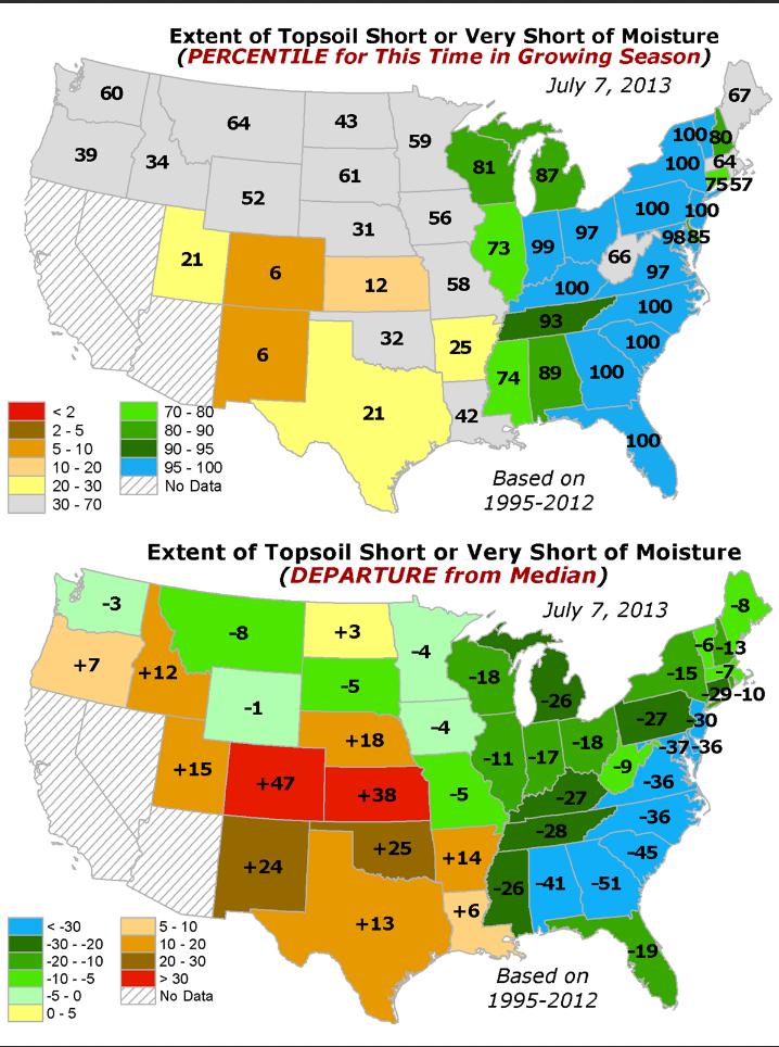
And let's not forget our subsoils are rated 63% as either short or very short,
with the remaining 37% being adequate. No surplus. That's up from 57% last week.
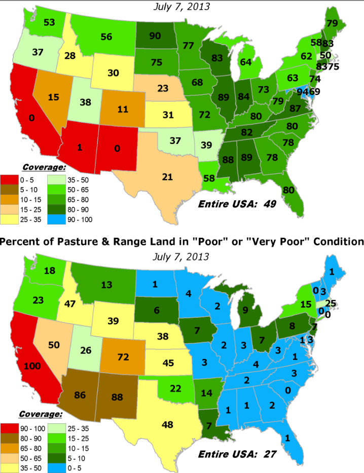
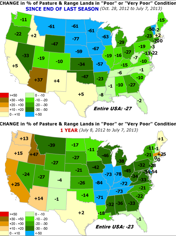
The NASS folks also tell us that the pasture and range conditions declined
again thanks to little moisture and also grasshoppers. Pasture conditions were
rated 63% very poor to fair, and 37% good to excellent. But still we are
better off than where we were last year at this time, and much better off than
when the last season ended in October 2012.
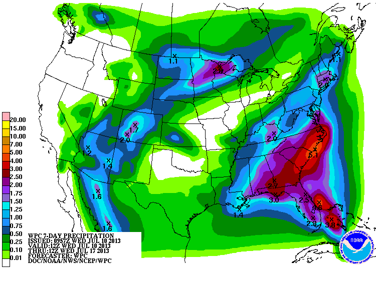
So we are keeping a keen eye on some of these indicators, and you can expect to
see dry conditions start to spread on the next few Drought Monitor maps if
rainfall does not materialize. The 7-day shows a bit of hope for minor relief,
but no drought-busting or even delaying rainfall.
Heck, I don't even need to show you a drought map. All you need to locate the
drought area is the days above 100 map.
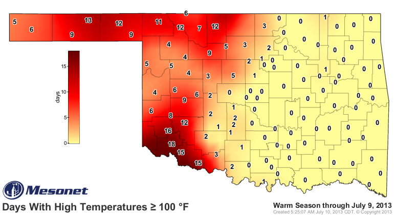
Those numbers will continue to add up out west where the dry soils are just
waiting to absorb all that heat, with little soil moisture to evaporate and
keep things a bit lower on the thermometers. Eastern areas of the state have
their own burden, however, with all that moisture creating some pretty high
heat indices.
Nothing TOO unusual going on here. It is summer after all. But for those folks
out west, the drought and heat remain on steroids.
Gary McManus
Associate State Climatologist
Oklahoma Climatological Survey
(405) 325-2253
gmcmanus@mesonet.org
July 10 in Mesonet History
| Record | Value | Station | Year |
|---|---|---|---|
| Maximum Temperature | 114°F | FREE | 2009 |
| Minimum Temperature | 55°F | EVAX | 2024 |
| Maximum Rainfall | 4.44 inches | MINC | 1996 |
Mesonet records begin in 1994.
Search by Date
If you're a bit off, don't worry, because just like horseshoes, “almost” counts on the Ticker website!