Ticker for June 27, 2013
MESONET TICKER ... MESONET TICKER ... MESONET TICKER ... MESONET TICKER ...
June 27, 2013 June 27, 2013 June 27, 2013 June 27, 2013
Drought, meet heat
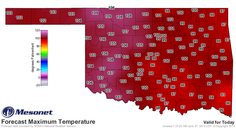
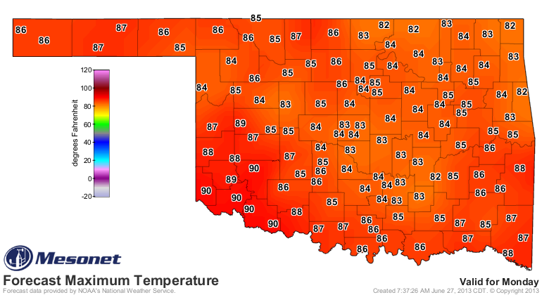
Temps are going to soar today, both the air temperatures AND the heat indices. We
have heat advisories and excessive heat warnings covering the state today. Here
are the warnings in graphics from the NWS offices.
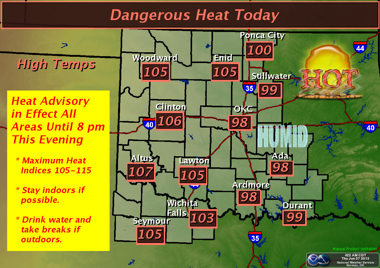
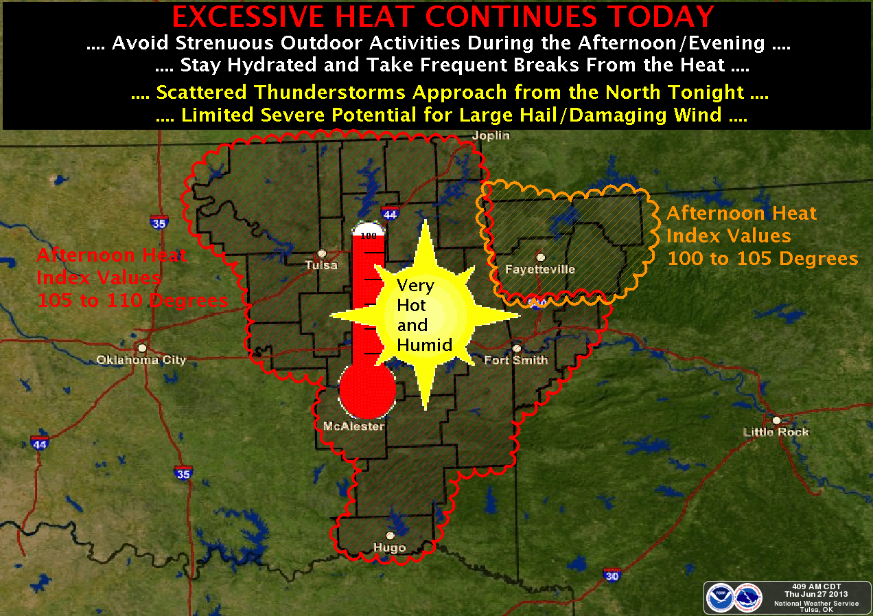
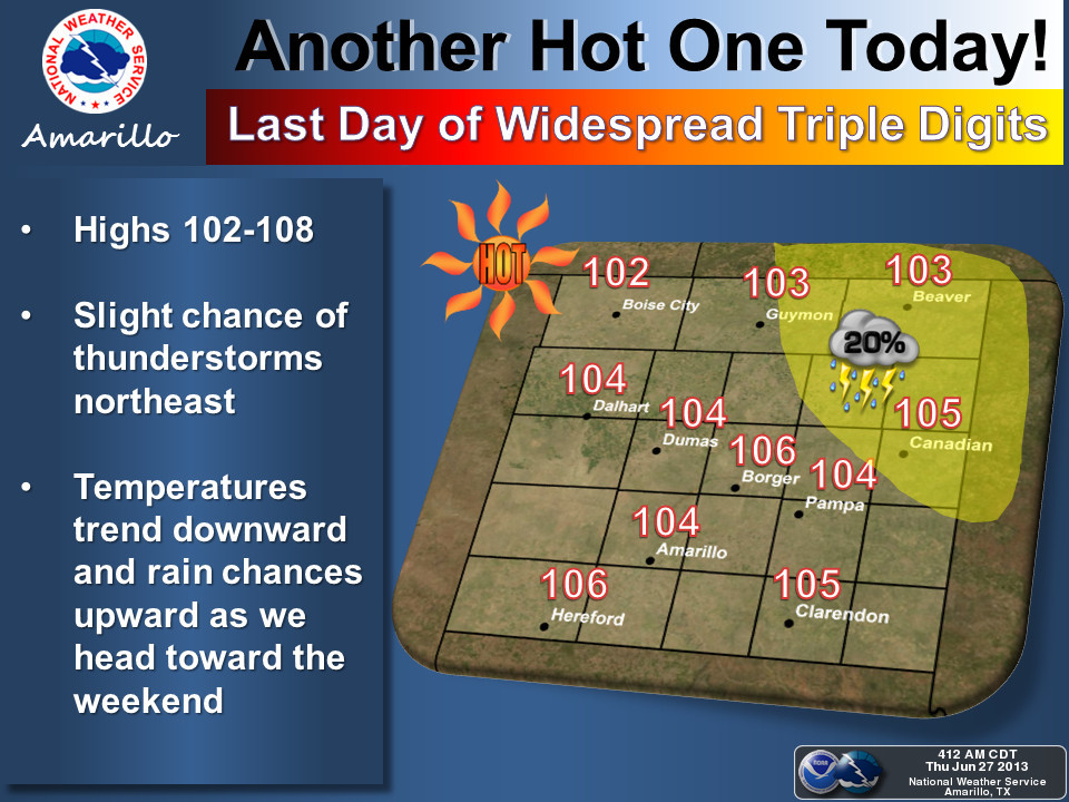
Just by air temperatures, today will prove to be the hottest since last summer.
None of this heat is going to help the drought situation out west. At least there
is a bit of rain in the forecast for the next week
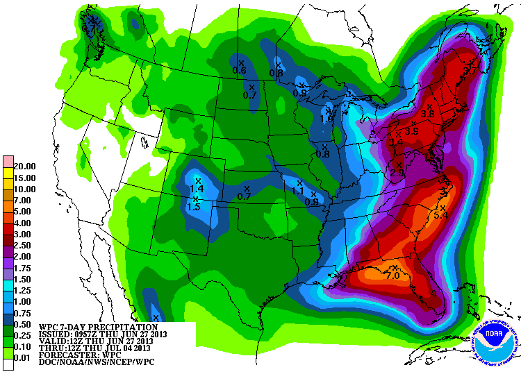
to go along with a nice cool down.
A persistent upper-level ridge over the western U.S. could keep us in a cool
pattern with northwesterly flow after that. Sorry western U.S., but we hope
this comes true!
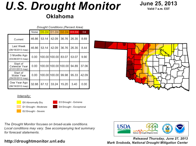
Now we didn't see much movement on the Drought Monitor ... more of a holding
pattern. However, due to reports from the field and soil moisture levels, we
did expand that D4 exceptional drought farther north up into Roger Mills
County. One ag producer remarked the soil conditions are the worst he's seen
in over 40 years out that way.
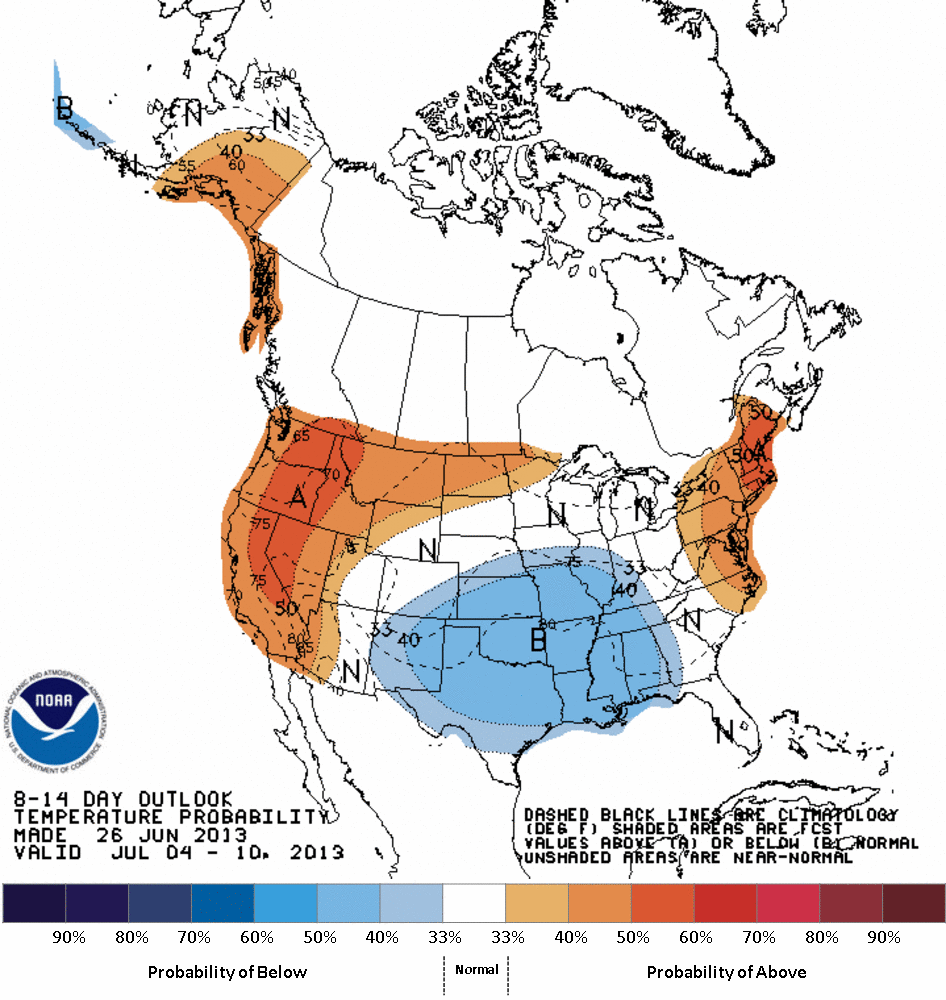
So while we often talk about "it's going to get hot in Oklahoma, there's no
stopping it," that's almost always true. The key is to keep that heat dome
shifted to the east or west from time to time. And that's what it looks like
will happen next week.
Enjoy!
Gary McManus
Associate State Climatologist
Oklahoma Climatological Survey
(405) 325-2253
gmcmanus@mesonet.org
June 27 in Mesonet History
| Record | Value | Station | Year |
|---|---|---|---|
| Maximum Temperature | 112°F | BUFF | 2012 |
| Minimum Temperature | 50°F | COOK | 2003 |
| Maximum Rainfall | 4.21 inches | KING | 2007 |
Mesonet records begin in 1994.
Search by Date
If you're a bit off, don't worry, because just like horseshoes, “almost” counts on the Ticker website!