Ticker for June 11, 2013
MESONET TICKER ... MESONET TICKER ... MESONET TICKER ... MESONET TICKER ...
June 11, 2013 June 11, 2013 June 11, 2013 June 11, 2013
The view from space
Satellites are obviously a great tool when it comes to all things weather and
climate related, including drought. The current views and findings from various
satellites continue to support our "haves vs. have nots" drought pattern across
the Southern Plains, including Oklahoma. Let's just start with the bird's eye
view of the MODIS (Moderate Resolution Imaging Spectroradiometer) view of the
western two-thirds of Oklahoma over into the High Plains area. Now I've tried
to sniff out some landmarks for ya so you can tell what's what. Mostly lakes,
and I tried to estimate the western edge of the Panhandle as well.
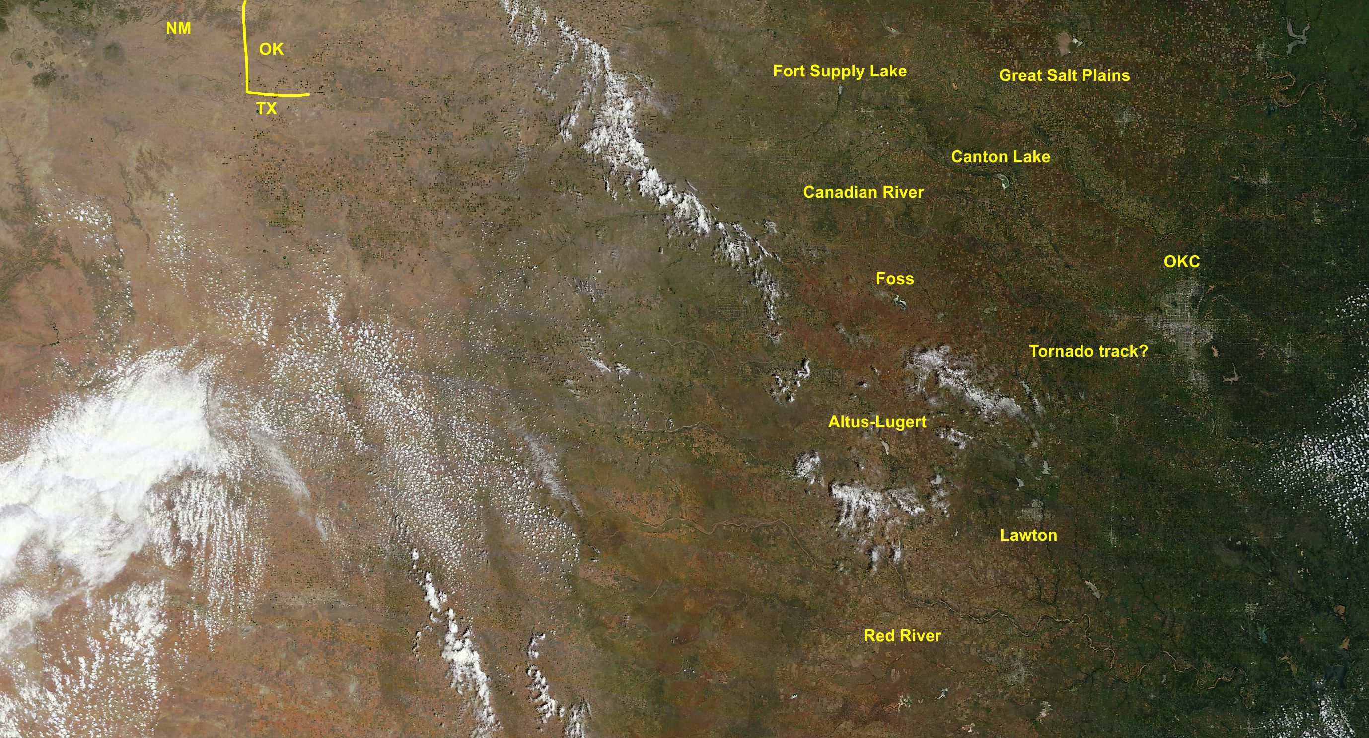
IN this image, you can see the transition from the lush greens of eastern and
central Oklahoma to the browns of western Oklahoma and the Panhandle. Now there
are still greens thrown in there across the west. The rains they were lucky
enough to receive did green things up here and there. Notice all the shoreline
visible at Canton Lake. And correct me if I'm wrong, but is that brown area from
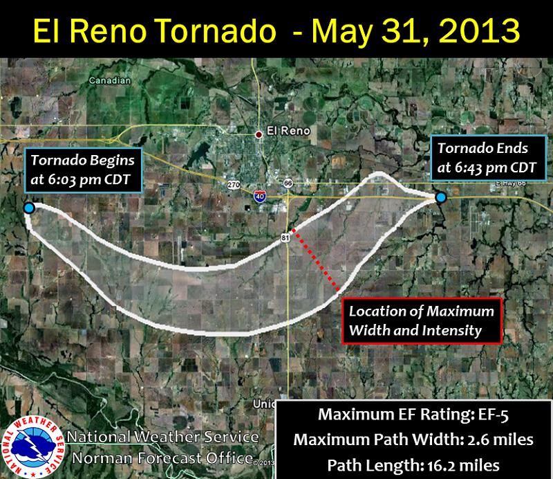
SW to E of El Reno the May 31 tornado track? You may have to zoom in.
Also notice the green dots in the Panhandles where those center pivot irrigation
systems are trying to augment the rains and keep crops alive.
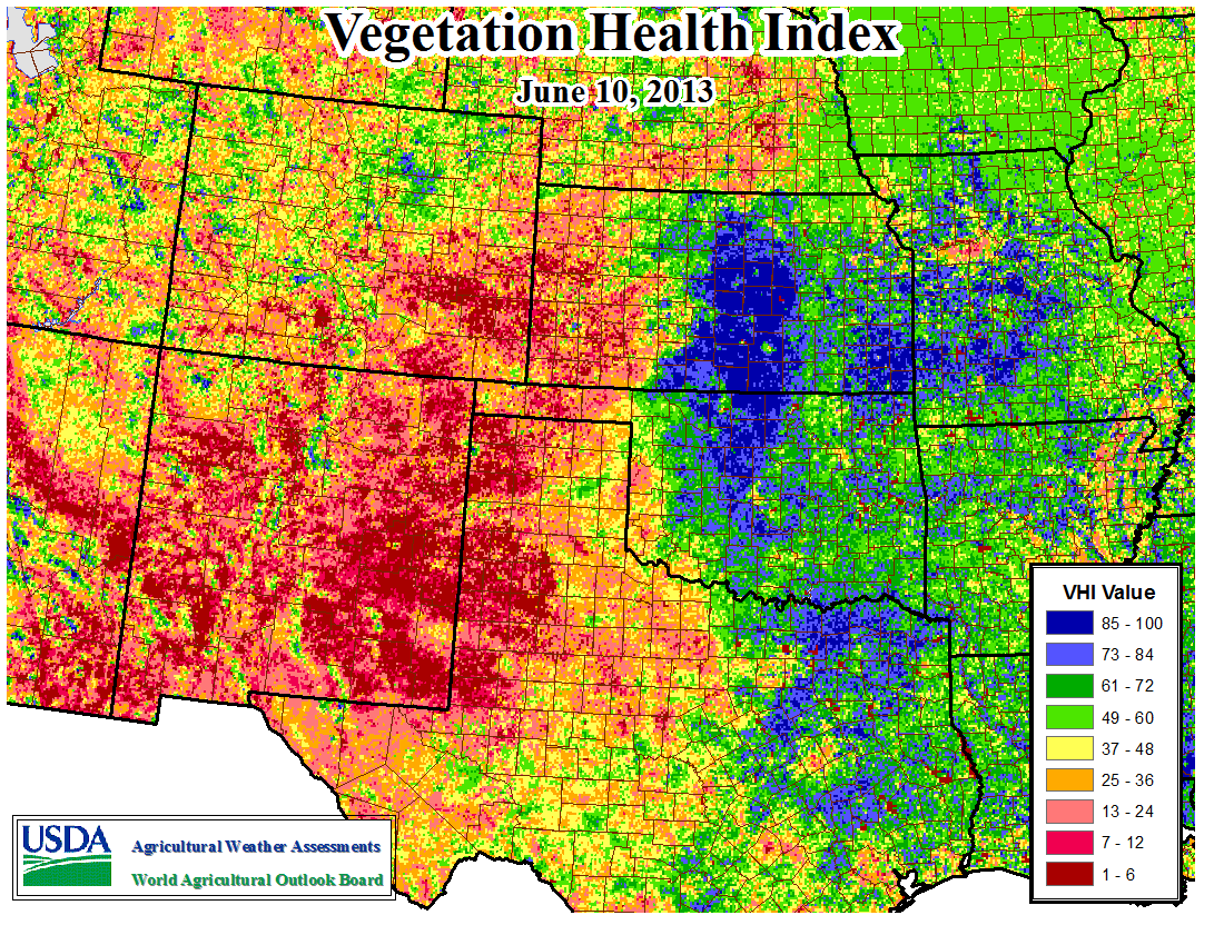
Now for the Vegetation Health Index view from the USDA. This satellite image
basically shows vegetative health (obviously!) as seen from above. Again, notice
the transition from "healthy" vegetation to the east, through the wheat belt,
to the really nasty stuff farther west.
Here's a look at the Winter Wheat Condition product, as a bonus. Things aren't
looking too good for Oklahoma according to the USDA, but it ain't looking good
for too many others either!
https://content.mesonet.org/ticker/archive/20130611/WinterWheat-Condition-06-11.pdf
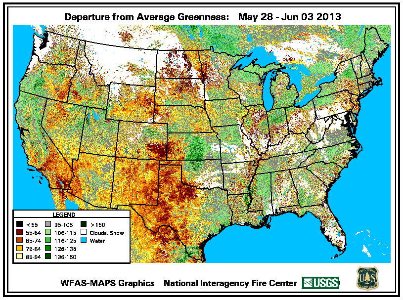
Finally, from the USGS fire weather folks, we can see how unusually green it is
across north central Oklahoma for this time of year (this image is actually
about a week old). I would guess that shows a winter wheat crop that is a
couple of weeks behind thanks to the cold weather we had from Feb-May. But
you can also see way too much red and yellow out west.
So the view from space pretty much confirms the view from ground level. Drought
intensifies quite rapidly to the west, the wheat crop has been delayed a bit,
and Canton Lake still needs water!
-------------------------------------------------------------------------------
Hot Hot Hot!
Yesterday's high temperatures were definitely a shock to the system. Those
105-ish temps in the Panhandle were near or above the record highs for June 10
out that way.
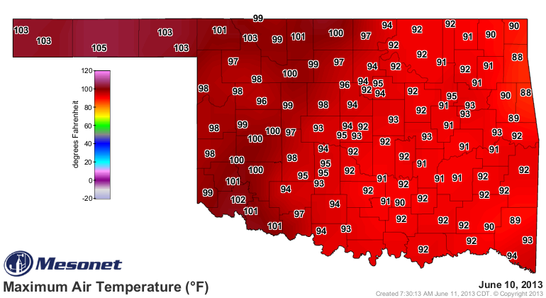
Watch out for today's highs as well. They will be nearing that record territory
out that way again.

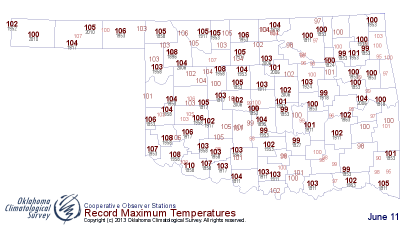
We don't need a bird's eye view of that. It's just plain hot.
Gary McManus
Associate State Climtologist
Oklahoma Climatological Survey
(405) 325-2253
gmcmanus@mesonet.org
June 11 in Mesonet History
| Record | Value | Station | Year |
|---|---|---|---|
| Maximum Temperature | 108°F | ALTU | 2022 |
| Minimum Temperature | 44°F | KENT | 2004 |
| Maximum Rainfall | 6.05 inches | COPA | 2007 |
Mesonet records begin in 1994.
Search by Date
If you're a bit off, don't worry, because just like horseshoes, “almost” counts on the Ticker website!