Ticker for March 14, 2013
MESONET TICKER ... MESONET TICKER ... MESONET TICKER ... MESONET TICKER ...
March 14, 2013 March 14, 2013 March 14, 2013 March 14, 2013
More better
Out to Goodwell to give another drought talk once again, and in honor of my trip
out here, the U.S. Drought Monitor saw fit to reduce the area's drought designation
from Exceptional (D4) to Extreme (D3). In actuality, they did so at my behest ...
not to gain favor from the locals, but from the information the locals gave me
last week. They said west of Highway 54 ... bad. East of Highway 54, not so bad.
So here's this week's U.S. DM, with those improvements as well as some across
southeastern Oklahoma.
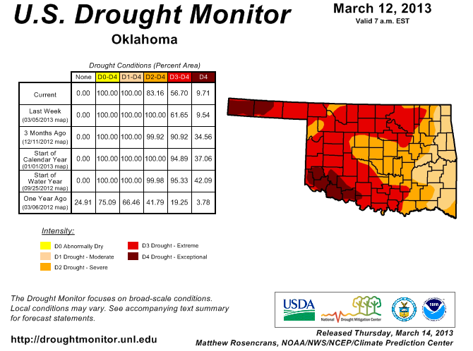
Our percentage of Extreme-Exceptional dropped from 62% to 67%, and our state now
sees a significant (17%) amount of Moderate (D1) drought for the first time since
December. Unfortunately, we saw just a tad bit of expansion of that Exceptional
drought in far southwestern Oklahoma, which has missed out on the recent relief.
The latest changes are prompted by last week's storm system that hit the northwest
and southeast after skipping much of the rest of the state.
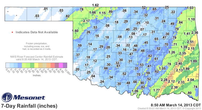
The previous improvements are mostly due to our February-forward rain and snow
events, which left us with nice rains throughout much of the state (sorry
south central, far southeast and far western Panhandle!). Here are the Feb. 1-
March 14 rainfall stats from the Mesonet.

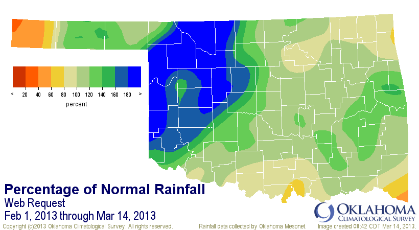
That's a statewide average total of 3.78", about 0.61" above normal, or 119%
of normal. That ranks this Feb 1-March 14 period as the 14th wettest such span
since 1921.
Now we need to keep it up. Looks fairly dry for the next 5 or 6 days, but there
is a storm system lurking a bit after that, just now starting to show up on
the 7-day rainfall forecast.
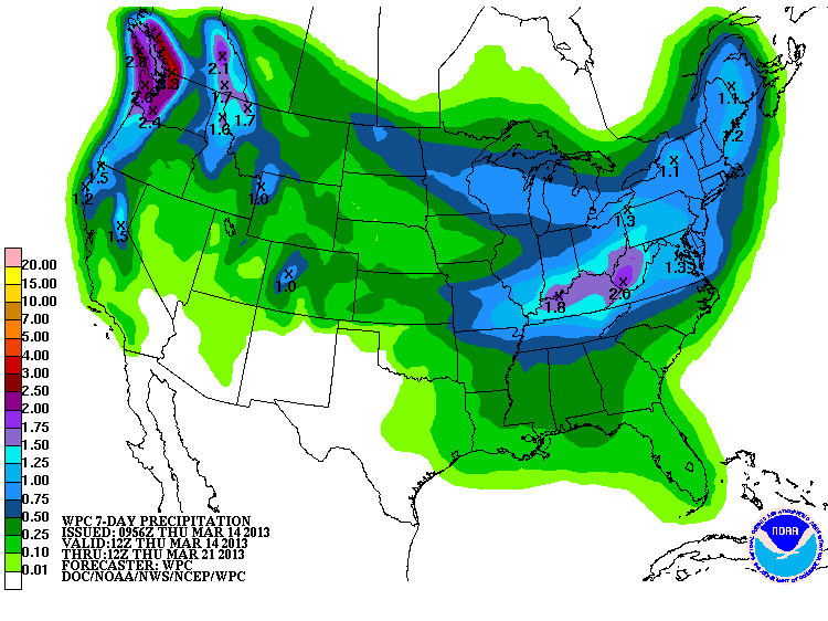
It ain't no gully-washer just yet, and it doesn't look like it will turn into
one. But it's wet, and wet is better'n dry. The best thing I can say about the
March 21-27 precipitation outlook from the CPC is, it's better to be in the
"near-normal" region than the brown "below-normal" area. We'd like to see that
green shift to the west ... maybe on today's map.
Gary McManus
Associate State Climatologist
Oklahoma Climatological Survey
(405) 325-2253
gmcmanus@mesonet.org
March 14 in Mesonet History
| Record | Value | Station | Year |
|---|---|---|---|
| Maximum Temperature | 90°F | WAUR | 2002 |
| Minimum Temperature | 10°F | HOOK | 1999 |
| Maximum Rainfall | 2.45 inches | BYAR | 2020 |
Mesonet records begin in 1994.
Search by Date
If you're a bit off, don't worry, because just like horseshoes, “almost” counts on the Ticker website!