Ticker for March 5, 2013
MESONET TICKER ... MESONET TICKER ... MESONET TICKER ... MESONET TICKER ...
March 5, 2013 March 5, 2013 March 5, 2013 March 5, 2013
Rodgers and Hammered
OOOOk-lahoma, where the wind comes and knocks your fence down, turns over your
trashcans and generally makes your life miserable. Now THERE is a musical! I had
no idea it was going to get so windy last night. What does that have to do with
drought?? In actuality, I like to keep myself in blissful ignorance of the weather
unless we're talking a week out. But yes, it was windy last night following the
passage of a cold front. Winds gusted to over 60 mph at our Medicine Park Mesonet
site, and generally from 40-50 mph across the western half of Oklahoma.
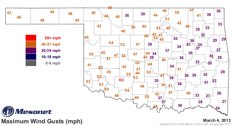
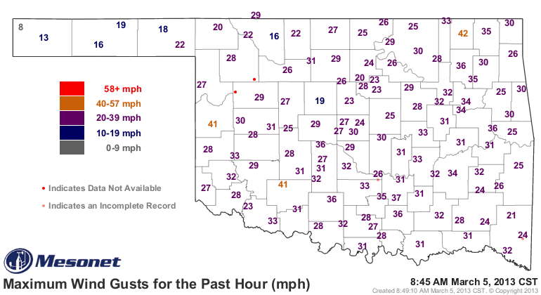
And they're no slouch this morning, either!
Those winds combined with the frigid air (sorta)behind the cold front (by the way,
notice how the cooling effect of the snowpack up in the northwest has finally
been washed out by the cooler air)
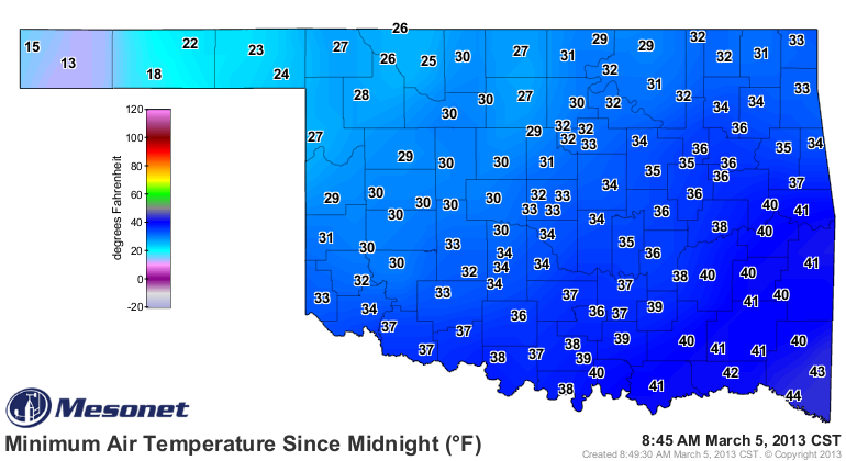
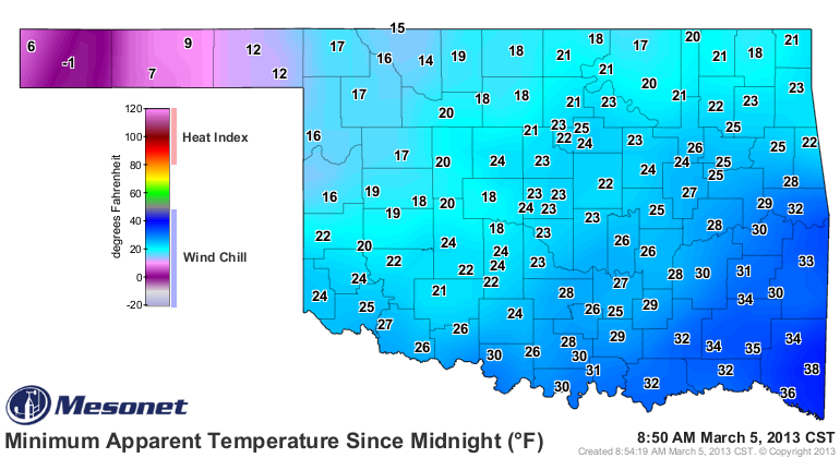
have given us wind chills down into the teens and 20s, with even a below-zero
reading up there in Boise City. These are the minimum wind chills for the day
thus far at each station.
Okay, I'm going to go ahead and say it ... that's toooooo cold! In fact (yes,
FACT), it has been toooooo cold since mid-February. Our old friend, the Arctic
Oscillation (AO), reflects that as well. Remember from past discussions, when
the AO goes significantly negative, that signals a weakening of the polar jet
stream. When that occurs, those big "kinks" can happen, spilling that arctic air
to the south across the continents. Here you can see where the AO went negative
sometime in mid-February and stayed there.
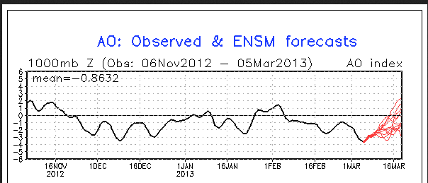
Those red lines are different forecast model runs over the next two weeks. It
does look like it might be headed closer to positive over that time, which
could signal a chance to keep that arctic air bottled up where it belongs far
to the north. It might not bring us above normal temps, but maybe closer to
normal.
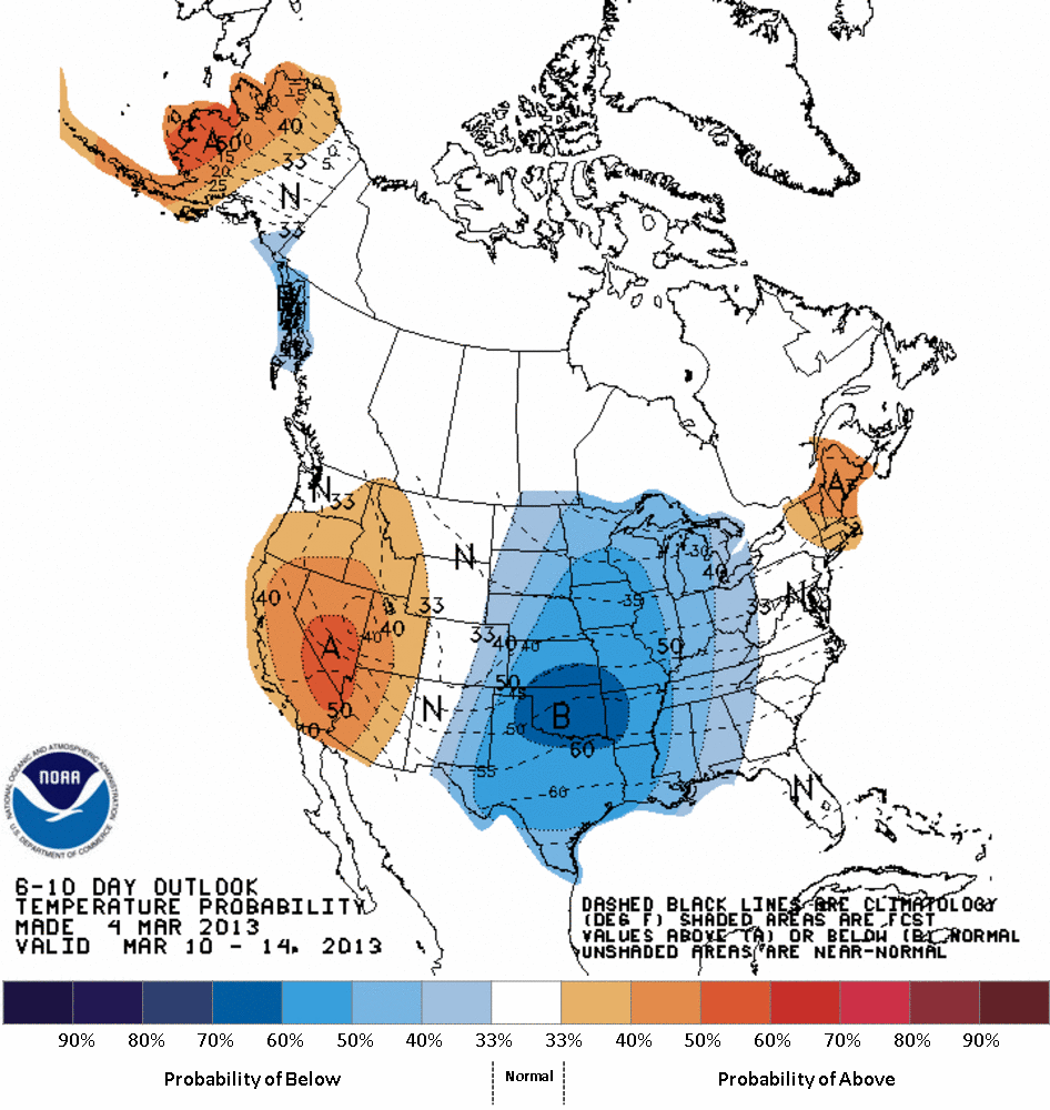
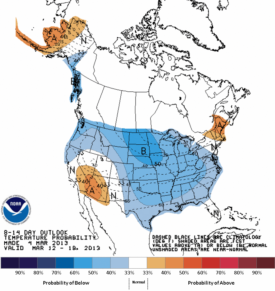
No sign of that on yesterday's temperature outlooks from CPC. On the 6-10 day
outlook (March 10-14), they show greatly increased odds of below normal temps.
Not quite as strong of odds for the 8-14 day period (March 12-18), but still
below-normal indications nonetheless.
This is a far cry from last year at this time, when we were having highs in the
70s and 80s with lows in the 40s and 50s, on our way to the warmest March on
record. Not only warmest, but warmest by a large margin, more than 9 degrees
above normal. It was also about to rain like mad, becoming the 6th wettest
March on record (dating back to 1895). Is that about to happen as well? We
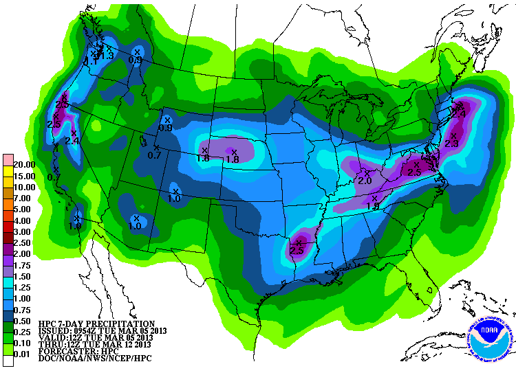
hope so, of course. The storm system forecast for this weekend is still on
track. Maybe not as heavy a rain as we'd like (we'd sure like to fill some of
those lakes up), but nothing to complain about either. At this time, still
looks like a good half-inch to an inch across the state, with localized heavier
amounts.
The cooler weather will help keep this soil moisture in place a bit longer. To
be honest (as usual, I promise!), I don't see much keeping us from having a
decent chance of at least normal springtime rainfall. With no La Nina hanging
around this spring, perhaps things will work in our favor.
Now off to sit alone and talk and watch a sparrow makin' lazy circles in the
sky.
Can't afford the hawk thanks to budget cuts.
Gary McManus
Associate State Climatologist
Oklahoma Climatological Survey
(405) 325-2253
gmcmanus@mesonet.org
March 5 in Mesonet History
| Record | Value | Station | Year |
|---|---|---|---|
| Maximum Temperature | 92°F | ALTU | 2009 |
| Minimum Temperature | -2°F | KENT | 2019 |
| Maximum Rainfall | 0.80 inches | REDR | 2021 |
Mesonet records begin in 1994.
Search by Date
If you're a bit off, don't worry, because just like horseshoes, “almost” counts on the Ticker website!