Ticker for February 28, 2013
MESONET TICKER ... MESONET TICKER ... MESONET TICKER ... MESONET TICKER ...
February 28, 2013 February 28, 2013 February 28, 2013 February 28, 2013
February brings winter storms, drought relief
Winter roared back into Oklahoma during February, providing significant drought
relief to much of the state while dumping as much as three feet of snow in the
northwest. According to preliminary data from the Oklahoma Mesonet, the statewide
average precipitation total for February was 3.03 inches, 1.27 inches above
normal. That would rank the month as the 13th wettest February since records
began in 1895, although melting snow in the northwest could push that mark higher.
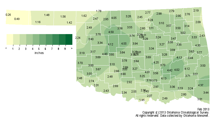
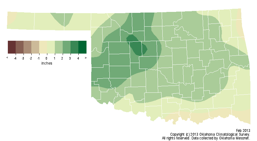
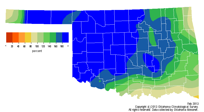
Radar estimates indicate 2-6 inches of liquid equivalent precipitation fell
across the state during the month.
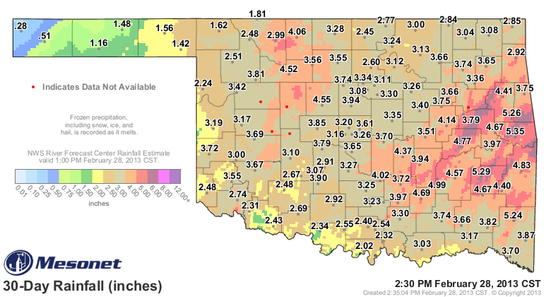
February was the wettest month in Oklahoma since April 2012, which had a
statewide average of 3.81 inches. A statewide average deficit of more than 12
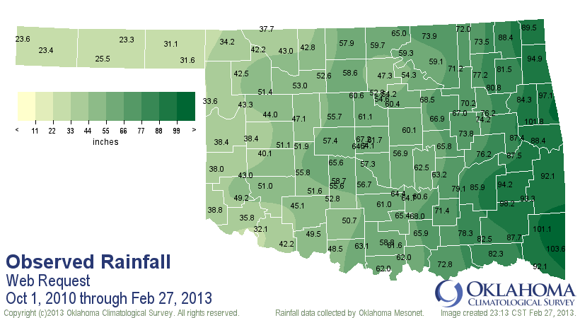
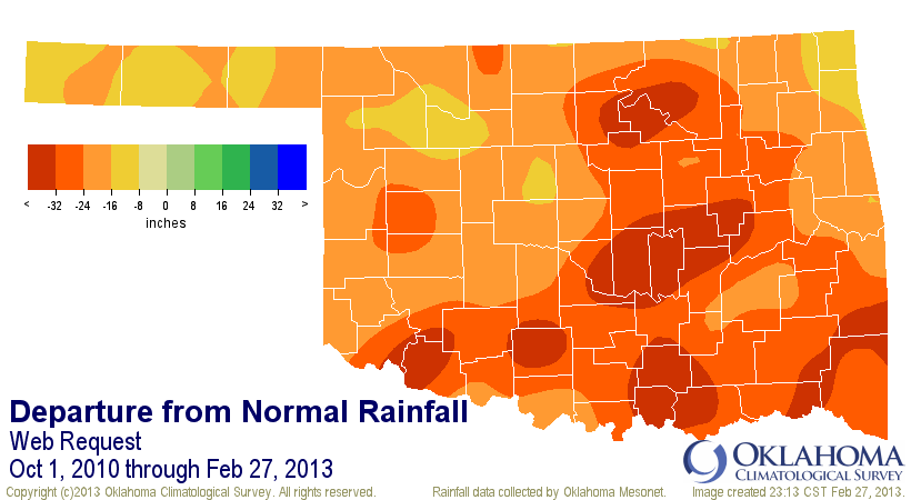
inches still exists since the beginning of last May, the beginning point of
this second round of drought that has persisted since October 2010.
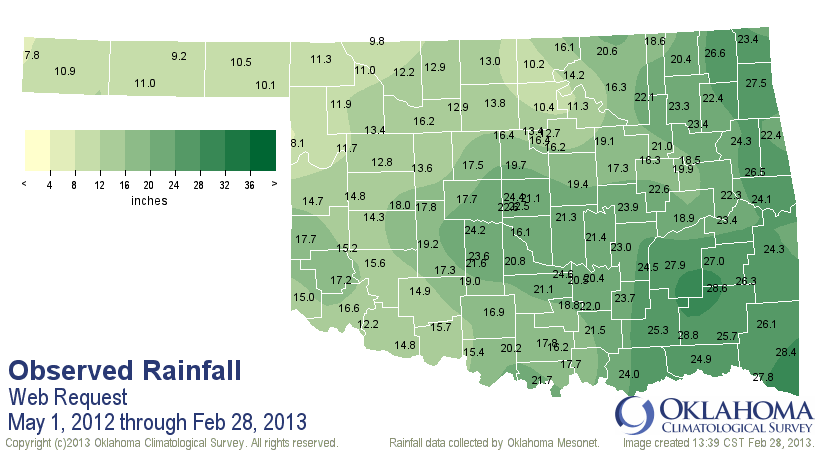
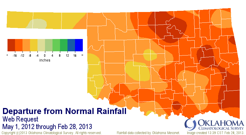
The deficit since that point is nearly 25 inches.
Not only was the month wetter than normal, it was also cooler than normal.
According to the Mesonet, the statewide average temperature finished at 40.7
degrees, 1 degree below normal ? only the seventh month out of the last 35 to
accomplish that feat.
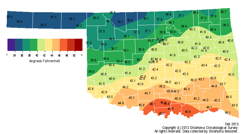
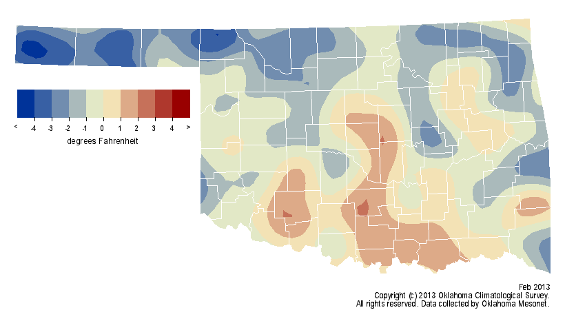
The winter period of December 2012-February 2013 ranked as the 30th warmest at
1.9 degrees above normal and 35th wettest at 0.6 inches above normal.
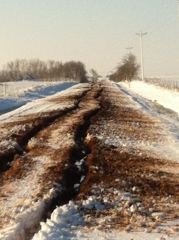
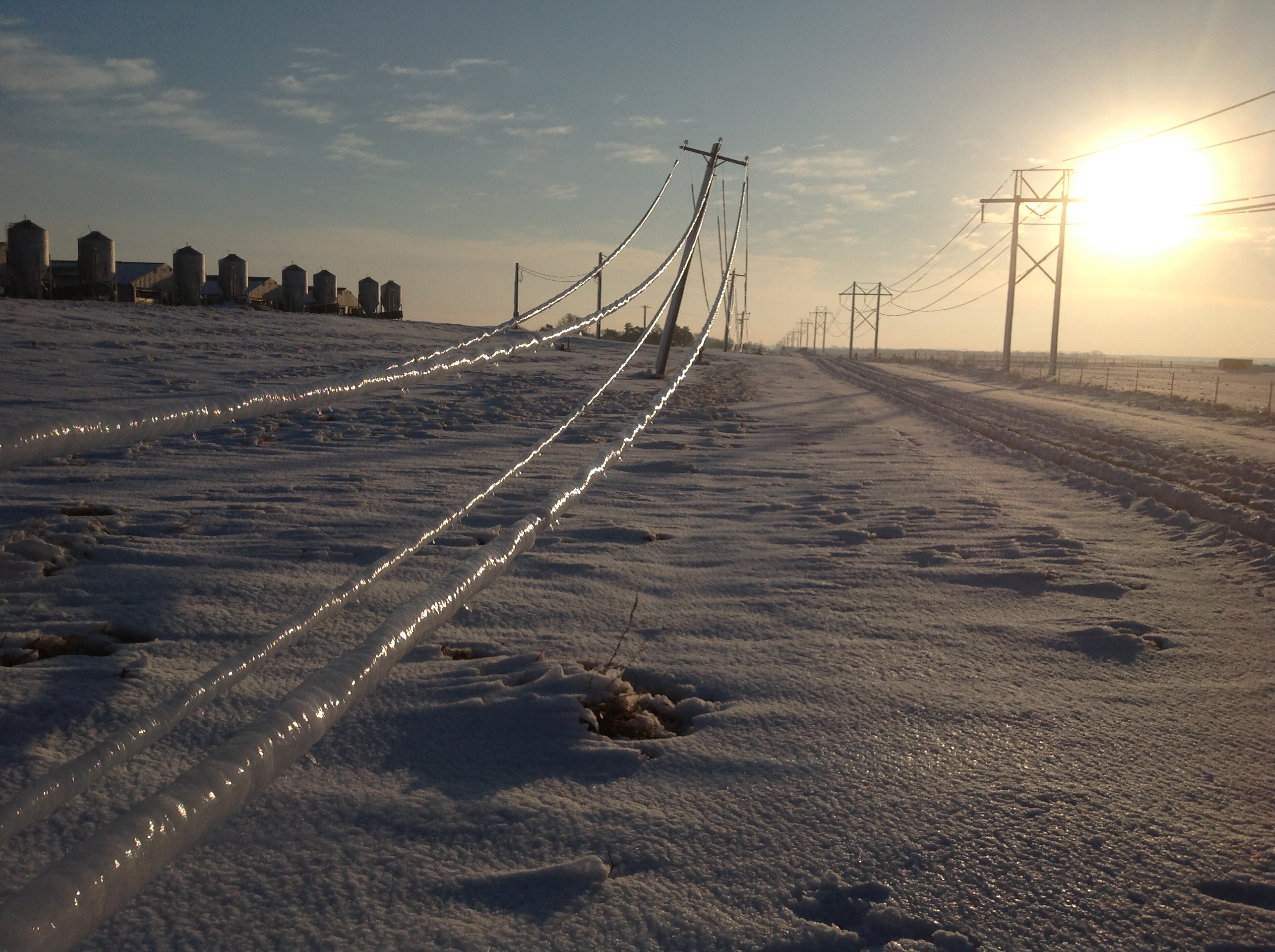
The month?s last storm system was also its most powerful. Severe thunderstorms,
hail, freezing rain and snow pounded the state on Feb. 24-26. Strong winds of
over 50 mph whipped the snow, often accompanied by thunder, into drifts as high
as 10 feet that paralyzed much of northwestern Oklahoma. More than 36,000
electrical customers were left without power thanks to ice-coated power lines
and trees, and nearly all highways across extreme northwestern Oklahoma were
shut down as roads drifted shut.
Blizzard pictures from Okeene/Fairview area courtesy of Sid Sperry (OAEC) and
Cimarron Electric

The heavy, wet snow crumpled awnings and in some cases, roofs. One fatality was
attributed to a roof collapse at a private residence in Woodward. The snow
totals were extreme, and in some cases, possibly record-breaking. The
preliminary February snowfall total of 42.5 inches from the small Ellis County
town of Arnett would break the state?s all-time snowfall record for any month
if it verifies. That mark currently stands at 39.5 inches from Buffalo, set in
February 1971. Alva, to the northeast in Woods County, recorded a preliminary
February total of 35.6 inches.
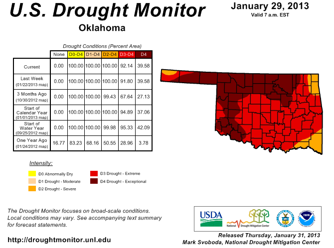
The month began with 92 percent of the state depicted in at least extreme
drought by the U.S. Drought Monitor, and 40 percent considered to be in
exceptional drought. The Drought Monitor?s intensity scale slides from
moderate-severe-extreme-exceptional, with exceptional being the worst category.
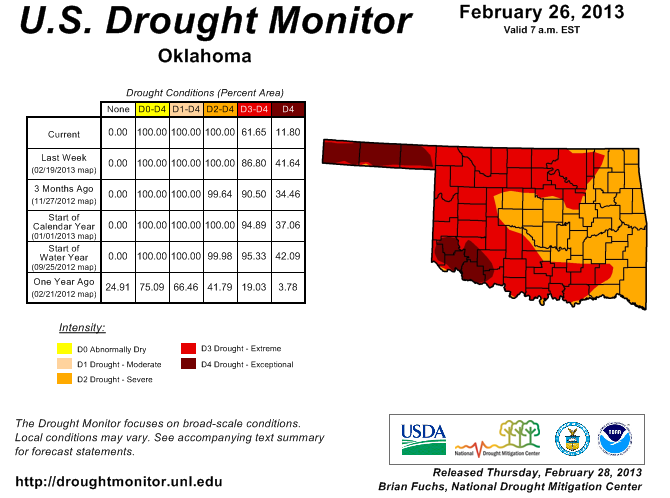
The latest report released on Feb. 28 portrays remarkable improvement with only
12 percent of the state in exceptional drought. The amount in at least extreme
drought dropped to 62 percent. The state had not seen a lower percentage of
exceptional drought since the end of last July when the level was at five
percent. Only the Panhandle and far southwestern Oklahoma remain in exceptional
drought.
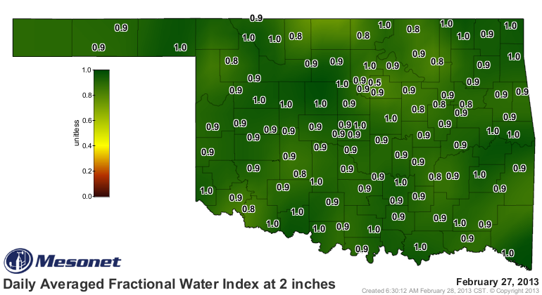
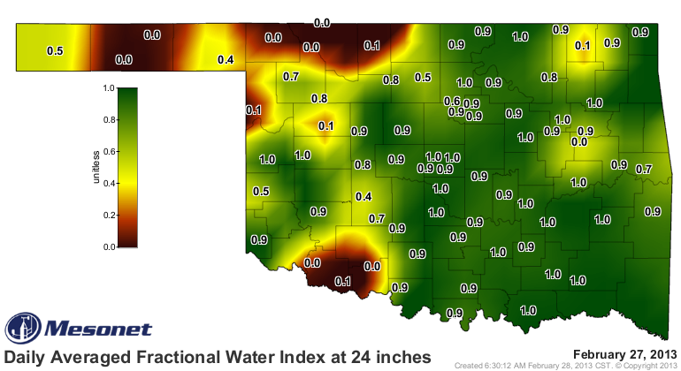
Most of eastern Oklahoma dropped from extreme to severe drought thanks to
improving drought impacts. Soil moisture data from the Oklahoma Mesonet show
saturated soils down to 24 inches across the eastern half of the state, with
similar conditions in the topsoils across all of Oklahoma.
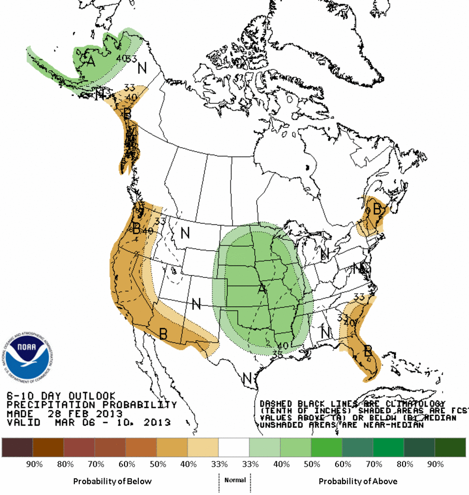
It appears the state will get something of a well-deserved respite from the
inclement weather of late February. The first week of March looks to remain on
the dry side with seasonable temperatures. Hints of another storm system are
beginning to appear for the following week.
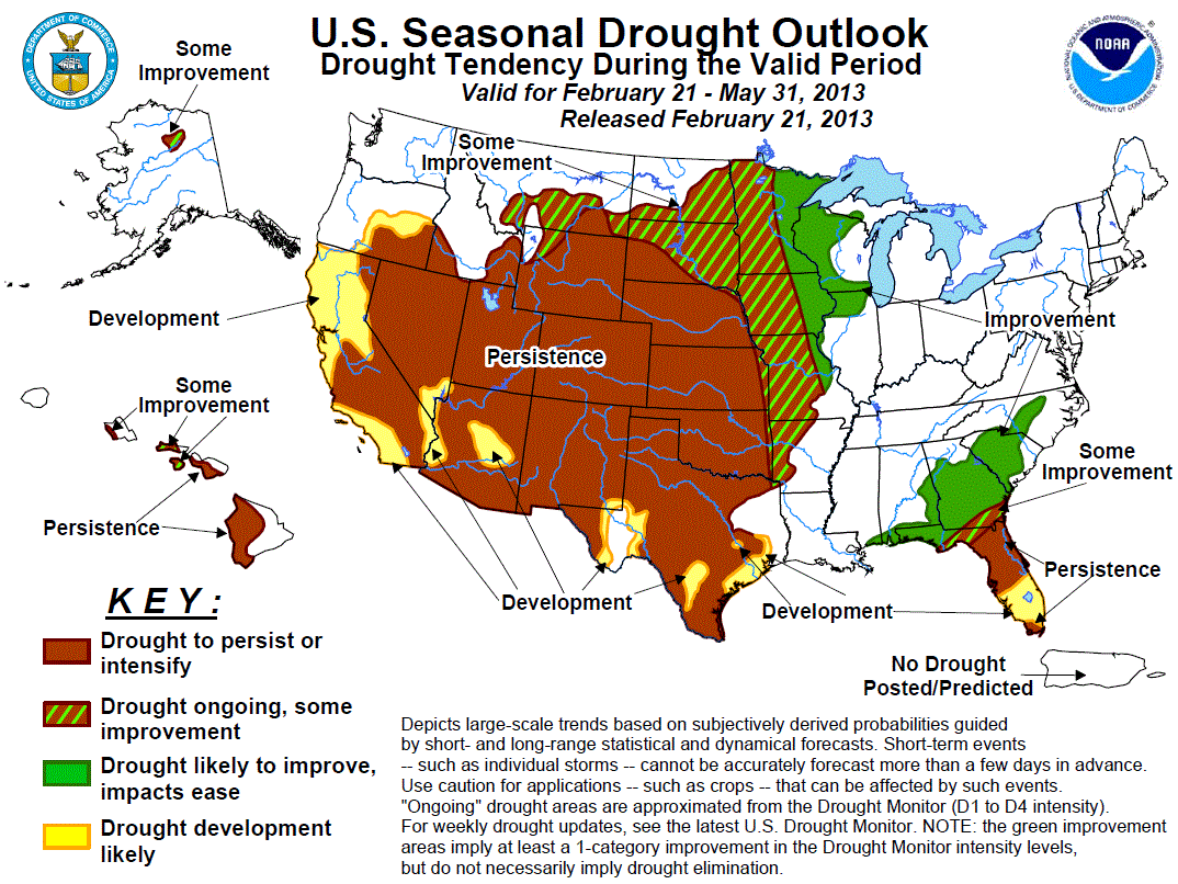
According to the latest U.S. Seasonal Drought Outlook from the National Weather
Service?s Climate Prediction Center, drought is expected to persist or
intensify for nearly the entire state through May 31. A sliver of far eastern
Oklahoma can expect some improvement according to the report.
Gary McManus
Associate State Climatologist
Oklahoma Climatological Survey
(405) 325-2253
gmcmanus@mesonet.org
February 28 in Mesonet History
| Record | Value | Station | Year |
|---|---|---|---|
| Maximum Temperature | 90°F | HOLL | 2006 |
| Minimum Temperature | 7°F | BEAV | 2019 |
| Maximum Rainfall | 3.70″ | BROK | 2018 |
Mesonet records begin in 1994.
Search by Date
If you're a bit off, don't worry, because just like horseshoes, “almost” counts on the Ticker website!