Ticker for February 18, 2013
MESONET TICKER ... MESONET TICKER ... MESONET TICKER ... MESONET TICKER ...
February 18, 2013 February 18, 2013 February 18, 2013 February 18, 2013
Lakes holding their own, is relief on the way?
In between drought talks and a nasty bout with the stomach flu (thanks to my
son, Typhoid Larry, who will see the appropriate response in his college fund!),
we've had plenty of time to ponder Oklahoma lake levels. Last spring, it
looked like many of the lakes were on their way to recovery from the brutal
drought of 2010-11. The abundant rains most of the state received from Oct.
2011-March 2012 made great improvements in the state's surface water stores.
The driest May-December, later to become the 3rd driest May-January, on record
(dating back to 1895) combined with the WARMEST year on record to dash those
hopes of recovery. Recent rains have at least stopped the decline in levels,
and allowed some lakes to make a huge comeback.
This rainfall total map ain't gonna win any awards for its humongous numbers (I
think they're like, 6-point font or something), but it ain't bad for the middle
of winter (or at least Jan. 1-Feb. 17)!
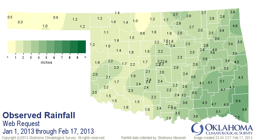
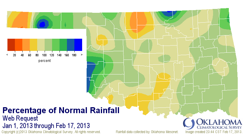
So that has contributed to the easing or at least maintenance of the status quo
for many Oklahoma lakes. Here's our updated lake level chart so you can see for
yourself.
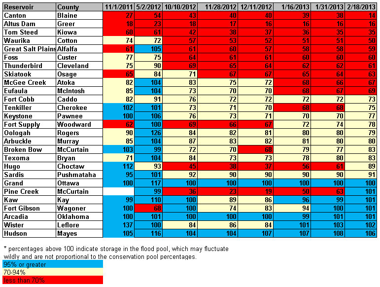
The big winner is Pine Creek down in McCurtain County. It was at 63% of the
conservation pool about three weeks ago, now into the flood pool (as the
chart says at the bottom, flood pool storage fluctuate wildly, much like
the demeanor of the Ticker). Lake Hugo, also down in SE OK, is up from 61%
to 89%. Lakes in the western half of the state remain at greatly depressed
levels, generally below 70%. Canton Lake, with water being released to OKC,
is now the state's lowest major reservoir at 14%. Lake Altus-Lugert happily
gives up the title, but sympathizes with Canton folks, for sure. Canton's
level should continue to drop until the water release is halted.
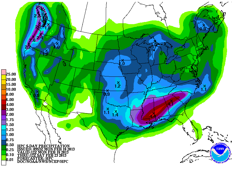
Is there relief in sight? YES! There appears to be a pretty significant storm
approaching the state in the next couple of days, promising (HA! Good one,
right?) a nice healthy dose of moisture for most of Oklahoma. The latest 5-day
rainfall map shows a great coverage of blues and greens over us, signalling
a half-inch to more than in inch.
Following that, the active pattern looks to continue even longer with another
possible storm system down the road in a week or so. That's pretty far out,
of course. I mean "a ways into the future," not "Wow, groovy man!" But it's
still further hope of continued moisture recharge into the state's beleaguered
water supply. The real key will come as spring approaches and temperatures
start to become more ... well, springlike. The latest model output from the
CPC looks a bit dubious, but just as with the forecast a week from now, that
is pretty groovy, man. I mean a ways out!
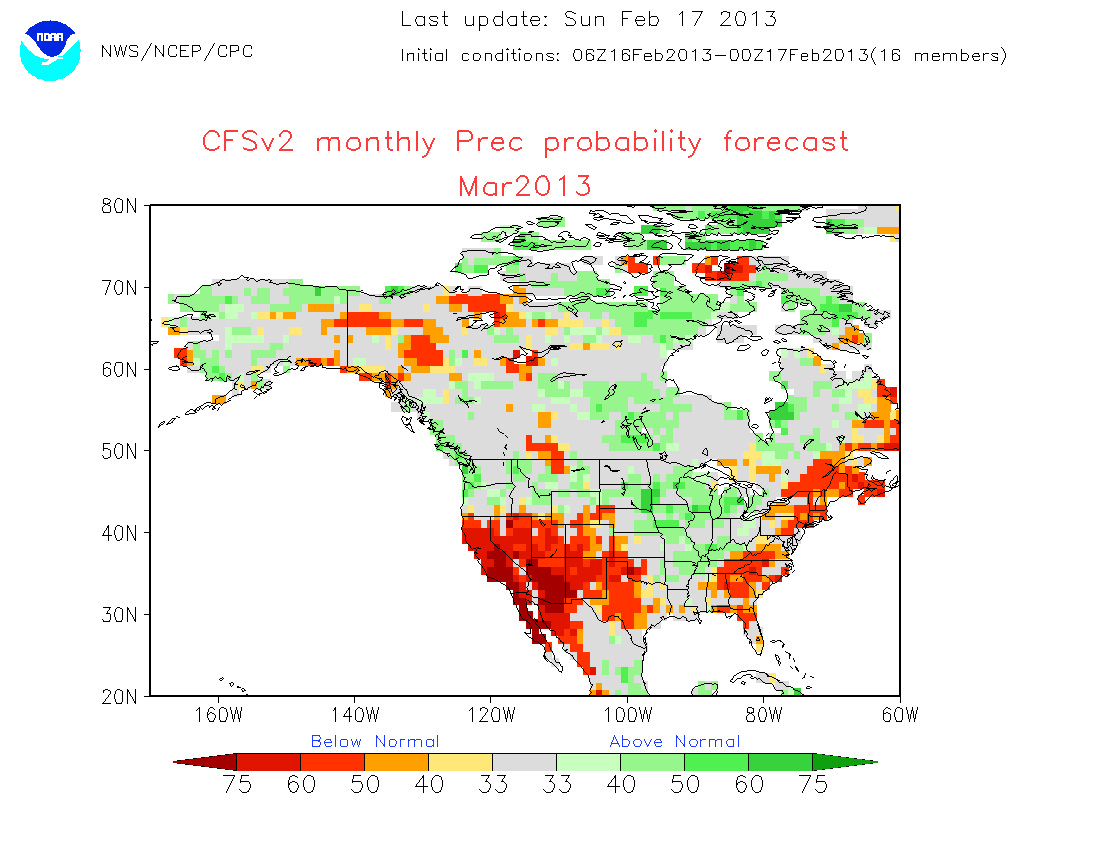
But at least those same model runs are not seeing the warmth of last year that
spurred the state's vegetation (and the atmosphere's evaporation) into
overdrive.
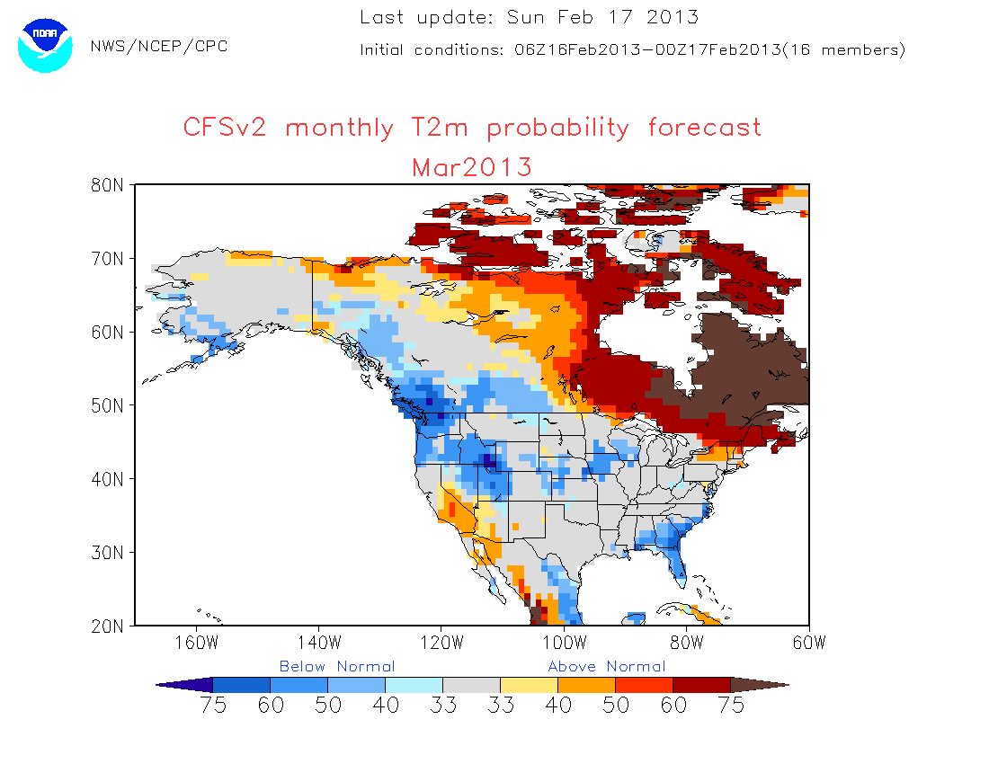
I'm not sure who put Mother Nature's hand in a warm bowl of water while she
slept. Maybe Jack Frost or the Tooth Fairy. But they need to get another
sleepover scheduled for spring.
Gary McManus
Associate State Climatologist
Oklahoma Climatological Survey
(405) 325-2253
gmcmanus@mesonet.org
February 18 in Mesonet History
| Record | Value | Station | Year |
|---|---|---|---|
| Maximum Temperature | 91°F | BUFF | 2016 |
| Minimum Temperature | -8°F | TIPT | 2021 |
| Maximum Rainfall | 0.78 inches | TIPT | 1998 |
Mesonet records begin in 1994.
Search by Date
If you're a bit off, don't worry, because just like horseshoes, “almost” counts on the Ticker website!