Ticker for February 13, 2013
MESONET TICKER ... MESONET TICKER ... MESONET TICKER ... MESONET TICKER ...
February 13, 2013 February 13, 2013 February 13, 2013 February 13, 2013
Find a happy place
As my son was painting our bathroom with Golden Corral about midnight last night
(yeah, it was as fun as it sounds), I thought to myself "Don't worry, be happy,
it rained and snowed!" It worked for a few seconds, but at least the system
yesterday brought almost the entire state a dose of at least *some* moisture.
Some more than others, of course, but everybody was appreciative, I'm sure.
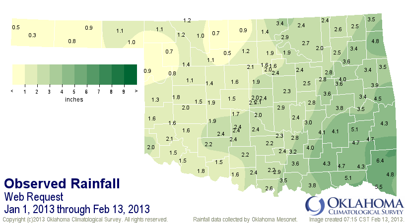
Here are the Mesonet rainfall totals (remember, we don't measure snow, just the
melt after it falls). I think we've captured most of it since it hovered at or
above freezing during the snow, plus it was a nice gentle snowfall with little
wind, so no loss of capture (unlike my son last night).
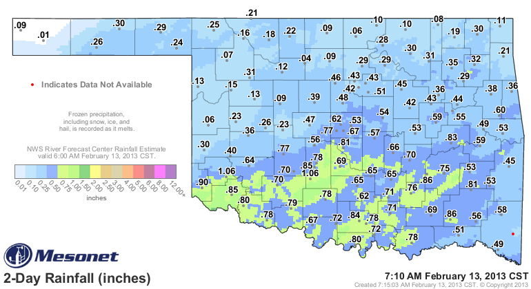
So a great dose of moisture, especially for southern Oklahoma. Combine that with
our "disappointing storm" from a few days ago, and it looks even better.
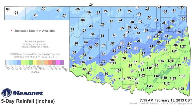
A nice general inch or so across the southern half of the state, and even more
importantly, the southwest. That area had been without decent moisture for quite
awhile. Here are some snow totals for the western two-thirds of the state, and
the Texas Panhandle for good measure (pun intended).
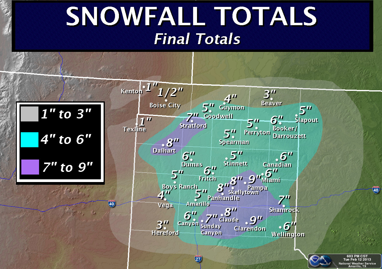
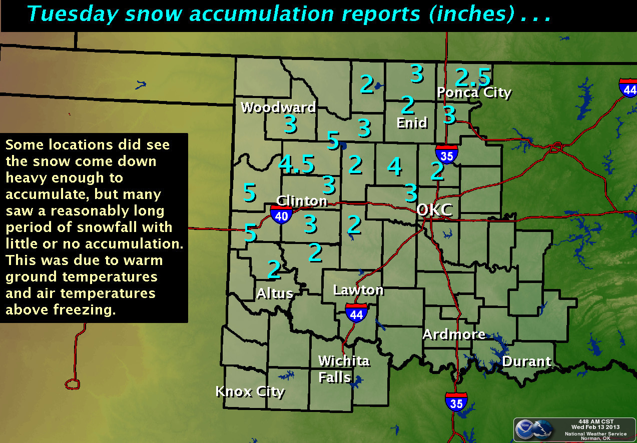
Looks like about 5 inches from the Panhandle and far western Oklahoma were
close to the top of the measurements. Of course it was melting as soon as it
hit, but that describes a good portion of Oklahoma snowfalls. The snow is great
for adding to the soil moisture, since it sits in one place and slowly melts,
not allowing for much runoff. It doesn't do much for filling stock ponds and
reservoirs, but it can help with that by allowing for more runoff the next
time it rains.
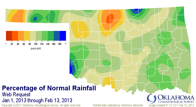
We add this moisture to a barely-above-normal January and we remain at least
close to normal for the Jan. 1-Feb. 13 period with a statewide average of 2.4",
0.1" above normal. WHOO-HOO! These are not impressive totals, but remember,
it's the driest time of the year. It's all relative. To be above normal by
a tenth of an inch also earns you the 35th wettest Jan. 1-Feb. 13 since 1921.
We're not quite having our same period from last year when we had an average of
3.15" across the state, about an inch above normal, but last year is not really
one we want to emulate, eithe.
Not much rain (or snow) is showing up for the next 7 days just yet, but not to
fret ... this last one wasn't exactly painting the state green 7 days out
either.
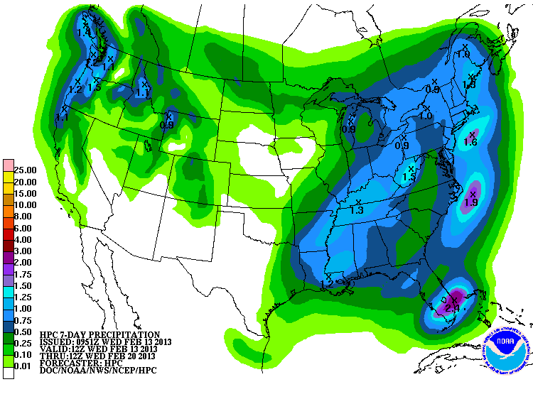
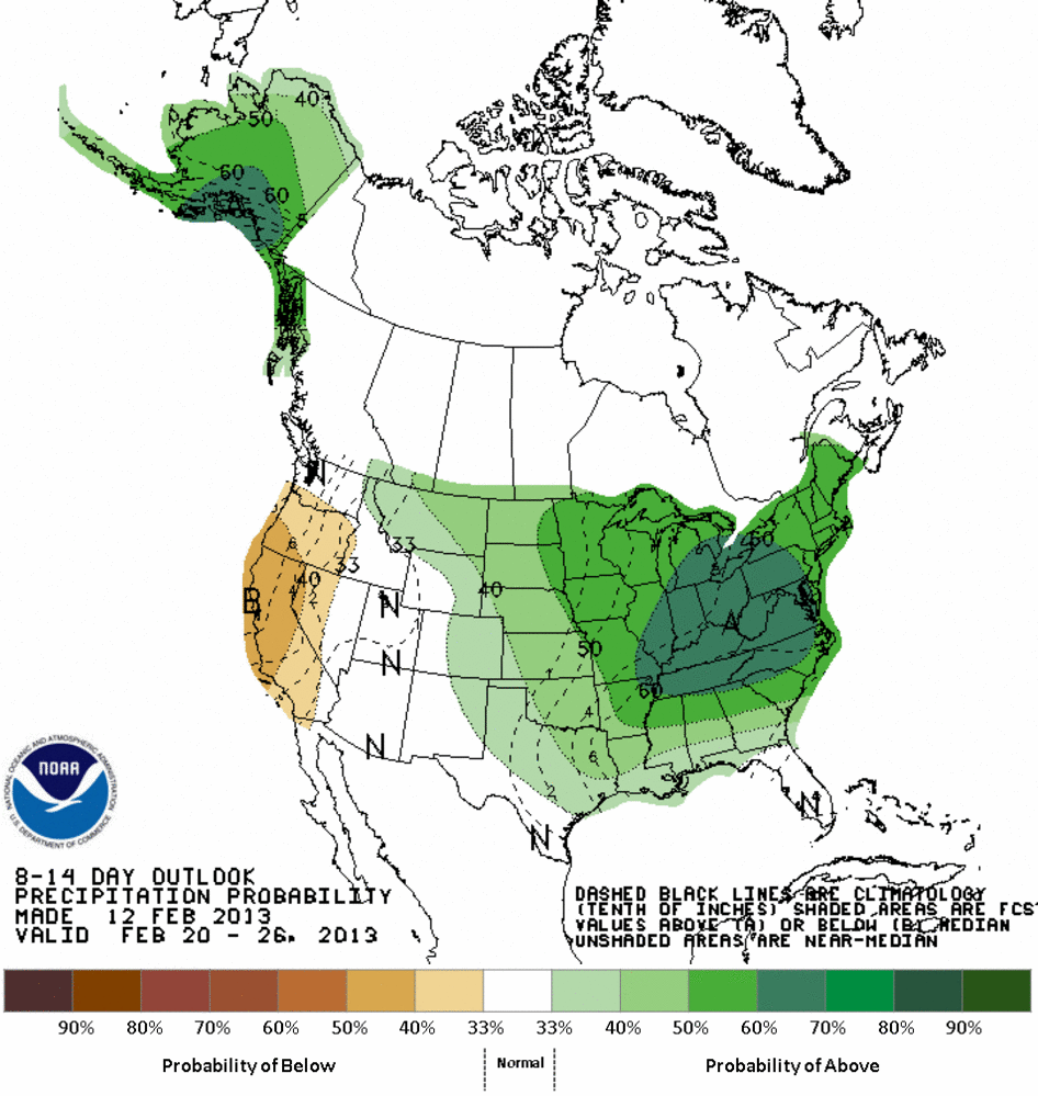
You can start to see the hint of more rain right at the end there, and that is
also showing up on the CPC medium-range outlooks for the February 20-26 period
with increased odds of above normal precipitation across the entire state
(remember, these maps don't show amounts, just probabilities ... there is no
indication of how much above normal it will be). Looks to remain colder than
normal too.
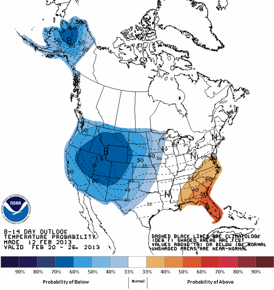
Looks like February might end up as one of those odd "cooler than normal" months
we see every five or six, so maybe we'll have more chances for snow down the
road. My son will NOT be eating Golden Corral if that's the case.
Gary McManus
Associate State Climatologist
Oklahoma Climatological Survey
(405) 325-2253
gmcmanus@mesonet.org
February 13 in Mesonet History
| Record | Value | Station | Year |
|---|---|---|---|
| Maximum Temperature | 79°F | KENT | 2016 |
| Minimum Temperature | -8°F | EVAX | 2025 |
| Maximum Rainfall | 2.32″ | BBOW | 2001 |
Mesonet records begin in 1994.
Search by Date
If you're a bit off, don't worry, because just like horseshoes, “almost” counts on the Ticker website!