Ticker for December 10, 2012
MESONET TICKER ... MESONET TICKER ... MESONET TICKER ... MESONET TICKER ...
December 10, 2012 December 10, 2012 December 10, 2012 December 10, 2012
It began to look a lot like ...
snow! Yes, it did snow, and I hope those folks down in south central Oklahoma
stocked up on bread and milk. That snow is still visible on satellite, at least
for a short time longer. You can see it as the faint gray area from eastern
Cotton County up through the Arbuckles.
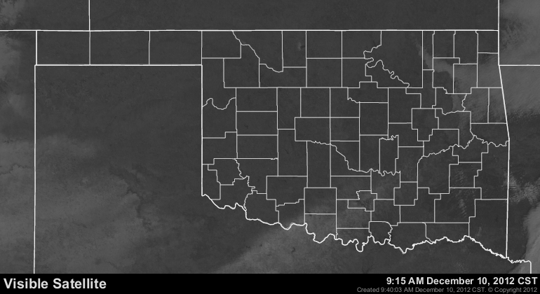
There were some reports of upwards of 3 inches of snow in the Arbuckles - enough
to shut down the highway there for a short time with more than 40 accidents
reported from that area. A few flakes were seen in central Oklahoma as well (you
might even know some of them ... oh yeah, the snowflake variety as well).
Other than that, the big story is the cold. Temperatures continued to plunge
overnight after yesterday's big frontal passage. Temperatures remain below
freezing across most of the state with wind chills in the single-digits to teens.
The Oklahoma Panhandle saw lows dip to near zero. Hooker wins the prize on the
Mesonet with a low temperature of 1 degree. Still quite a ways away from record
lows, however.

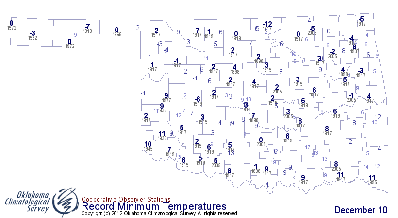
That's the lowest temperature recorded on the Mesonet since Christmas Day in
2011 when Kenton fell to 0 degrees. Before we start to declare a bone-chilling
winter back in the works, we should remember what happened last December. It
had already reached as low as -6 degrees in the Panhandle by this time last
year (-6 degrees at Kenton, Dec. 6, 2011). But this is easily the coldest air
we've seen this season, and probably since a year ago December.
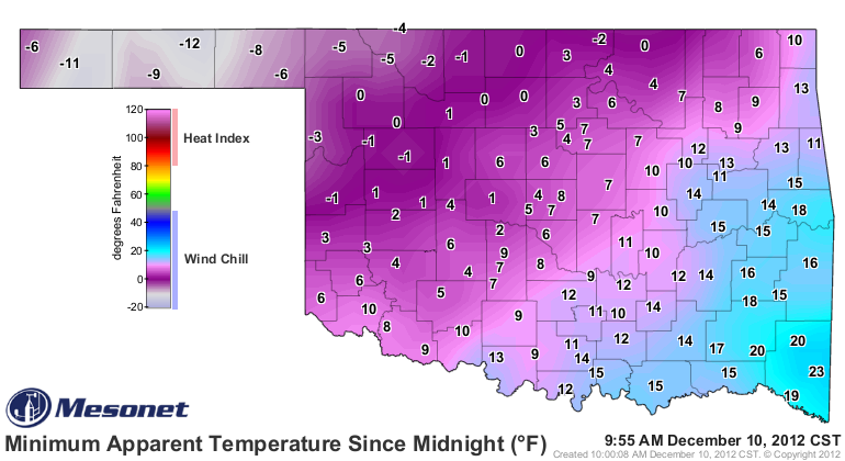
The wind chills last night were no walk in the park either, and if you were
walking in a park, you could probably confirm that. Those apparent temperatures
dropped to less than -10 degrees in the Panhandle and close to zero across much
of northwestern Oklahoma.
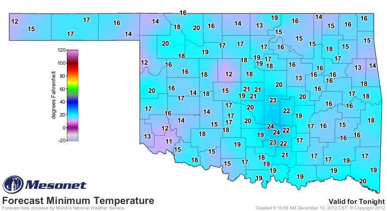
The air will now start to quickly modify and we'll see a warm up over the next
few days. Lows will dip into the teens tonight and we'll see highs in the 50s
and 60s by Wednesday and Thursday.
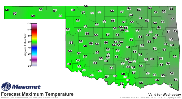
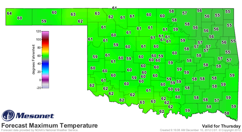
The next rain chance comes up on Friday and the NWS' HPC is starting to paint
the entire state green. Maybe as much as a quarter-to-half an inch across the
state, with a bit more down in the southeast.
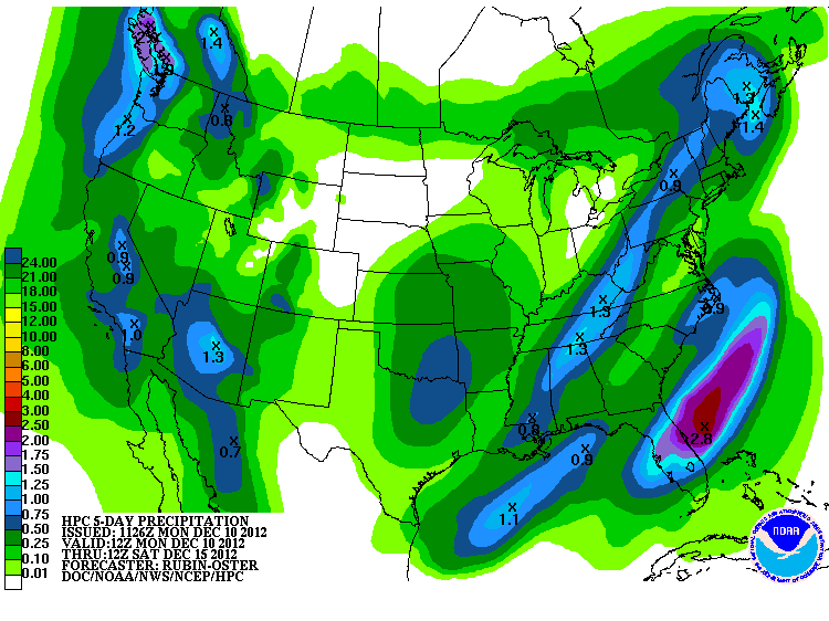
It's nice to see them go out on a limb (somewhat) like that! That would be a
great early Christmas present. It's not much and wouldn't dent the drought at
all, but it would be some nice moisture regardless.
Gary McManus
Associate State Climatologist
Oklahoma Climatological Survey
(405) 325-2253
gmcmanus@mesonet.org
December 10 in Mesonet History
| Record | Value | Station | Year |
|---|---|---|---|
| Maximum Temperature | 85°F | WAUR | 2021 |
| Minimum Temperature | -5°F | CAMA | 2013 |
| Maximum Rainfall | 2.15″ | JAYX | 2022 |
Mesonet records begin in 1994.
Search by Date
If you're a bit off, don't worry, because just like horseshoes, “almost” counts on the Ticker website!