Ticker for November 29, 2012
MESONET TICKER ... MESONET TICKER ... MESONET TICKER ... MESONET TICKER ...
November 29, 2012 November 29, 2012 November 29, 2012 November 29, 2012
Drought surged during November with a return to the dry, warm and windy weather
pattern that Oklahoma has become accustomed to over the last couple of years.
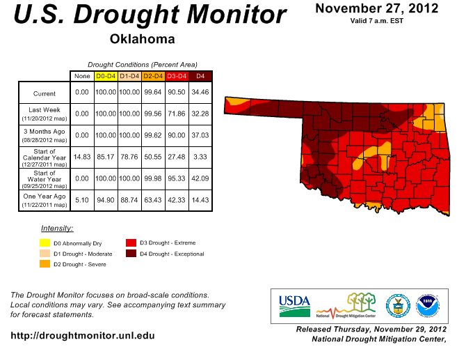
According to the latest U.S. Drought Monitor report, the amount of extreme to
exceptional drought rose from 72 percent last week to 91 percent this week. The
state had not seen that amount of extreme to exceptional drought since late
September. Other than a small but persistent area of moderate drought in far
northeastern Oklahoma, the entire state remained in at least severe drought
according to the report. The Drought Monitor?s intensity scale slides from
moderate-severe-extreme-exceptional, with exceptional being the worst category.
The bulk of that increase came across areas in southern and eastern Oklahoma
that had been categorized in severe drought since September.
Through November 28, the statewide average temperature stood at 52.4 degrees
according to preliminary data from the Oklahoma Mesonet, approximately 3.4
degrees above normal. That would rank this November as the 12th warmest since
1895, although a couple of warm days to finish the month could increase that
ranking. November is set to become the 26th month out of the last 32 to finish
warmer than normal, dating back to April 2010. Oklahoma?s 2012 January-November
average temperature remains approximately two-tenths of a degree ahead of 1954
in a race to break the record for warmest calendar year.
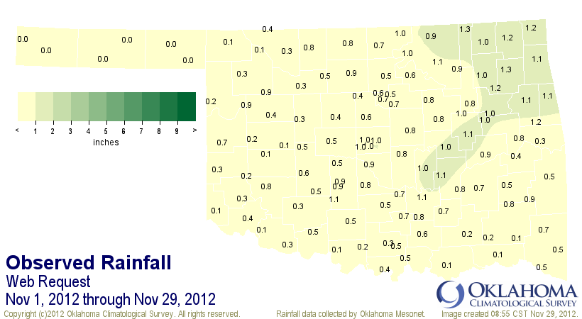
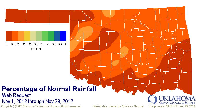
The month has also been exceedingly dry, a continuation of what the state has
seen since May. The Mesonet?s statewide average total for the month will finish
at 0.57 inches, more than 2 inches below normal and the 21st driest November on
record.
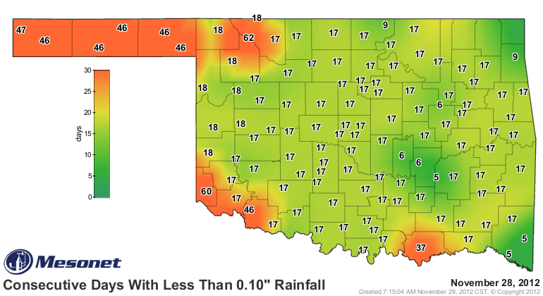
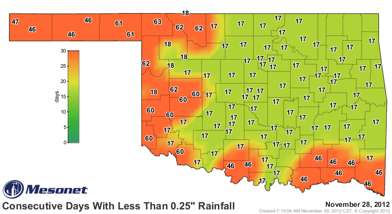
It has been 63 days since the Mesonet site at Buffalo has seen a day with at
least a quarter-inch of rain. Other parts of western and southern Oklahoma have
gone from 40-60 days with a similar lack of rainfall. It has been 60 days since
the Hollis Mesonet site has recorded a tenth of an inch of daily rainfall and
as many as 47 days in the Panhandle.
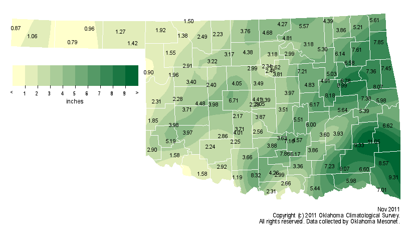
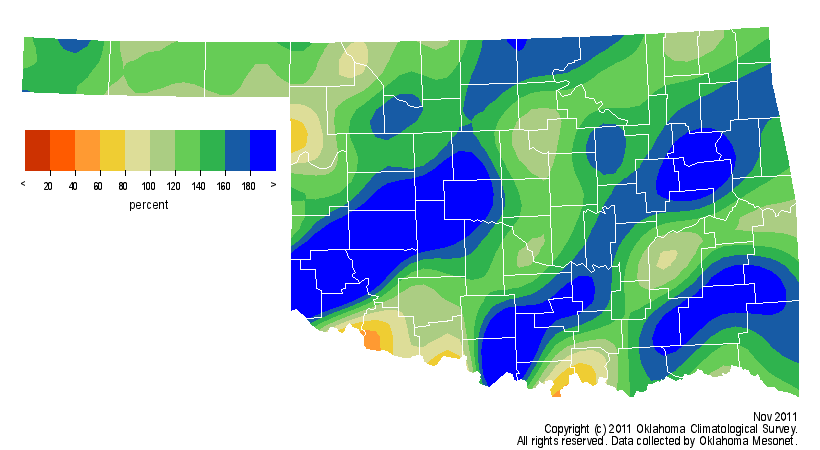
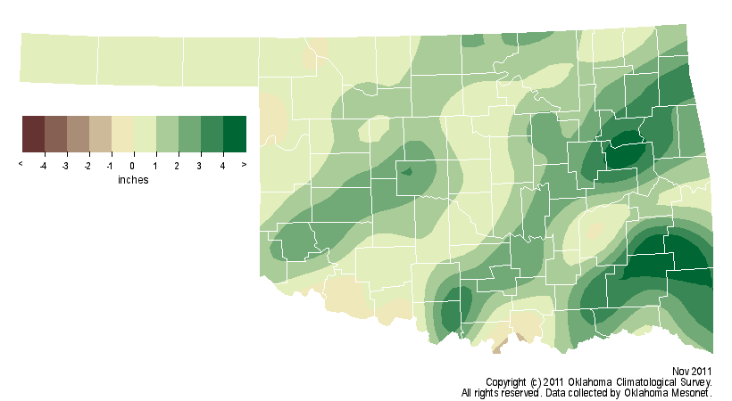
This November stands in stark contrast to last year?s version, which ended as
the 12th wettest on record at nearly 2 inches above normal.
November 2011 rainfall maps
The current span of particularly dry weather extends farther back than the
beginning of November. According to preliminary data from the Oklahoma Mesonet
and the National Climatic Data Center, the statewide average rainfall total for
May through November was 13.48 inches, the second driest such period on record
in Oklahoma. The only drier May through November was 1952?s 13.34 inches.
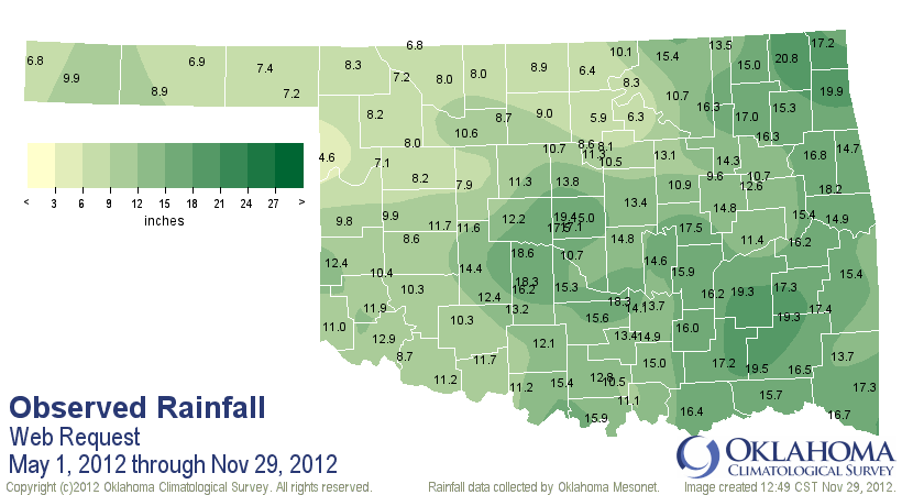
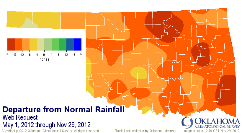
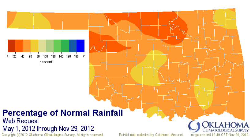
The combination of wind, warmth and lack of rainfall accelerated the loss of
moisture from the state?s soils and reservoirs, and impeded the progress of the
winter wheat crop. The November 26 weekly crop update from the USDA?s Oklahoma
office of the National Agricultural Statistics Service noted that the state?s
topsoil and subsoil moisture conditions were rated 95 percent and 97 percent
poor to very poor, respectively. The report also indicated that only 13 percent
of the winter wheat crop was rated as good, with one percent in the excellent
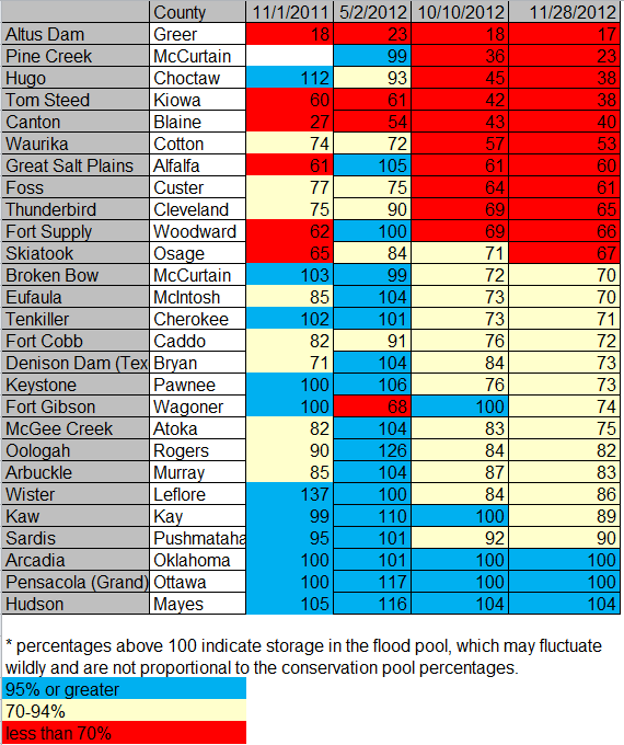
category. Eleven of the state?s major reservoirs are at less than 70 percent
of normal capacity, with an additional eight being below 80 percent. Lake
Altus-Lugert is in the worst shape at 17 percent of capacity.
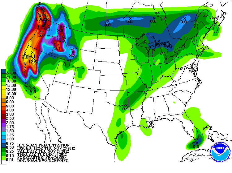
There is very little rain in the forecast, although light amounts are expected
across eastern Oklahoma associated with a frontal system early next week.
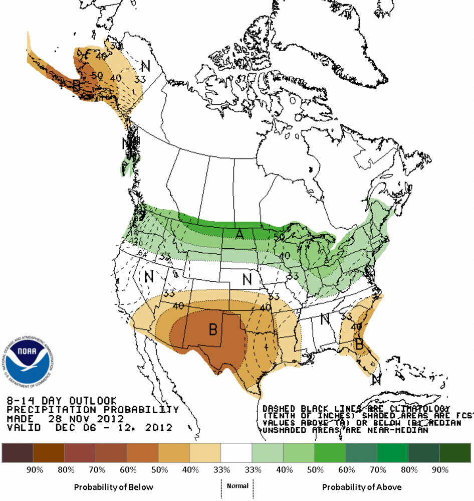
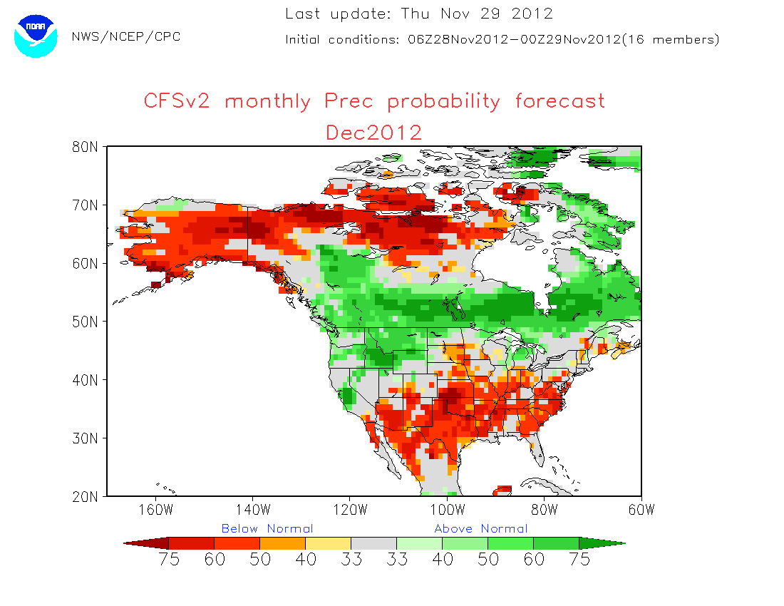
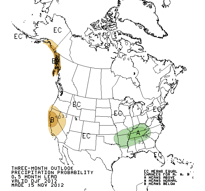
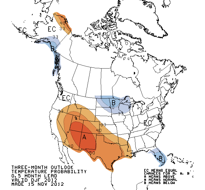
Longer range outlooks from the National Weather Service?s Climate Prediction
Center (CPC) indicate increased odds of more warm and dry weather in store for
December.

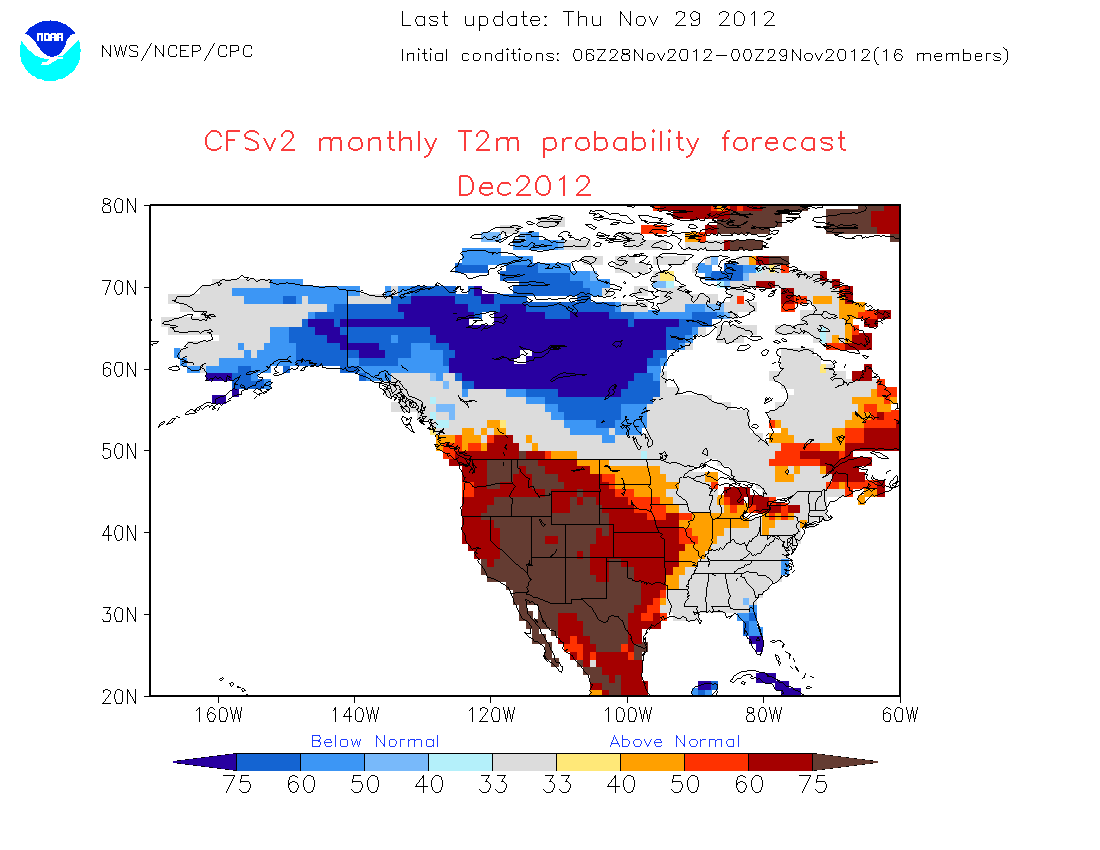
The CPC also sees increased odds of above normal temperatures lasting through
the winter, but little confidence in any prediction on precipitation. December,
January and February are the three driest months for Oklahoma.
Gary McManus
Associate State Climatologist
Oklahoma Climatological Survey
(405) 325-2253
gmcmanus@mesonet.org
November 29 in Mesonet History
| Record | Value | Station | Year |
|---|---|---|---|
| Maximum Temperature | 84°F | ARNE | 2014 |
| Minimum Temperature | 8°F | TIPT | 2001 |
| Maximum Rainfall | 3.85″ | TALI | 2006 |
Mesonet records begin in 1994.
Search by Date
If you're a bit off, don't worry, because just like horseshoes, “almost” counts on the Ticker website!