Ticker for November 1, 2012
MESONET TICKER ... MESONET TICKER ... MESONET TICKER ... MESONET TICKER ...
November 1, 2012 November 1, 2012 November 1, 2012 November 1, 2012
Did October end Oklahoma's quest for warmest year on record?
It?s been awhile since Oklahoma has seen a month like October. Eleven months, to
be exact. Not since September 2011 had Oklahoma seen a month where the statewide
average temperature finished on the cold side of normal. In fact, 25 of the 30
months prior to October were warmer than normal, starting with April 2010.
According to data from the Oklahoma Mesonet, October became the 26th coolest on
record with a statewide average of 59.7 degrees, 1.6 degrees below normal.
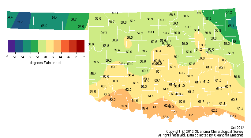
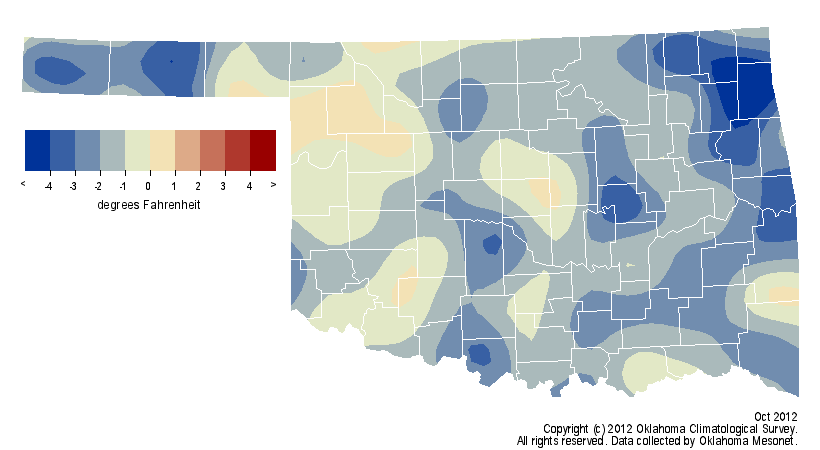
Statewide records date back to 1895. Oklahoma seemed to be racing towards its
warmest calendar year on record, a mark currently held by 1954 at 62.8 degrees.
The cool October dealt that effort a major blow, however, bringing the two years
into a virtual dead heat with two months remaining. The January-October statewide
average temperature came in at 66.2 degrees, a mere tenth of a degree ahead of
1954. These values remain unofficial until the National Climatic Data Center
releases its final numbers in a few months as data continue to trickle in.
The cool month was due in large part to a couple of intrusions of frosty air. A
strong arctic cold front plowed through the state during the month?s first week,
bringing one of the earliest fall freezes on record at some locations. The
thermometer hit 31 degrees at Will Rogers World Airport on Oct. 8, the earliest
freeze ever for the official Oklahoma City observing station. Another cold
plunge of air from the Arctic provided a widespread freeze during October?s
final week, an early occurrence for southern parts of the state.

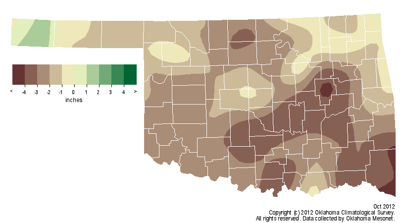
Although the heat may have faded during October, the dry weather did not. The
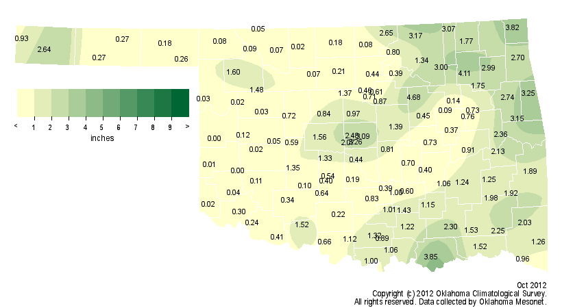
Mesonet?s statewide average rainfall total of 1.1 inches fell more than 2
inches below normal and ranked the month as the 15th driest October on record.
Eighteen of the Mesonet?s 120 stations recorded less than a tenth of an inch of
rain for the month and 66 measured less than an inch. The Cheyenne and Retrop
stations recorded no precipitation during October. On the bright side, twelve
stations recorded at least 3 inches of rain during the month with Oilton
leading the way at 4.7 inches.
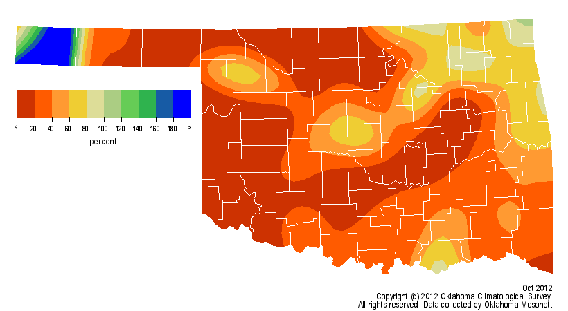
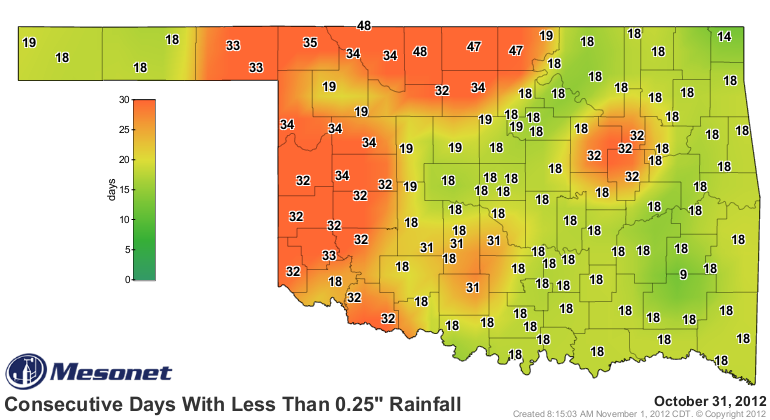
By October 31, it had been up to 34 days since parts of northern and western
Oklahoma had seen a tenth of an inch of rainfall in a single day, and as many
as 48 days without at least a quarter of an inch.

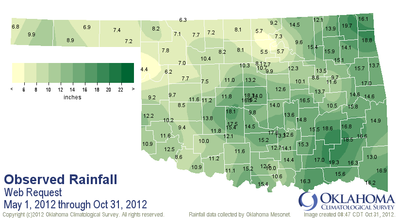
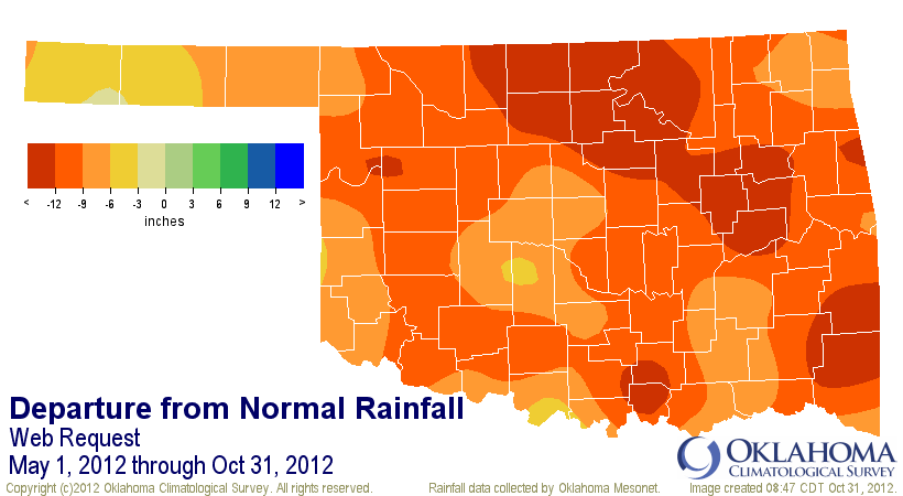
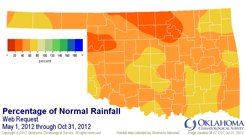
Although parts of the state have been in continual drought for more than two
years, most of the state?s current drought woes can be traced back to deficits
beginning in May 2012. The May-October statewide average of 12.72 inches fell
more than 9 inches below normal and ranked as the fourth driest such period on
record. For the important wheat producing area of north central Oklahoma, the
statistics are even more dismal with deficits of more than 13 inches. The
May-October rainfall total of 8.1 inches in that part of the state is the
second lowest on record for that span.
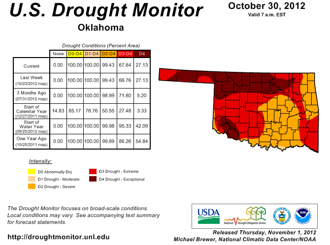
The latest U.S. Drought Monitor report, released on Nov. 1, showed that
extreme-to-exceptional drought still covered more than two-thirds of the state.
Virtually all of Oklahoma was covered by severe-to-exceptional drought. The
Drought Monitor?s intensity scale slides from moderate-severe-extreme-
exceptional, with exceptional being the worst category.
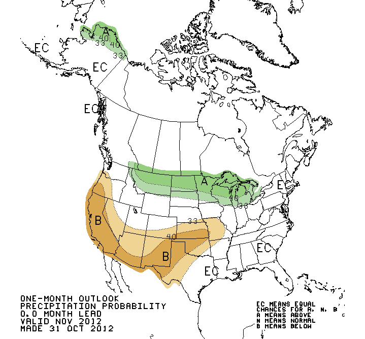
There is little relief showing up in the short term, and the state looks mostly
dry through the first week of November. Farther out, the November outlooks from
the National Weather Service?s Climate Prediction Center (CPC) show increased
odds for above normal temperatures and below normal precipitation across the
state.

The development of a significant El Ni?o event ? the warming of the equatorial
Pacific waters that can sometimes bring the southern United States cooler and
wetter weather from late fall into early spring ? appears less likely at this
point. The lack of an expected boost from that phenomenon just as the Southern
Plains enters its driest part of the calendar leads to a fairly pessimistic
U.S. Seasonal Drought Outlook from the CPC. The outlook sees our current
drought persisting or perhaps even intensifying through January 2013.
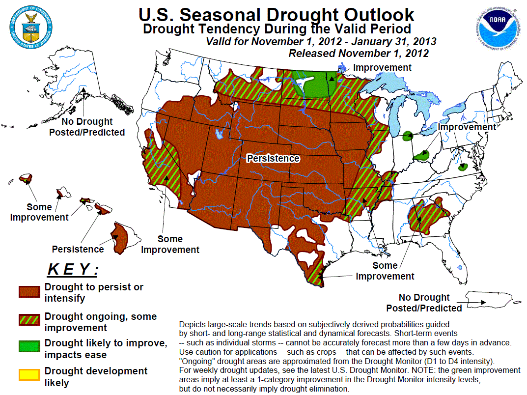
Should that outlook come to fruition, the state would see greatly enhanced odds
of entering next spring with significant drought in place.
Gary McManus
Associate State Climatologist
Oklahoma Climatological Survey
(405) 325-2253
gmcmanus@mesonet.org
November 1 in Mesonet History
| Record | Value | Station | Year |
|---|---|---|---|
| Maximum Temperature | 90°F | ALTU | 2001 |
| Minimum Temperature | 16°F | VINI | 2023 |
| Maximum Rainfall | 3.65″ | NEWK | 1998 |
Mesonet records begin in 1994.
Search by Date
If you're a bit off, don't worry, because just like horseshoes, “almost” counts on the Ticker website!