Ticker for May 17, 2012
MESONET TICKER ... MESONET TICKER ... MESONET TICKER ... MESONET TICKER ...
May 17, 2012 May 17, 2012 May 17, 2012 May 17, 2012
Extreme drought creeping back into southwestern Oklahoma, June/Summer looks hot
We talked last week about our underwhelming (thus far) rainy season for much of
the state. Our wet March turned into a partially-wet April for some, but the
moisture slowdown began for real in mid-April. Northern Oklahoma saw a ton of
rain the last few days of last month, but May has been disappointing so far.
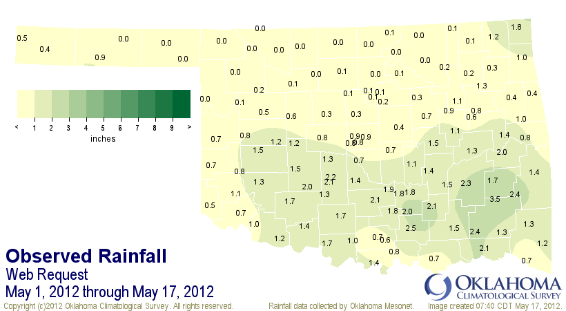
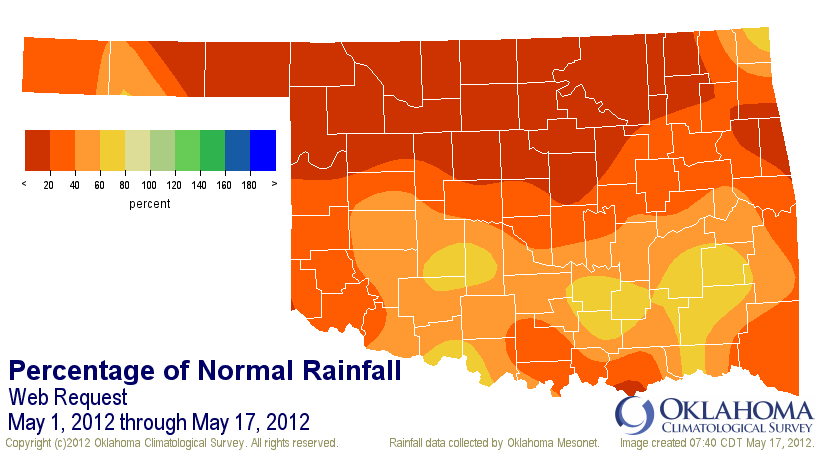
That 1-3 inches scattered about southern Oklahoma looks okay until you remember
that THIS IS THE RAINY SEASON and compare it to normal. Even those areas are at
best 60%-80% of normal. The statewide average for May so far is 0.87 inches,
1.94 inches below normal. The driest May on record was 1988's 1.3 inches.
That's not a record we need to be shooting for.
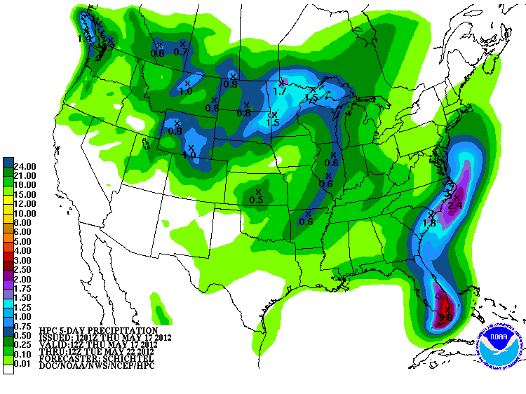
The latest 5-day forecast from the NWS' Hydrometeorological Prediction Center
shows our weekend rain chances, but it doesn't look like a lot just yet.
When you combine the heat that we've had (we're well on our way to the warmest
January-May and spring March-May periods on record for the state) and the
absence of spring rains, you will have drought begin to sneak in once again.
Especially in areas that never fully recovered from last year's disaster. The
latest U.S. Drought Monitor map, released this morning, portrays
the weakening of the drought relief we've seen since last October. Extreme (D3)
drought has once again wormed its way back into far southwestern Oklahoma.
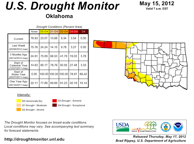
It's a very small change for now, but hot southwesterly winds blowing off the
more widespread drought area of west Texas will spread that drought to the
northeast if rains do not return.
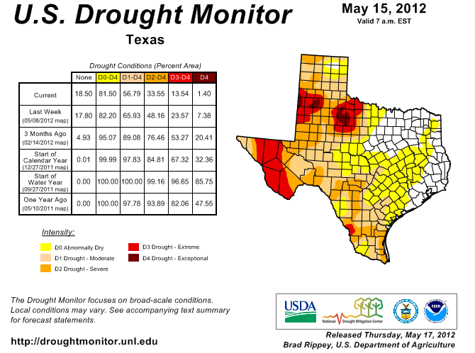
The good news is that west Texas just got a good dose of rain in some places,
so relief was close, at least. There are no large-scale climate factors
indicating a continued absence of our normal spring rains. The double-dip
La Nina that we experienced the last two years has now dissipated and oceanic
and atmospheric anomalies now reflect neutral conditions.
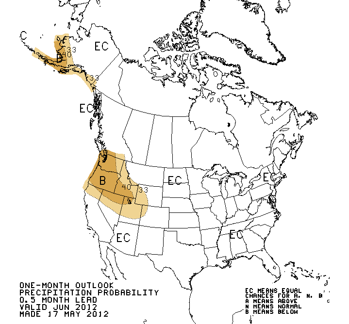
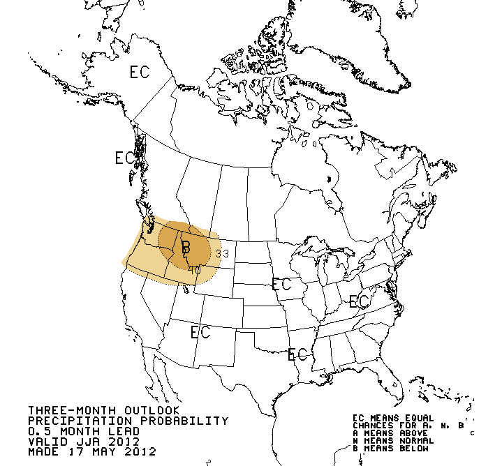
The latest outlooks reflect the lack of those large-scale influences on the
precipitation for the southern U.S., including Oklahoma. The "EC" designation
for our area indicates "Equal Chances" for above-, below- or near-normal
rainfall for June and also the June-August (summer) periods.
CAUTION: THAT DOES NOT MEAN NORMAL RAINFALL IS FAVORED! The lack of indicators
simply means that they can't tilt the odds for any favored regime.
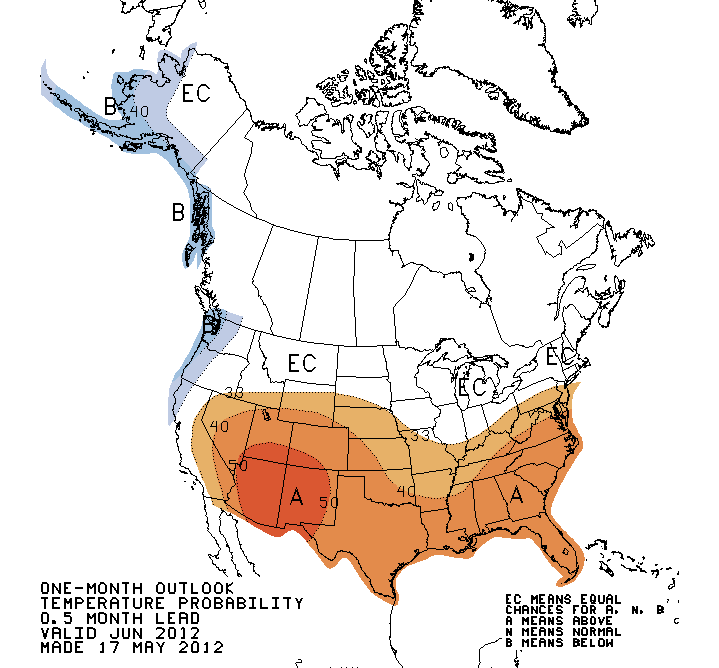
The temperature outlooks are a completely different story. There are strong
indications from dynamic climate models in particular that we are in for a
warmer than normal June and summer as well. Diminishing soil moisture as we
head into the calendar's hottest section is another indicator of above normal
temperatures.
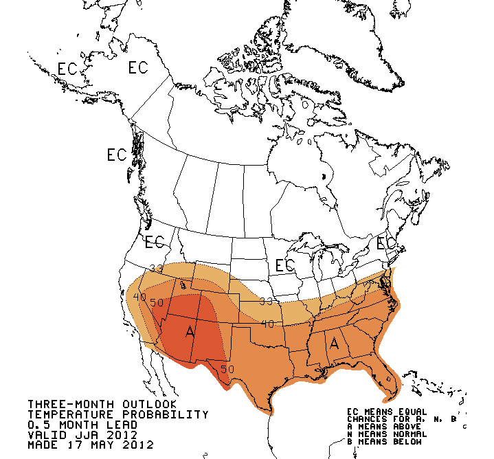
Now here's an important caveat. The skill on these outlooks is admittedly
fairly low during the warm season, especially the summer months. Until our
persistent above normal temperatures subside, however, that looks like the
possible direction our temperatures are going to go. Our ace in the hole is
precipitation. As we've talked about numerous times, our summer heat features
a strong negative correlation to rainfall. So if we have a wetter than normal
summer, the temperatures should be a bit milder.
It's something to hope for.
Gary McManus
Associate State Climatologist
Oklahoma Climatological Survey
(405) 325-2253
gmcmanus@mesonet.org
May 17 in Mesonet History
| Record | Value | Station | Year |
|---|---|---|---|
| Maximum Temperature | 101°F | HOLL | 2022 |
| Minimum Temperature | 37°F | CAMA | 2009 |
| Maximum Rainfall | 3.66″ | PORT | 2002 |
Mesonet records begin in 1994.
Search by Date
If you're a bit off, don't worry, because just like horseshoes, “almost” counts on the Ticker website!