Ticker for February 29, 2012
MESONET TICKER ... MESONET TICKER ... MESONET TICKER ... MESONET TICKER ...
February 29, 2012 February 29, 2012 February 29, 2012 February 29, 2012
Been planning a trip to White Sands New Mexico?
Cancel your itinerary. Since gas prices are so high, Mother Nature decided to
bring White Sands to you. Yesterday's mostly-dry-for-Oklahoma storm system was as
miserable as advertised with severe thunderstorm strength winds without the
thunderstorms, blowing dust and just a bit of rain. Those non-thunderstorm winds
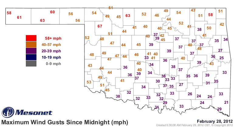
peaked in the 60 mph range in the northwest and Panhandle. The Oklahoma Mesonet
site at Woodward recorded a gust of 67 mph last night.
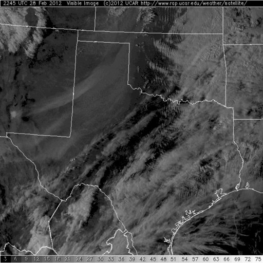
Now those winds were not just in Oklahoma, extending back to the west into the
High Plains of New Mexico and Colorado. In this visible satellite picture from
yesterday, you can clearly see the plume of dust from White Sands, New Mexico,
extending into northwestern Oklahoma. Dust from other parts of that area can
be seen traveling up into Oklahoma as well.
The blowing dust was so bad in the Panhandle that it caused road closures, as
this alert from the Oklahoma Highway Patrol screamed:
"STATE HIGHWAY 136 NORTH OF GUYMON, OKLAHOMA IS CLOSED DUE TO HIGH WINDS,
BLOWING DUST AND LOW VISIBILITY."
As we've talked about to the point of nausea here on the Ticker, that area in
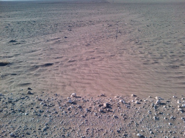
the Panhandle is still faced with catastrophic drought conditions. Local experts
in that area fear another year with little agricultural output. This picture
I received yesterday from a farm north of Guymon, taken on February 25, is a
pretty good indication of the drought disaster that is still going strong in
that part of the state.
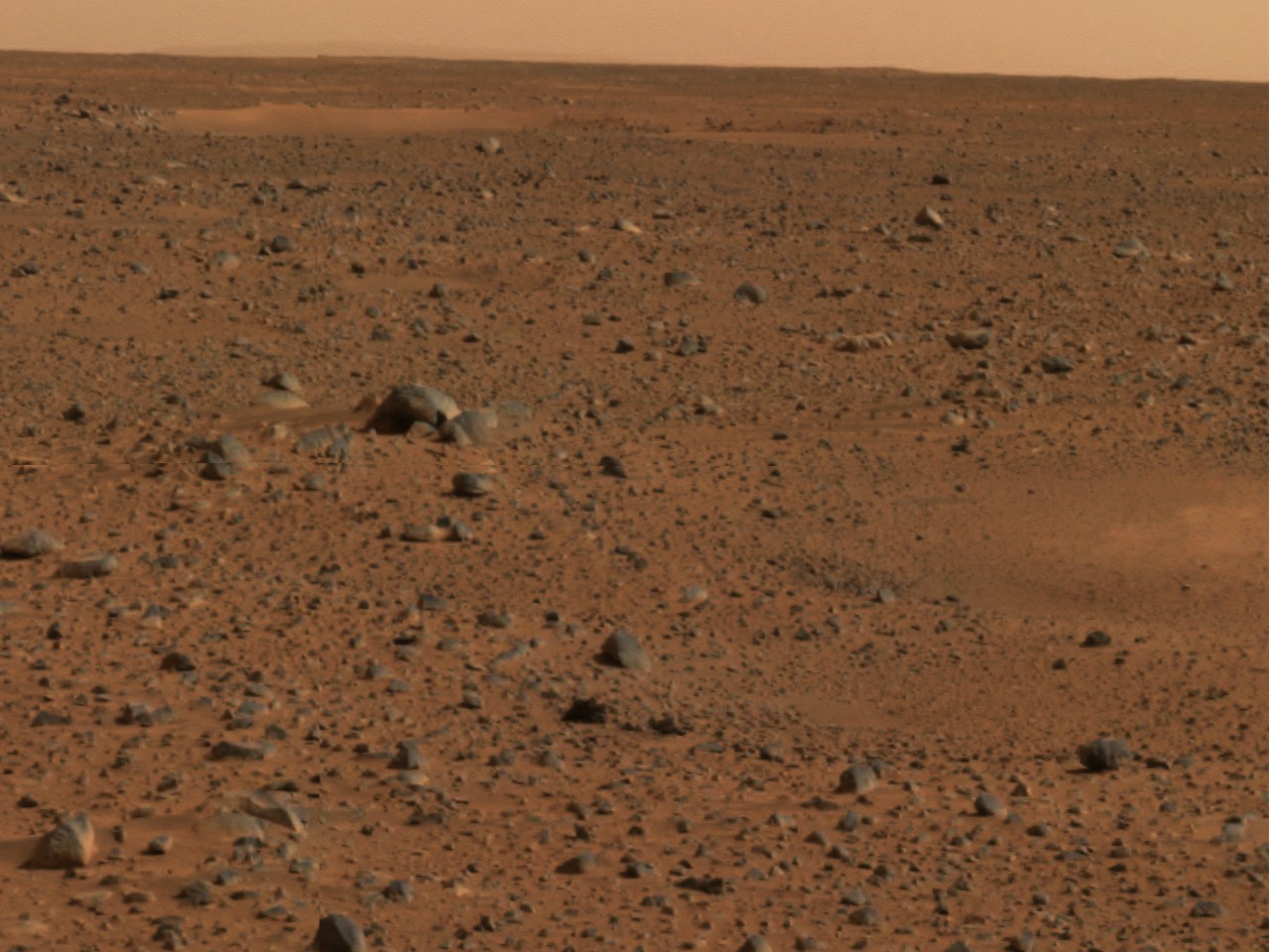
As somebody else mentioned to me, compare that pic to this one from Mars in
2003, "another area that can't seem to shake D4 drought."
Since this drought began in early fall of 2010, 17 months strong now, that
area of the state has seen 9-10 inches of rainfall.
Again, 9-10 inches of rainfall in 17 months.
With everything that happened in the state during 2011, and the relief we've had
since October, some folks have been asking "I wonder what the next weather
disaster will be?" The question for some Oklahomans is not what the next one
will be, but when will the current one end.
Gary McManus
Associate State Climatologist
Oklahoma Climatological Survey
(405) 325-2253
gmcmanus@mesonet.org
March 1 in Mesonet History
| Record | Value | Station | Year |
|---|---|---|---|
| Maximum Temperature | 80°F | WAUR | 2016 |
| Minimum Temperature | 19°F | KENT | 2012 |
| Maximum Rainfall | 1.11 inches | ACME | 2016 |
Mesonet records begin in 1994.
Search by Date
If you're a bit off, don't worry, because just like horseshoes, “almost” counts on the Ticker website!