Ticker for December 15, 2011
MESONET TICKER ... MESONET TICKER ... MESONET TICKER ... MESONET TICKER ...
December 15, 2011 December 15, 2011 December 15, 2011 December 15, 2011
New (old) Drought Monitor maps, and outlooks from CPC released
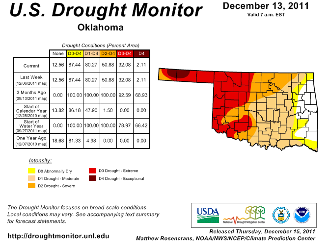
Today's new U.S. Drought Monitor map looks exactly like last Thursday's DM map.
Very little rain had fallen since last week and before the cut-off date of 6 a.m.
Tuesday for consideration in the new map. So here is the new/old map.
The newest U.S. Seasonal Drought Outlook from the NWS' Climate Prediction Center
is also remarkably like the one two weeks ago. It continues to show improvement
in eastern Oklahoma and persistence/intensification in western Oklahoma. The
expectations would be for these storm systems to continue to dump more
significant rains over NE Texas, E Oklahoma and the Ohio River Valley. Exactly
as they have been doing.
I can't say it any better than my friend Brad Pugh, CPC forecaster and former
OCS graduate student, so in his words:
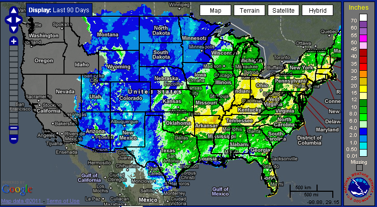
"Frequent periods of wet weather coupled with seasonably cooler
temperatures have resulted in drought reduction across the southern
Plains, most notably across Kansas, Oklahoma, and north Texas.
During the past 30 days, 2 to 5 inches of precipitation was observed
across these areas with the heaviest amounts in southeast Oklahoma.
According to the Oklahoma Mesonet, Broken Bow has recorded 11.05
inches of precipitation since November 13. Short and medium-range
forecasts indicate 1-3 inches of rainfall in southeast Kansas,
eastern Oklahoma, and northeast Texas. Due to this expected wetness
and relatively low probabilities for below median precipitation in
the CPC January-March precipitation outlook, improvement is forecast
in southeast Kansas, eastern Oklahoma, and northeast Texas. Across
the remainder of Texas and the high Plains of Kansas and Oklahoma,
higher probabilities for below median precipitation in the CPC
January-March precipitation outlook and limited precipitation
amounts expected during the short to medium-range favor drought
persistence.
Forecast confidence for the southern Plains is high."
Here's a look at those January-March climate outlooks from the CPC.
January
Temperature: 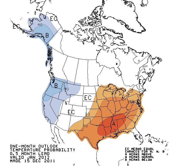
Precipitation: 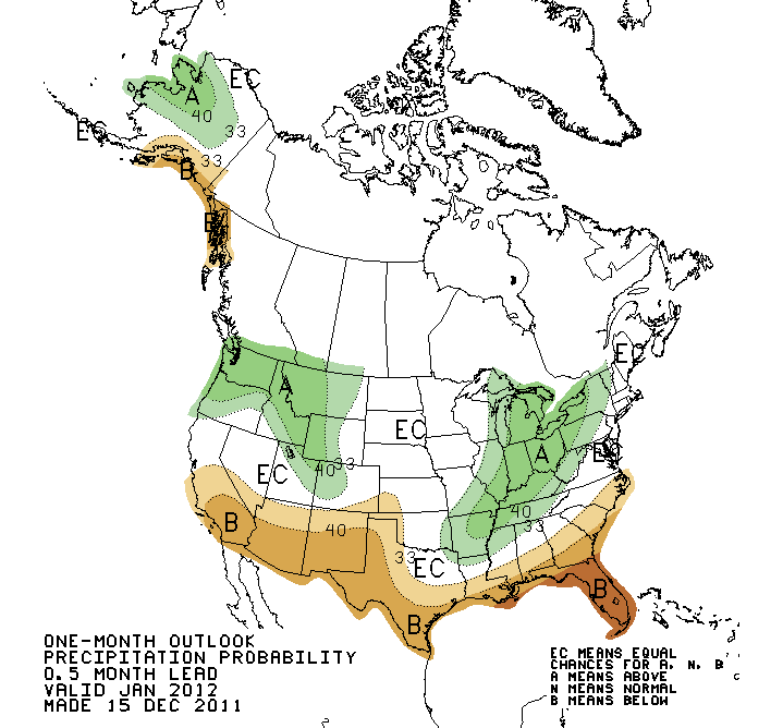
January-March
Temperature: 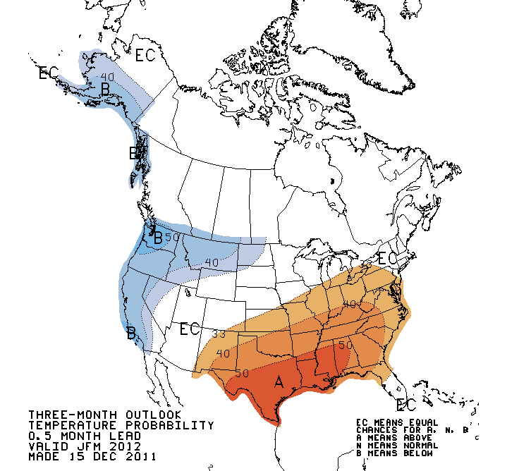
Precipitation: 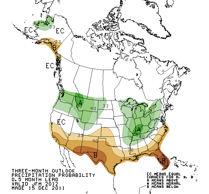
In a nutshell, increased chances of above normal temperatures for both the
January and January-March periods, and increased chances of below normal
precipitation for western Oklahoma in both periods. Those are close to the
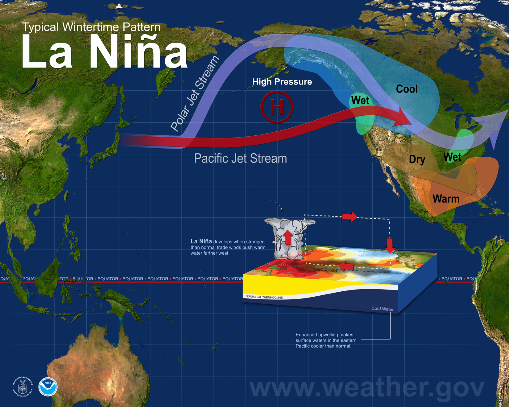
typical precipitation outlooks during La Nina winters, modified with the
persistence of that wet pattern down into the eastern parts of the state. To
have that wet tongue extend down into eastern Oklahoma from the Ohio River
Valley is not THAT unusual with a La Nina pattern.
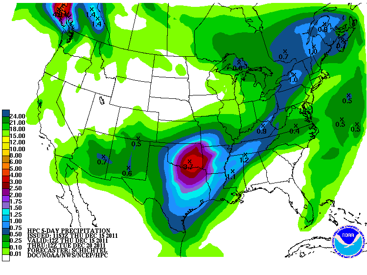
The latest 5-day precipitation forecast from the NWS' Hydrometeorological
Prediction Center is starting to pick up the rains predicted not only today,
but also for early next week in eastern Oklahoma. And of course, this could
change significantly in the next few days. But just a hint ...
Gary McManus
Associate State Climatologist
Oklahoma Climatological Survey
(405) 325-2253
gmcmanus@mesonet.org
December 15 in Mesonet History
| Record | Value | Station | Year |
|---|---|---|---|
| Maximum Temperature | 83°F | SEIL | 2021 |
| Minimum Temperature | 2°F | KENT | 2008 |
| Maximum Rainfall | 1.99″ | BBOW | 2001 |
Mesonet records begin in 1994.
Search by Date
If you're a bit off, don't worry, because just like horseshoes, “almost” counts on the Ticker website!