Ticker for October 3, 2011
MESONET TICKER ... MESONET TICKER ... MESONET TICKER ... MESONET TICKER ...
October 3, 2011 October 3, 2011 October 3, 2011 October 3, 2011
The Good, the Bad and the Climatologist
Wait, I don't think I did that correctly. Oh well. There's no time to correct
such an obvious error when there is possible good news to report. The latest
outlooks for October from the NWS' Climate Prediction Center were released on
Friday. At least for parts of Oklahoma, a wet signal is showing up through the
month. As shown below, the forecasters at the CPC see an increased chance for
above normal precipitation in the eastern one-third of the state or so. Notice
also the increased chance for above normal temperatures in the eastern half of
the state.
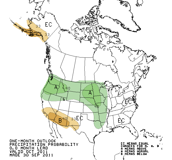
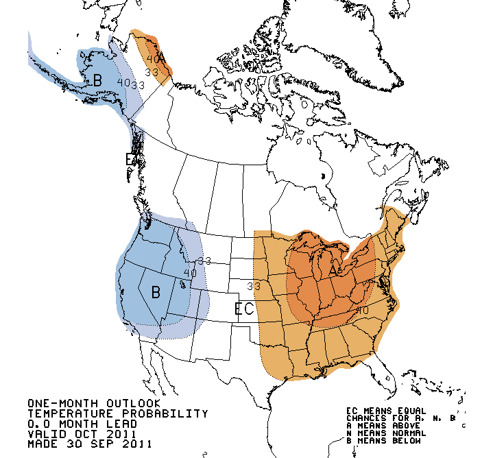
The "EC" designation, once again, basically means the forecaster had little
confidence on any sort of signal (A-Above, B-Below, N-Normal). They punted. And
remember, this is a map of probability, not rainfall anomaly amounts. According
to the forecaster, these outlooks were based off of extended-range dynamical
model forecasts for the first two weeks of October. Obviously, they are counting
on that trough digging into our area (and we all know just how painful that can
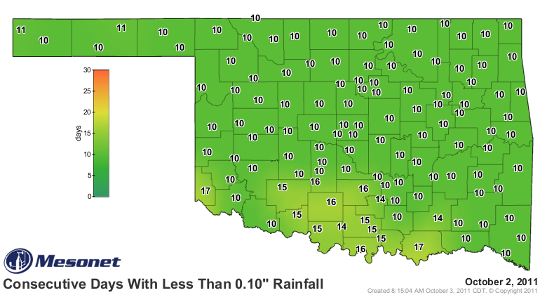
be) and giving us some rainfall this weekend. Of course, that will be after a
week of dry October weather. As has been the norm over the last year, each
decent rainfall event is soon followed by a relatively long stretch of dry
weather (i.e., no reinforcing moisture).
Speaking of that rainfall, the latest 5-day precipitation forecast from the
Hydrometeorological Prediction Center (HPC) throws a big old bull's eye of
approximately 4 inches in western Oklahoma through Saturday morning.
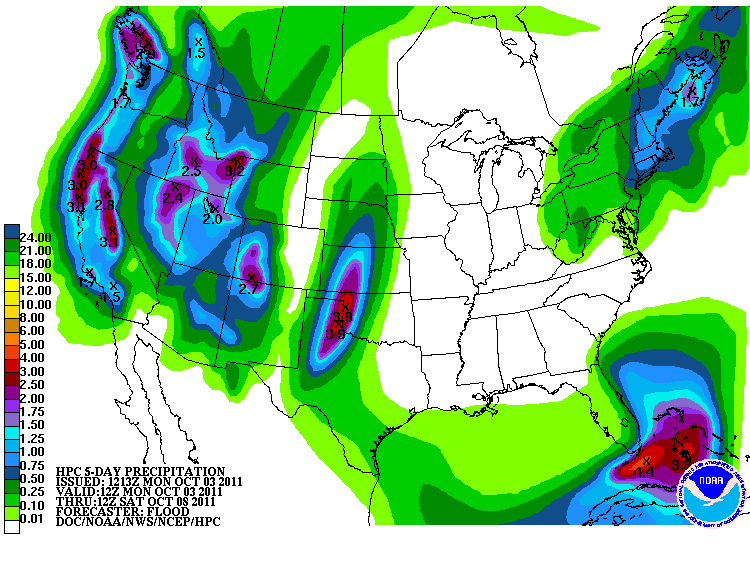
That would be beyond welcome if it verified, but 5 days is a long way out when
that low pressure system is still so far away.
This next graph shows the change in U.S. Drought Monitor designation for the
water year (Oct 1, 2010-Sep 30, 2011), a period that coincides very neatly with
the life cycle of this drought. Still waiting to write the epitaph, however.
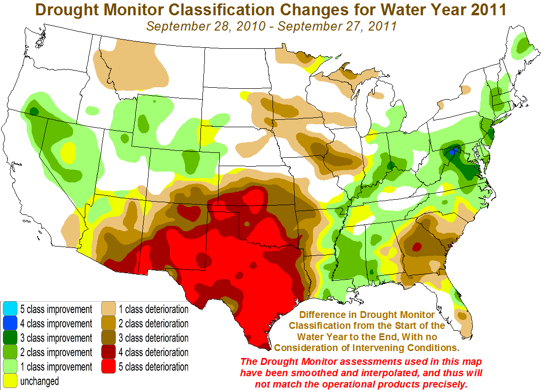
Lots of 4- and 5-class deterioration for Oklahoma and Texas and other parts
of the Southern Plains. And of course some parts of the state were already in
a minor drought classification or there would be more of the 5-class
deterioration showing up.
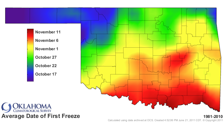
Finally, Oklahoma has yet to record a freezing temperature this fall. We've
come close with a few mid-30s over the last couple of days. That's not entirely
unusual, but we will be approaching the average date of the first fall freeze
(based upon 1981-2010 data) in a couple of weeks in the northwest.
We're shooting by the dates for the earliest first freeze (1981-2010) with
each passing day.
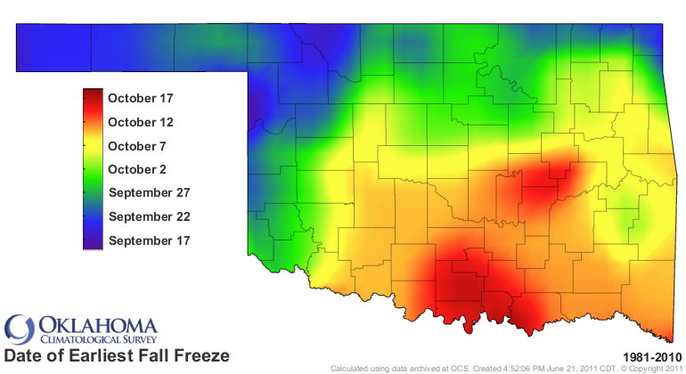
Those types of temperatures are not showing up just yet. But with the sun's
angle diminishing and the number of daytime hours slowly withering away each day,
it's inevitable.
Happens every year.
Gary McManus
Associate State Climatologist
Oklahoma Climatological Survey
(405) 325-2253
gmcmanus@mesonet.org
October 3 in Mesonet History
| Record | Value | Station | Year |
|---|---|---|---|
| Maximum Temperature | 106°F | HOLL | 2000 |
| Minimum Temperature | 31°F | OILT | 2010 |
| Maximum Rainfall | 4.11 inches | WOOD | 2019 |
Mesonet records begin in 1994.
Search by Date
If you're a bit off, don't worry, because just like horseshoes, “almost” counts on the Ticker website!