Ticker for September 29, 2011
MESONET TICKER ... MESONET TICKER ... MESONET TICKER ... MESONET TICKER ...
September 29, 2011 September 29, 2011 September 29, 2011 September 29, 2011
New drought monitor and another 100? Are you kidding me?
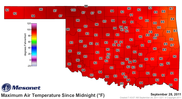
Before we get to the drought news, we have to first talk about the heat from
yesterday. We skipped back about a month yesterday with highs rising into the
90s across most of the state. However, one Oklahoma Mesonet station managed to
hit triple digits one more time. Fittingly, that station was Buffalo, the most
awesome town in these here United States! Check out the maps below for highs
from yesterday and the new count for 100-degree days across the state.
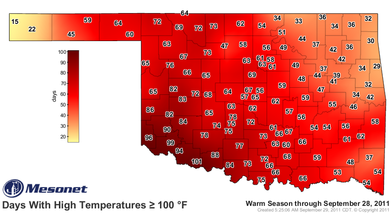
That brings the count for Buffalo up to 72 days at-or-above 100 degrees for 2011
thus far. The previous record for Buffalo was 68 days, set back in 1954. Data for
Buffalo begins in 1907. Grandfield still leads the state with 101 days, a new
record for Oklahoma. The previous record was 86 days set at Hollis back in 1956.
Is that the final nail in the 100-degree day coffin? Not necessarily. History
shows more than half of the days in October have registered a few hundreds dating
back to the 1890s. The latest 100-degree readings I can find in the state came
on Halloween at Kingfisher way back in 1899 and at Temple in 1907.
Enough about hot air. Let's move on to dry dirt. The U.S. Drought Monitor map
came out this morning and we did see some improvements in the state.
Unfortunately, the improvements were not widespread, mostly confined to the
northeastern quarter of the state.
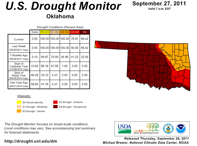
The amount of exceptional drought (D4) in the state stayed at 66%, but the
amount of extreme-to-exceptional drought (D3-D4) went from 90% to 79%. So that
area of D3 in eastern Oklahoma dropped by 11%. It ain't much, but hey, it's
better than nothing!
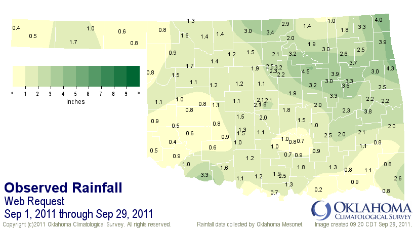
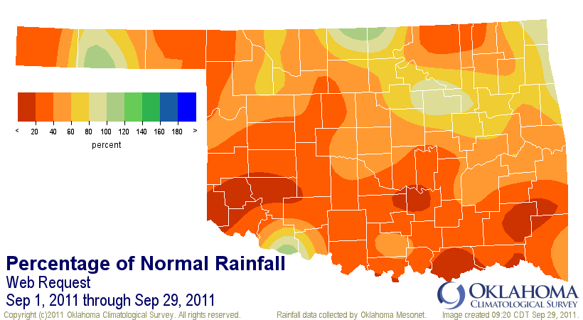
September ends tomorrow and it ended up as a dud for most of the state in its
role as the beginning of the secondary rainy season. The statewide average for
September will finish around 1.66", 2.01 inches below normal or 45% of normal.
Very few places in the state reached normal precipitation levels during the
month, as shown in the following two maps from the Oklahoma Mesonet. However,
those 3-4 inch amounts from eastern Oklahoma look pretty awesome to me.
We'll have the new October and Oct-Dec outlooks from the Climate Prediction
Center for you tomorrow. I would expect them to say we'll continue with this
"wonderful/delightful/splendid" weather we've been having that is threatening
its second wheat crop in a row and adding another billion or two onto its
$2 billion in damages thus far.
Sarcasm? Who, me?
Gary McManus
Associate State Climatologist
Oklahoma Climatological Survey
(405) 325-2253
gmcmanus@mesonet.org
September 29 in Mesonet History
| Record | Value | Station | Year |
|---|---|---|---|
| Maximum Temperature | 102°F | BURN | 2011 |
| Minimum Temperature | 31°F | KENT | 1999 |
| Maximum Rainfall | 4.93 inches | STIG | 2012 |
Mesonet records begin in 1994.
Search by Date
If you're a bit off, don't worry, because just like horseshoes, “almost” counts on the Ticker website!