Ticker for September 22, 2011
MESONET TICKER ... MESONET TICKER ... MESONET TICKER ... MESONET TICKER ...
September 22, 2011 September 22, 2011 September 22, 2011 September 22, 2011
A fella could get used to this!
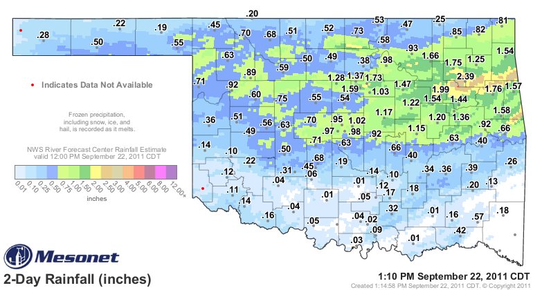
Two Thursday U.S. Drought Monitor releases in a row have been met in Oklahoma by
gray, cool weather. These are once again not drought-busting rains, being in the
1-inch category and not widespread enough. Eastern Oklahoma once again got the
lion's share of the heavier precipitation with a 2-3 inch streak across the
northeast. Payne County had a nice bull's eye of close to 2 inches as well. Of
course, amounts vary in localized areas. Here's the Oklahoma Mesonet total map
with radar-estimated overlay from the NWS River Forecast Center.
So great news for those folks that got the heavier totals. For much of southern
and western Oklahoma, it was simply not enough, however. But I think we can trust
that they are happy they got what they did. Hopefully it's enough to allow for
planting of wheat and other crops with the meager amount of moisture added to the
soils. Maybe enough for one more hay.
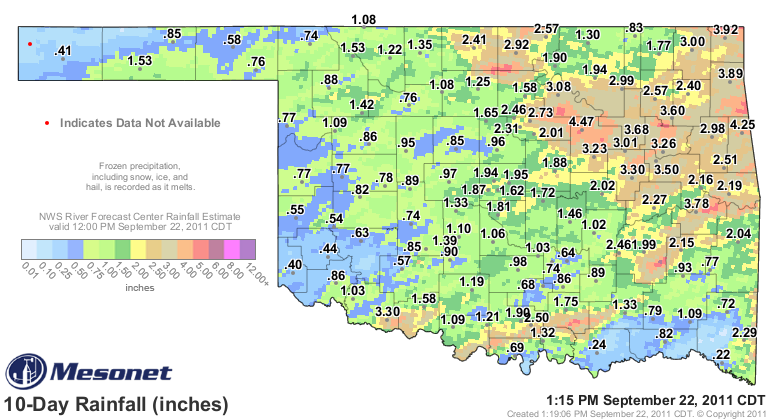
When you combine it with the rains from last week, the story is quite clear.
Northeastern and east central Oklahoma are the real winners. For western Oklahoma,
the same old story. Too dry.
This most recent rainfall was not considered in the latest U.S. Drought Monitor
map. As explained in previous Tickers, the cutoff for precip to be considered is
technically 7 a.m. on Tuesday. Taking into account last week's rainfall,
we did see some improvement in the state's depiction up in the Osage County
area.
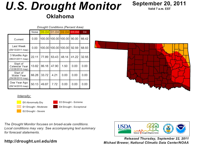
The main factor in keeping much of the state in the same intensity level is
the long-term statistics (and impacts) continuing to overwhelm the short-term.
The lack of reinforcing rainfall has been a particular problem. The current
rain definitely reinforced those rains in the northeast. Look for more
improvements in that area next week.
Remember, much of southern Oklahoma was from 15 inches to more than 20 inches
below normal for the water year (Oct. 1-Sep. 30) through yesterday. And in
another look, much of the western two-thirds of the state was running 20-60%
of normal for the same time period. So when you're 22 inches down for the last
11 months (hey to Grandfield!), the 3 inches you just received might not reduce
your drought intensify very much.
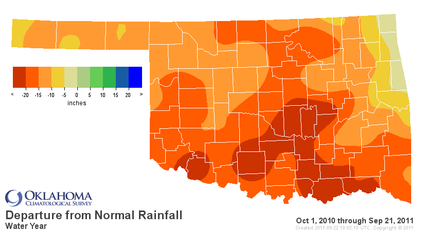
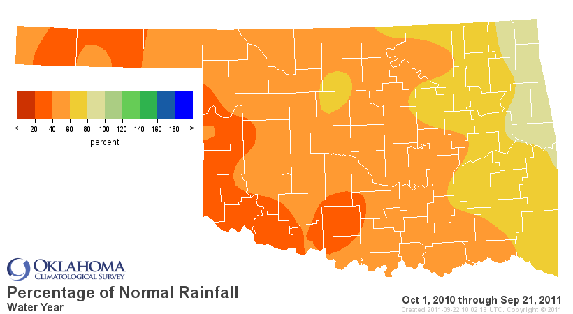
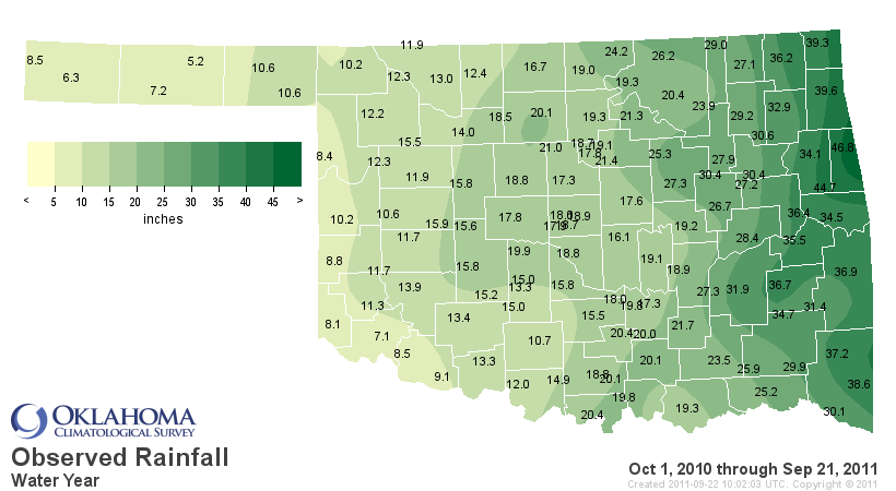
That is a lot of dryness and associated impacts to overcome. When we solicited
input from across the state this week, the tales we got were of continued
drought with little improvement in those impacts in most areas. Hopefully we'll
get a better report when we start assessing next week.
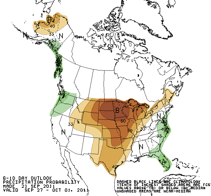
It looks like we might be going back into another dry and warm pattern according
to the short-term outlooks from the CPC. As you can see, increased chances of
below-normal precipitation and above-normal temperatures are indicated for the
end of September through early October period.
6-10 day (Sep. 27-Oct. 1) Outlooks
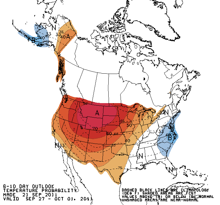
8-14 day (Sep. 29-Oct. 5) Outlooks
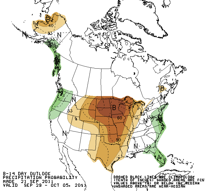
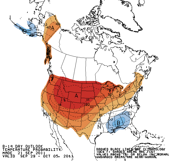
At any rate, we'll take the moisture we did get, bank it and hope for more.
Gary McManus
Associate State Climatologist
Oklahoma Climatological Survey
(405) 325-2253
gmcmanus@mesonet.org
September 22 in Mesonet History
| Record | Value | Station | Year |
|---|---|---|---|
| Maximum Temperature | 102°F | HOLL | 2023 |
| Minimum Temperature | 36°F | EVAX | 2018 |
| Maximum Rainfall | 7.63 inches | SEIL | 1997 |
Mesonet records begin in 1994.
Search by Date
If you're a bit off, don't worry, because just like horseshoes, “almost” counts on the Ticker website!