Ticker for August 25, 2011
MESONET TICKER ... MESONET TICKER ... MESONET TICKER ... MESONET TICKER ...
August 25, 2011 August 25, 2011 August 25, 2011 August 25, 2011
Warning, disgruntlement contained within
I'll be danged if Mother Nature didn't up and give us a mighty uncomfortable day
yesterday as we entered the last week of August, and I'll be double-danged (work
with me, I'm off the script) if it didn't end up being tied as one of the
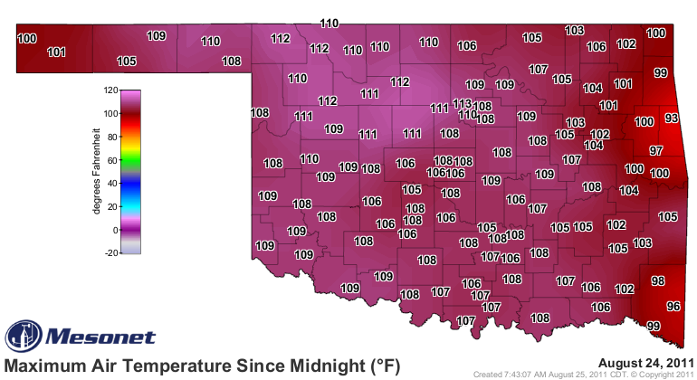
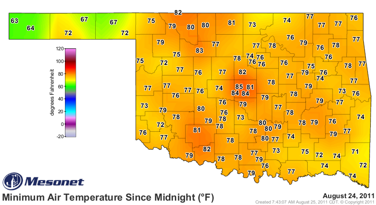
hottest 50 days in Oklahoma history. The statewide average temperature according
to the Oklahoma Mesonet was 91.5 degrees. That ties yesterday (August 24, 2011)
with July 15, 1954, for the 41st hottest day in state history. We constricted
the historical comparison to days with at least 70 functional COOP stations in
the state, so this goes back to around 1914, or approximately 35,400 total days.
What does the 41st hottest day in state history look like? Something like this.
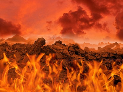
Whoops, sorry. That's either Hell or SW Oklahoma. Hard to tell. Let's try again.
And keep in mind quite a few of those lows were set yesterday evening with a
line of showers that moved through.
By the way, since you asked, here's what the hottest day in state history looks
like (statewide average of 94.9 degrees from August 12, 1936):
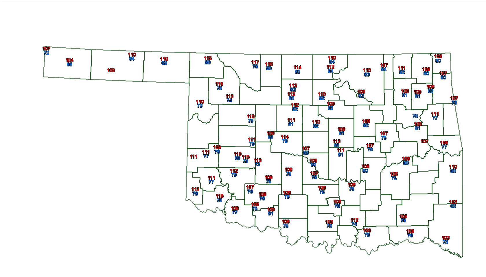
To tell you the truth, that looks like several days we've had this summer. Very
close to the SECOND hottest day on record in Oklahoma with a statewide average
of 94.5 degrees ... August 2, 2011.
************************************
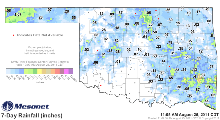
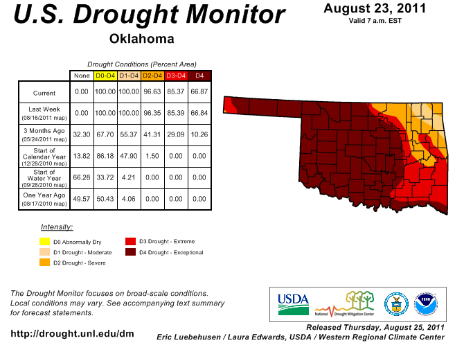
Little improvement in drought seen
As I feared, we've had very little in the way of reinforcing rains after the
good soaking of a couple weeks ago. We need more yellows and oranges, fewer
blues.
So the U.S. Drought Monitor has seen very little change since last week.
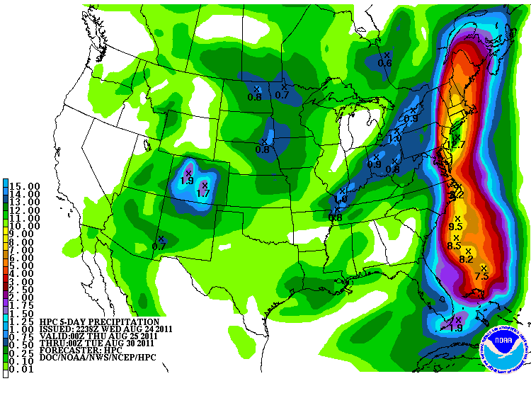
The potential for some rain in the next five days in Oklahoma is there with
another front, but the big amounts through Monday still appear absent. Hey,
can you tell where Hurricane Irene is tracking??
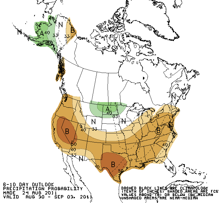
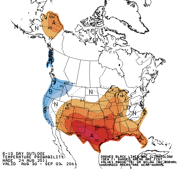
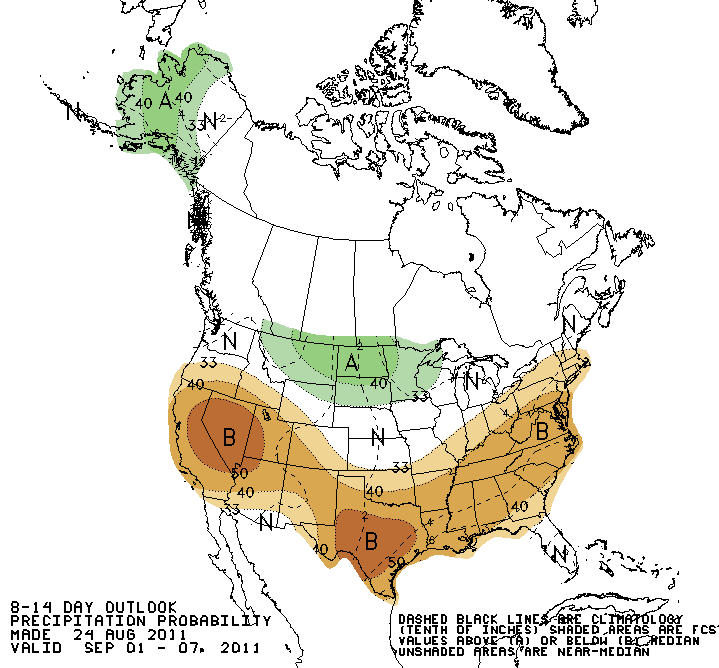
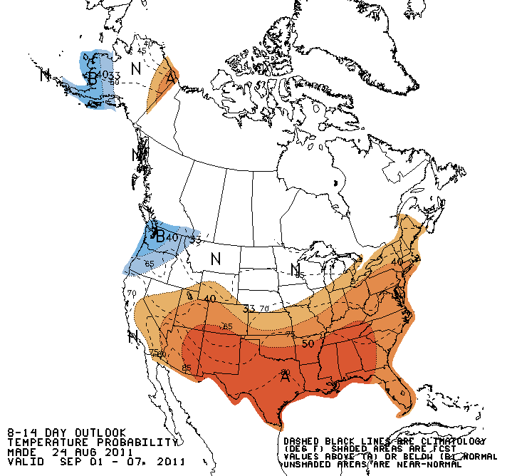
Looking ahead at August 30-September 7 or so, the NWS' Climate Prediction Center
sees increased chances of below normal rain and above normal temperatures.
6-10 day outlooks:
8-14 day outlooks:
Ugh. Okay Mother Nature, enough's enough. Either bring us fall or get lost. And
take your Parkay margarine with you (young folks, ask your parents).
This Associate State Climatologist has had it.
Gary McManus
Associate State Climatologist
Oklahoma Climatological Survey
August 25 in Mesonet History
| Record | Value | Station | Year |
|---|---|---|---|
| Maximum Temperature | 109°F | FREE | 2024 |
| Minimum Temperature | 46°F | BEAV | 2010 |
| Maximum Rainfall | 4.69 inches | MEDI | 2017 |
Mesonet records begin in 1994.
Search by Date
If you're a bit off, don't worry, because just like horseshoes, “almost” counts on the Ticker website!