Ticker for February 15, 2011
MESONET TICKER ... MESONET TICKER ... MESONET TICKER ... MESONET TICKER ...
February 15, 2011  February 15, 2011  February 15, 2011  February 15, 2011


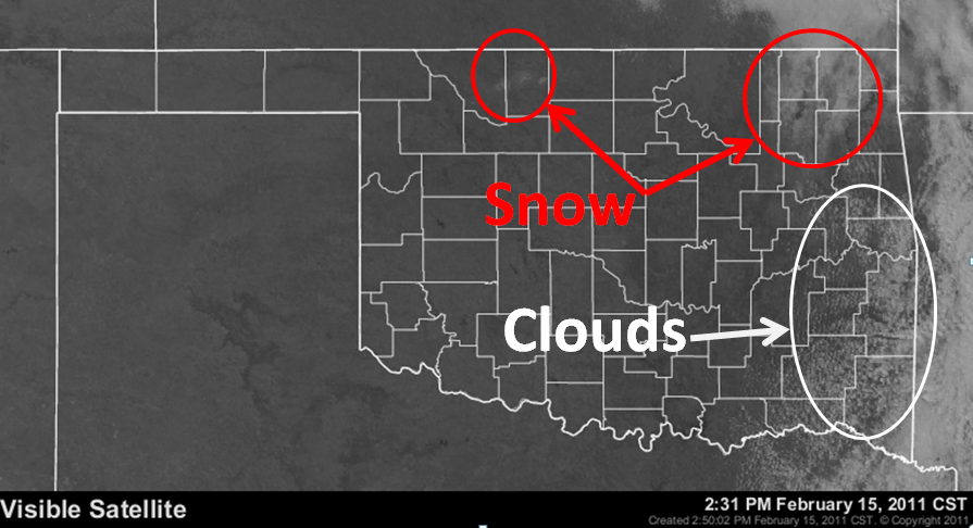
Where's the snow?

Having trouble finding the snow? Well, that's because it melted. Glad to help.

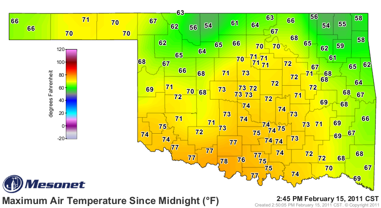
But it hasn't melted everywhere, and you don't necessarily need a visible
satellite view to discover that. Check out the max temperature map from the
Oklahoma Mesonet today.


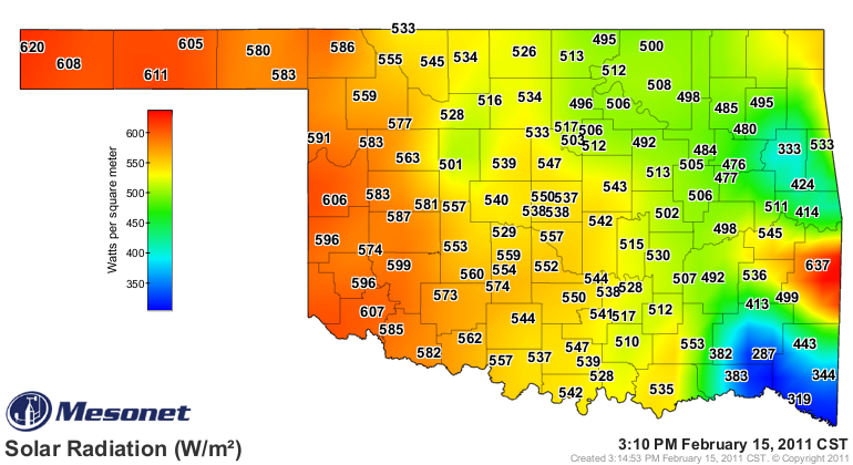
Sort of obvious, but also a tad tricky. Let's add the solar radiation map from
the Mesonet to help.


A bit of missing data there, but we can tell in the far east-central and
southeast that some cloudiness is responsible for some of the suppressed
temperatures there. For confirmation, check out the visible satellite map.


It may not seem like a lot of snow, but from reports in the northeast corner
of the state, there is still 6-12 inches of snow on the ground. The sun is
getting higher in the sky with each passing day and we're getting more sunlight,
but the reflectivity (albedo) of that snow is still mighty powerful this time
of year.

It remains to be seen if Nowata and those areas can reach the magical
100-degree temperature swing mark within a week. The albedo is working against
them. Their biggest ally at this point (other than the sun) is the warmth
carried northeastward on strong southwesterly winds.

The race is on!

Gary McManus
Associate State Climatologist
Oklahoma Climatological Survey
(405) 325-2253
February 15 in Mesonet History
| Record | Value | Station | Year |
|---|---|---|---|
| Maximum Temperature | 86°F | BURN | 2000 |
| Minimum Temperature | -22°F | KENT | 2021 |
| Maximum Rainfall | 2.12″ | CLOU | 2001 |
Mesonet records begin in 1994.
Search by Date
If you're a bit off, don't worry, because just like horseshoes, “almost” counts on the Ticker website!