Ticker for January 4, 2011
MESONET TICKER ... MESONET TICKER ... MESONET TICKER ... MESONET TICKER ...
January 4, 2011 January 4, 2011 January 4, 2011 January 4, 2011
December/Annual numbers are in
Welcome to 2011, where extreme weather is OUT and tranquility rules. Also, all
of my hair has grown back AND I had a very slimming holiday season. Okay, now
I'm pushing it. But our weather has been peaceful thus far in 2011, conveniently
ignoring the strong tornado near Westville on New Year's Eve and the approach of
COLD-MAGEDDON coming next week. But that is a good four days in a row. As we've
said after every year for the last 11 or so ... here's hoping this one will be
a sight better than the last one.
**********************************************************************************
December, Year Warmer and Drier Than Normal
December tried to end 2010 in a tranquil manner after a year?s worth of
tumultuous weather. Mother Nature provided a punctuation mark instead as a
strong tornado touched down near Westville in Adair County on New Year?s Eve.
The tornado eventually traveled into Arkansas, killing three near the small
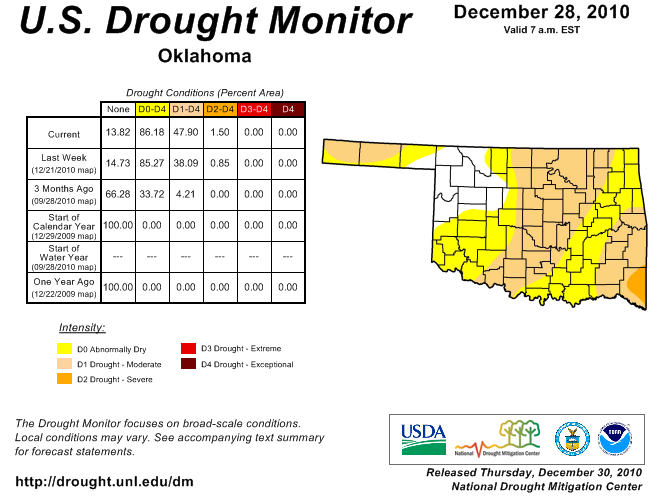
town of Cincinnati. A less violent hazard ? drought ? dug its heels into most
of the state during the month as lack of precipitation contributed to the 32nd
driest December since records began in 1895. Statewide average temperatures
were a bit above normal as well but the month still finished as the 58th
coolest on record.
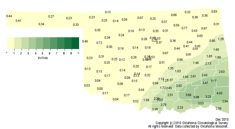
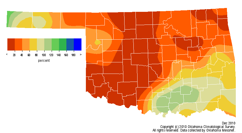
While southeastern Oklahoma managed to finish with a bit of a moisture surplus,
most of the state collected a meager 20-40 percent of normal for the month. The
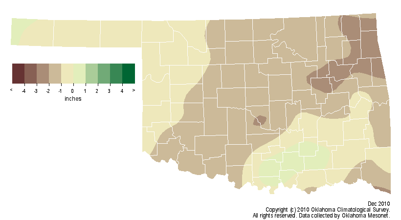
statewide average ended with a deficit of over an inch with a total of 0.91
inches according to the Oklahoma Mesonet. The southeast led the state with an
average total of nearly 4 inches, but the deficit in that area was also a little
less than an inch. The southwest barely registered precipitation at all with an
average total of 0.09 inches, a deficit of 1.29 inches and the eighth driest
December on record for that part of the state. The Mesonet site at Mt. Herman
led the way with 4.03 inches of rainfall while Altus went rainless for the
entire month. In fact, most of the northwestern two-thirds of the state
received less than a half-inch of rainfall.
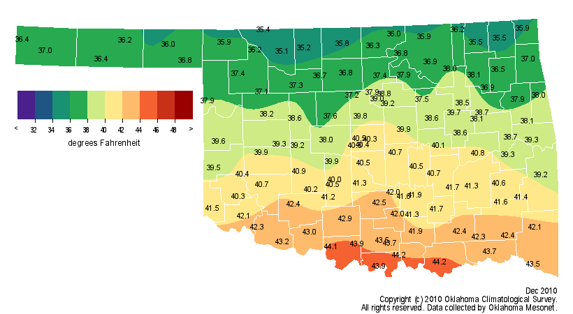
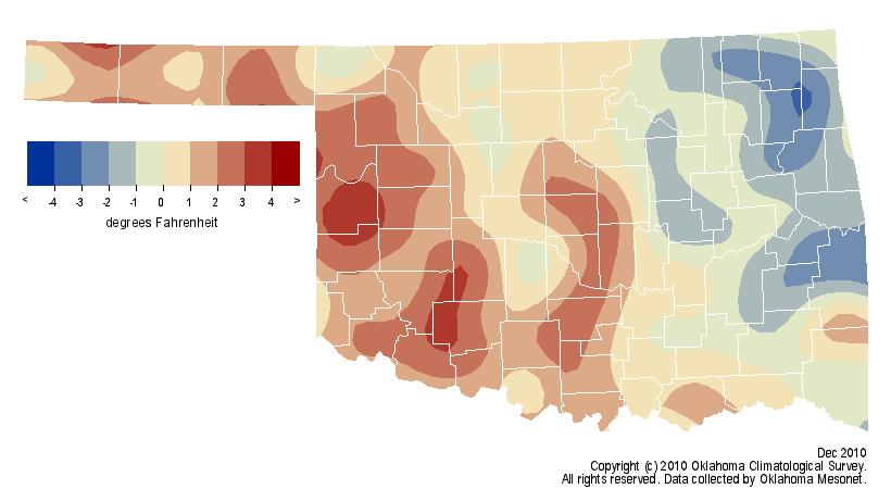
The statewide average temperature was 39.3 degrees, 0.3 degrees above normal.
Regionally, much of eastern Oklahoma was 1-4 degrees below normal and much of
western Oklahoma was 1-4 degrees above normal. The southwest enjoyed its 46th
warmest December on record while the southeast experienced its 46th coolest.
The highest temperature of the month, 83 degrees, was recorded at Hollis and
Tipton on the 15th and at Waurika on the 20th. The coldest reading of zero
degrees occurred on the 31st at Kenton and Boise City.
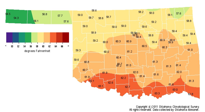
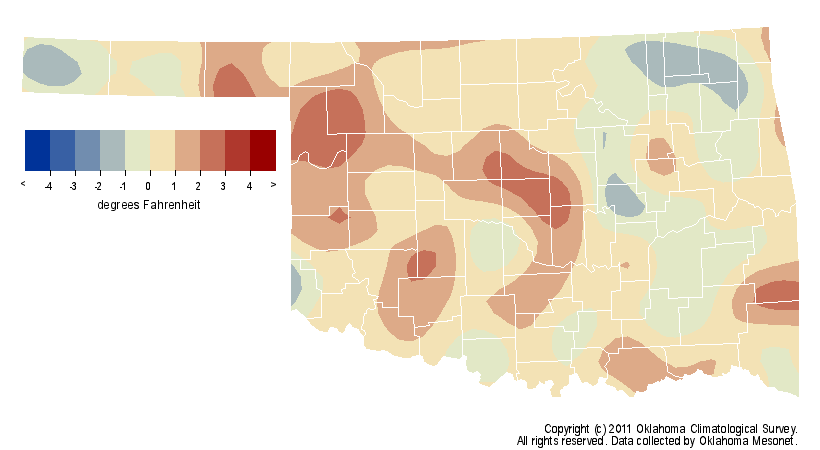
The somewhat warm and dry December contributed to the 43rd driest and 37th
warmest year on record for Oklahoma. The statewide average temperature was 60
degrees, 0.4 degrees above normal. The northeast finished right at normal while
west central Oklahoma was one degree above normal for the year. The rest of
Oklahoma fell somewhere in between. The statewide average rainfall total was
31.99 inches, 4.7 inches below normal. Not all areas of the state finished
equally, however. The southeast had a deficit of 12.29 inches for their 17th
driest year on record while the Panhandle fell to 0.49 inches below normal, the
51st wettest year for that area.
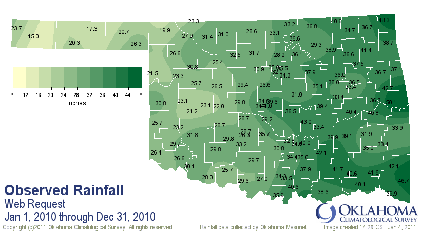
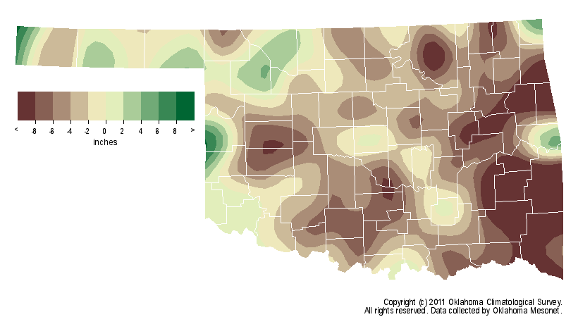
The highest temperature recorded by the Mesonet during 2010 was 109 degrees at
Freedom on August 2 and 13. On the cold side, -6 degrees was recorded at
Buffalo on January 8 and at Vinita on January 10. Miami recorded the most
rainfall with 48.26 inches while Boise City brought up the rear at 15.01 inches.
The tornado on the year?s final day brought the preliminary total for the year
to 102, the third-highest tally behind 1999?s 145 and 1957?s 107.
Gary McManus
Associate State Climatologist
Oklahoma Climatological Survey
(405) 325-2253
gmcmanus@mesonet.org
January 4 in Mesonet History
| Record | Value | Station | Year |
|---|---|---|---|
| Maximum Temperature | 72°F | HOLL | 2022 |
| Minimum Temperature | -6°F | BOIS | 2015 |
| Maximum Rainfall | 5.42 inches | COOK | 1998 |
Mesonet records begin in 1994.
Search by Date
If you're a bit off, don't worry, because just like horseshoes, “almost” counts on the Ticker website!