Ticker for December 23, 2010
MESONET TICKER ... MESONET TICKER ... MESONET TICKER ... MESONET TICKER ...
December 23, 2010 December 23, 2010 December 23, 2010 December 23, 2010
Drought persists in Oklahoma
At the urging of state and federal weather partners, the U.S. Drought Monitor
continued to show moderate drought (D1) conditions in the central one-third of
the state along the I35 corridor and southeastern Oklahoma. In fact, the
moderate drought designation actually increased in southeastern Oklahoma, and a
small patch of severe drought (D2) was added in McCurtain County.
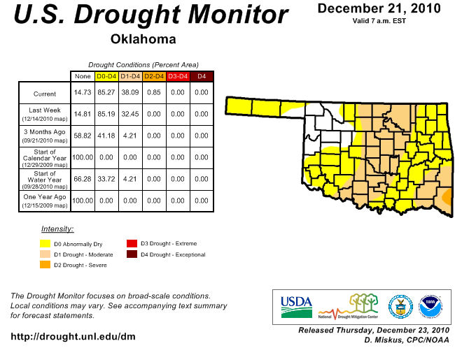
Shrinking ponds and reservoirs have reached levels not seen since the 2005-06
drought, and in some cases, they've outpaced even those levels. The dry weather
has persisted through fall and winter under an upper-level air pattern
influenced by La Nina. The Oklahoma Mesonet shows just how little rainfall has
fallen since summer in percent-of-normal rainfall maps for various intervals.
30-day: 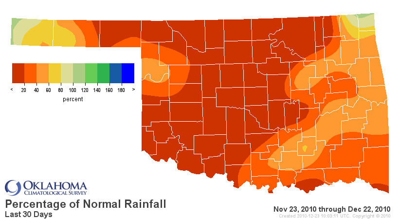
60-day: 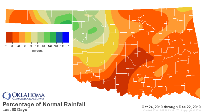
90-day: 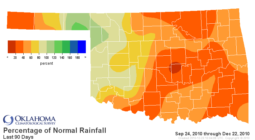
120-day: 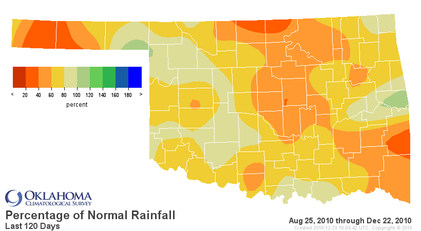
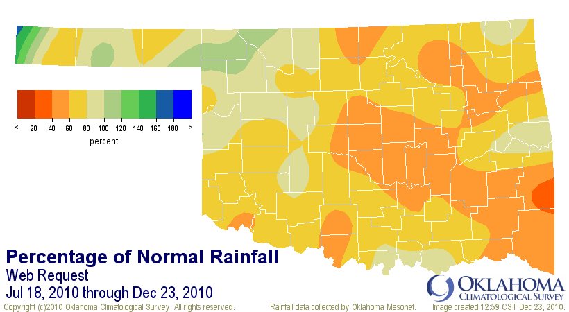
As noted in previous Tickers, this dryness is actually a continuation of a
more general pattern that began in mid-July after an extended period of heavy
rains. Those long-term conditions show up quite well in a percent of normal
rainfall map from the Mesonet since July 18:
We should not expect much drought expansion over the next month or so since
drought impacts will not be exacerbated by continued dryness (should that
dryness continue to occur). Demand for water is significantly lower during the
winter months for a variety of reasons:
1) Most plants are dormant so they do not require much water
2) Lower temperatures and less sun favor less evaporation
3) Human consumption is down (e.g., not much residential lawn watering occurring)
That is why the winter months are thought of as a recharge period for the
coming spring when demands slowly start to increase.
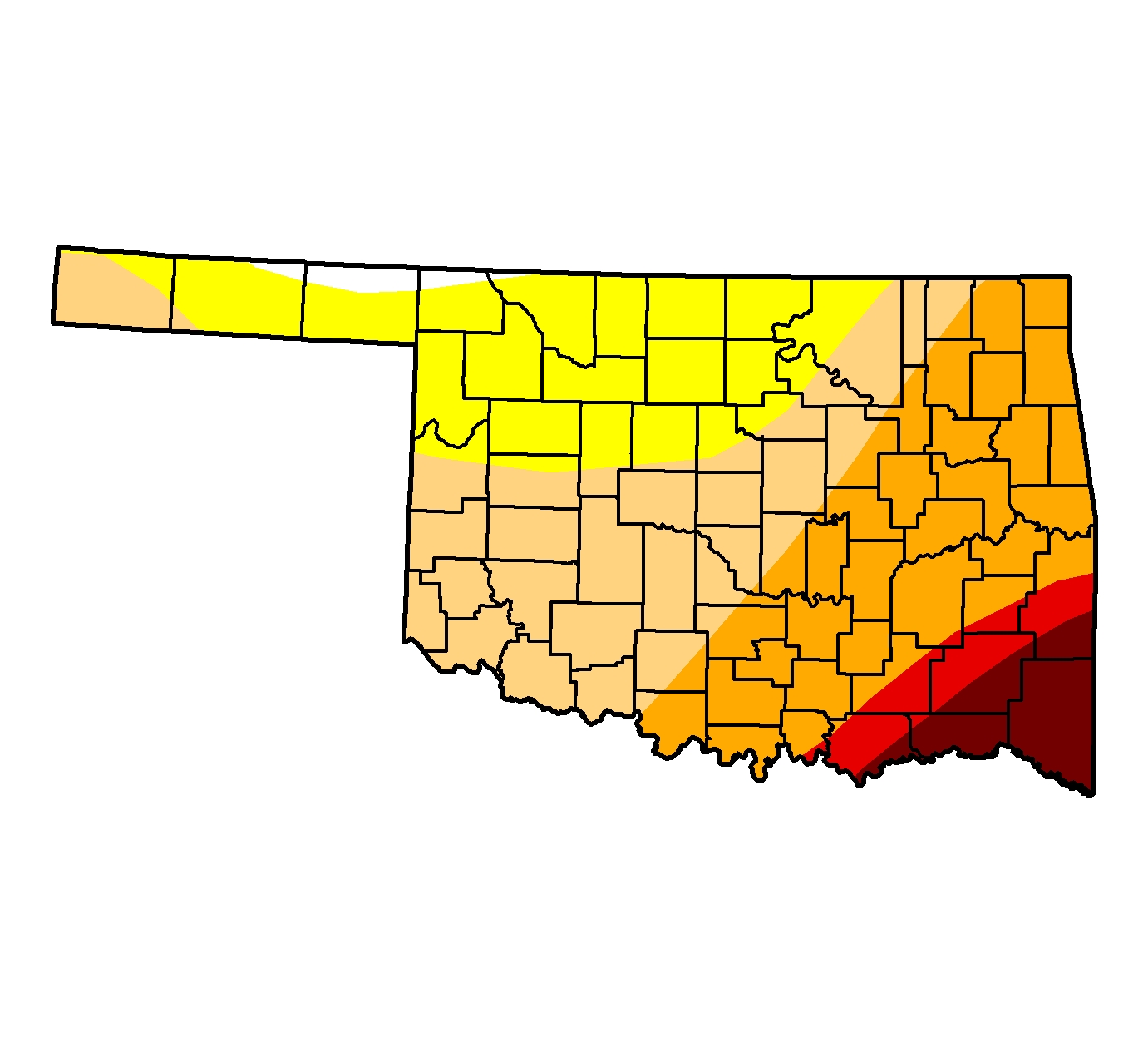
The current drought is minor compared to the aforementioned 2005-06 drought at
this point. A glance back at the Drought Monitor map from that period shows
our dryness going into the new year was quite severe with the worst drought
designation, "exceptional" drought (D4), appearing in the southeast:
La Nina's effects, which usually are not too significant for Oklahoma, were
quite apparent in the upper-air patterns this fall and winter. Those effects
normally weaken for this area of the Southern Plains the further we travel into
winter so that should help us see a bit more relief over the next couple of
months.
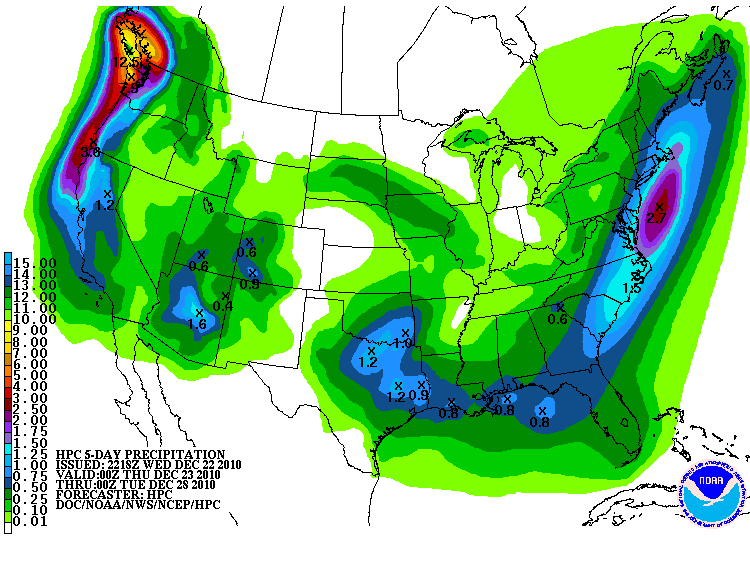
Unfortunately, since this is our driest part of the year, even normal
precipitation will not get us out of our current drought situation. The storm
that just finished inundating Southern California might be a beginning of at
least a little bit of relief, especially for southeastern parts of the state:
As mentioned previously, however, we'll need to see more storms as we get
closer to spring when water demands increase.
Happy Holidays to you and yours!
Gary McManus
Associate State Climatologist
Oklahoma Climatological Survey
(405) 325-2253
gmcmanus@mesonet.org
December 23 in Mesonet History
| Record | Value | Station | Year |
|---|---|---|---|
| Maximum Temperature | 85°F | ALTU | 2025 |
| Minimum Temperature | -11°F | GOOD | 2004 |
| Maximum Rainfall | 2.48″ | IDAB | 2009 |
Mesonet records begin in 1994.
Search by Date
If you're a bit off, don't worry, because just like horseshoes, “almost” counts on the Ticker website!