Ticker for December 20, 2010
MESONET TICKER ... MESONET TICKER ... MESONET TICKER ... MESONET TICKER ...
December 20, 2010  December 20, 2010  December 20, 2010  December 20, 2010


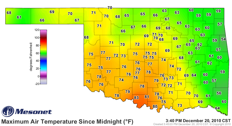
Temperatures soar across most of Oklahoma

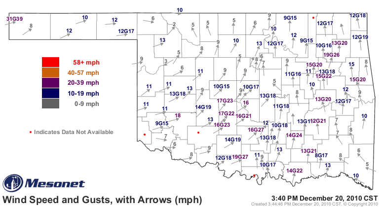
Strong southwesterly winds are bringing plenty of warm air into Oklahoma today,
as evidenced by the maximum temperature map from the Oklahoma Mesonet.


Today's top-15 warmest readings from the Mesonet (as of 3:30pm):

1 - Waurika 	        83.5F
2 - Ringling 	        81.8F
3 - Burneyville 	80.1F
4 - Pauls Valley 	78.8F
5 - Walters 	        78.6F
6 - Newport 	        78.1F
7 - Ketchum Ranch 	77.9F
8 - Mangum 	        77.7F
9 - Washington 	        77.7F
10 - Grandfield 	77.5F
11 - Hobart 	        77.3F
12 - Ninnekah 	        77.3F
13 - Bessie 	        77.1F
14 - Butler 	        77.0F
15 - Norman 	        76.7F

Those highest of those high temperatures are no doubt shattering records.
The normal high temperature for today at Waurika is 54 degrees and the record
high is 74 degrees. When you best a record high or low temperature by 10
degrees, that's a significant accomplishment indeed!

Oklahoma City also got into the record biz today with 74 degrees thus far,
topping their previous high of 73 degrees set in 1966.

Gary McManus
Associate State Climatologist
Oklahoma Climate Survey
gmcmanus@mesonet.org
(405) 325-2253
December 20 in Mesonet History
| Record | Value | Station | Year |
|---|---|---|---|
| Maximum Temperature | 83°F | WAUR | 2010 |
| Minimum Temperature | 1°F | EVAX | 2022 |
| Maximum Rainfall | 3.31″ | DURA | 1997 |
Mesonet records begin in 1994.
Search by Date
If you're a bit off, don't worry, because just like horseshoes, “almost” counts on the Ticker website!