Ticker for November 10, 2010
MESONET TICKER ... MESONET TICKER ... MESONET TICKER ... MESONET TICKER ...
November 10, 2010  November 10, 2010  November 10, 2010  November 10, 2010


Bring on the clouds!

Rain is in the forecast, so our bright sunshiny skies are about to go away for
awhile. Frankly, we're due for some dank, gray weather. Proof positive from the
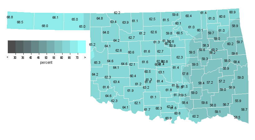
Oklahoma Mesonet, take a look at this percent of possible solar radiation map
for climatological fall (September 1-November 9) thus far:


You can see values from the 55 percent range in the southeast to nearly 70
percent in the Oklahoma Panhandle for a statewide average of 61.2 percent. Big
deal, right? Like most data, that means nothing without some perspective. So
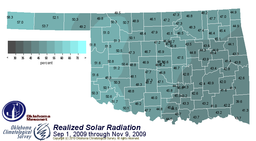
let's look back to the same period last year during one of our coolest and
wettest falls on record:


What a difference a year makes! That's map works out to a statewide average of
46.7 percent. Now that's dank, and I should know because I looked it up in the
dictionary:

"unpleasantly moist or humid; damp and, often, chilly"

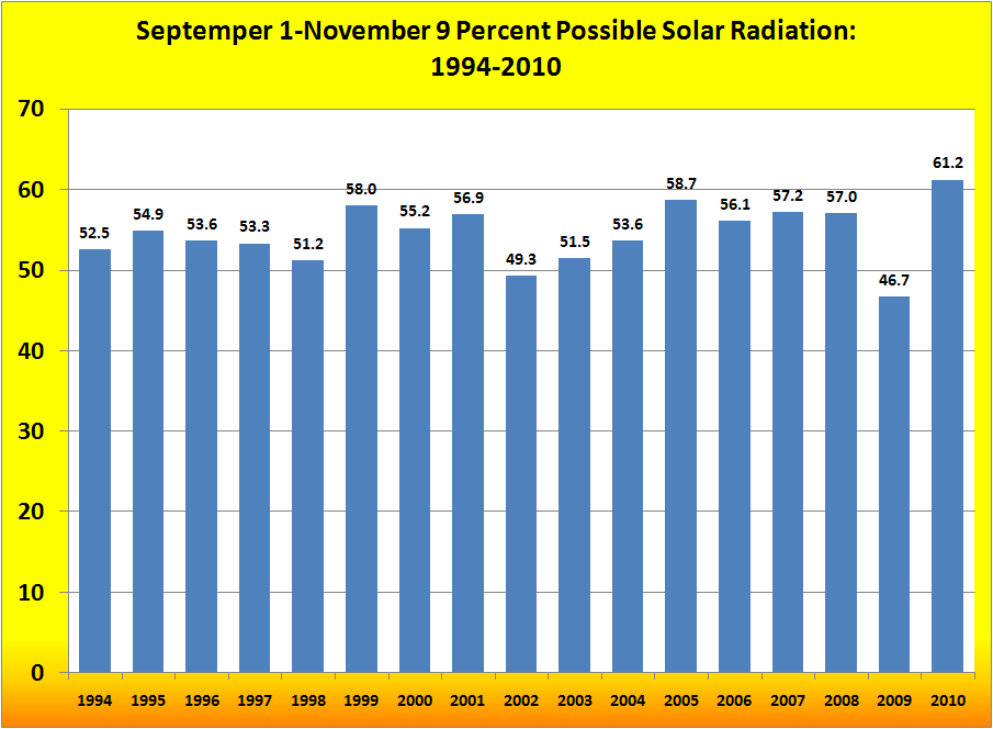
In fact, let's take a look at every September 1-November 9 since the Mesonet
began in 1994:


Not only was last year the lowest percentage, this year's same period is
the highest. Again, what a difference a year makes. And it's not shocking to
see 2005 in second place with it being the start of a catastrophic drought.
La Nina definitely helped 2010 take the lead.

So bring on the rain and clouds, fitting with Thanksgiving approaching. I'm
really looking forward to my cold, dry turkey and dank stuffing!

Gary McManus
Associate State Climatologist
Oklahoma Climatological Survey
(405) 325-2253
gmcmanus@mesonet.org
November 10 in Mesonet History
| Record | Value | Station | Year |
|---|---|---|---|
| Maximum Temperature | 88°F | MANG | 2014 |
| Minimum Temperature | 13°F | VINI | 2018 |
| Maximum Rainfall | 2.98″ | WIST | 2008 |
Mesonet records begin in 1994.
Search by Date
If you're a bit off, don't worry, because just like horseshoes, “almost” counts on the Ticker website!