Ticker for October 27, 2010
MESONET TICKER ... MESONET TICKER ... MESONET TICKER ... MESONET TICKER ...
October 27, 2010   October 27, 2010   October 27, 2010   October 27, 2010


We got our rain ... now what??

The rainfall of last week definitely helped out some of the dry areas of the
state that had developed full-fledged drought conditions. But like I had
previously said, the overall pattern still looks dry and warm. The National
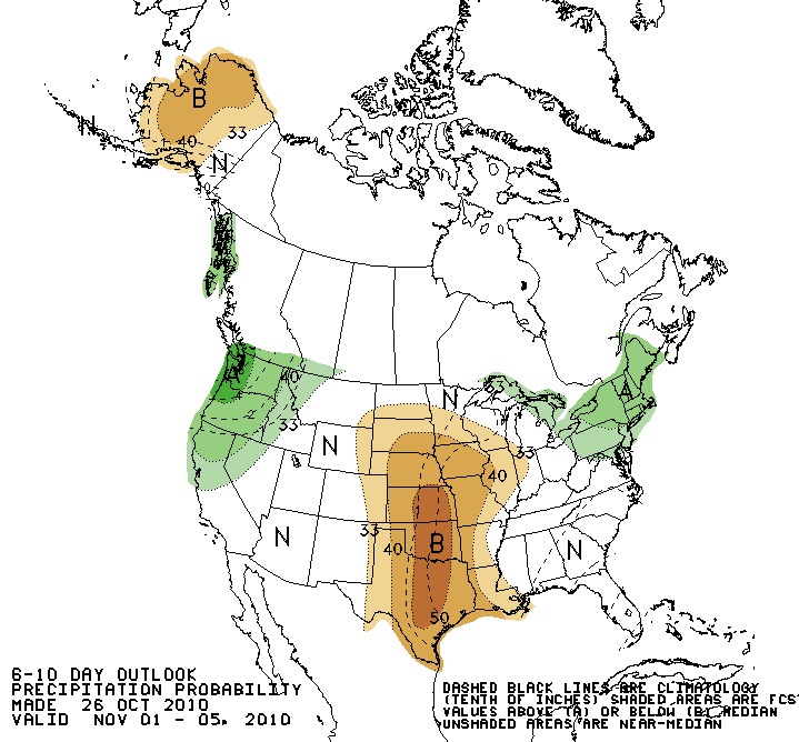
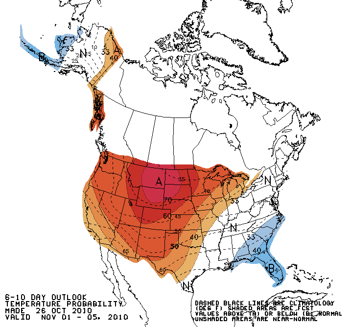
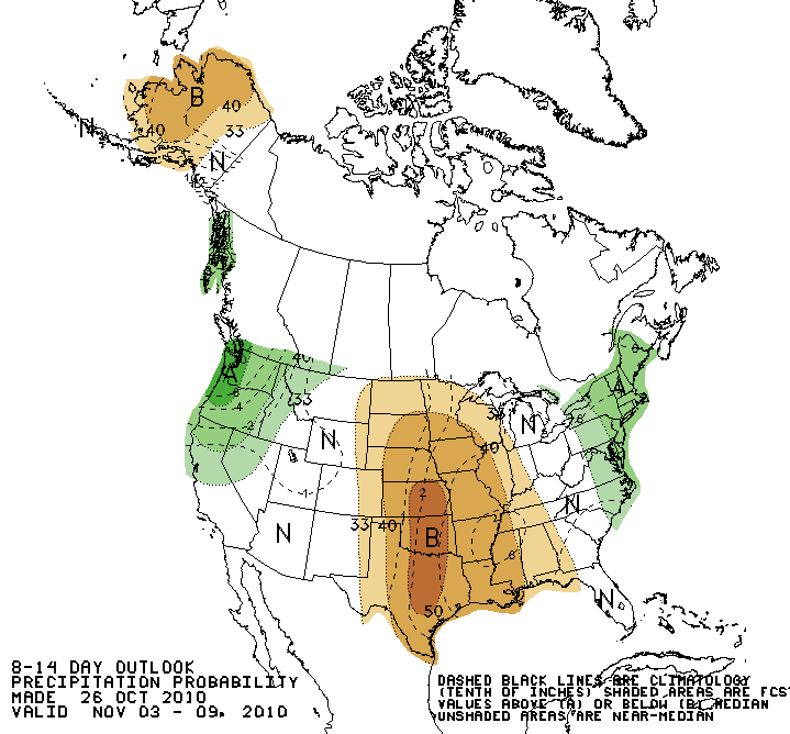
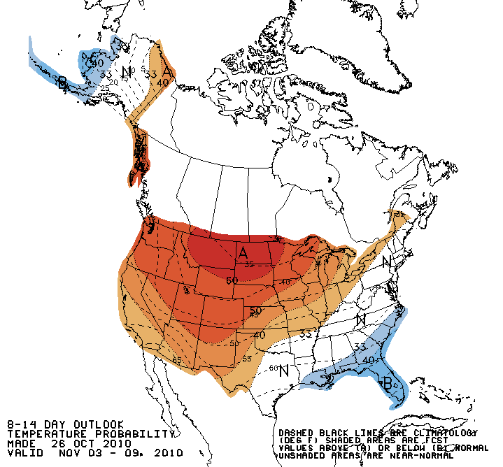
Weather Service's Climate Prediction Center (CPC) confirms that with their 6-10
and 8-14 day outlooks. In both, they give much of the state increased chances
for warmer and drier weather for the first week or so of November.

Outlooks for November 1-5:


Outlooks for November 3-9


Something to remember as we approach our dry season and we get a case of the
N's on the CPC's outlook maps. An "N" (for Near Normal) is basically a forecast
of very little precipitation since meager amounts fall during that period to
begin with. Accordingly, green areas (or Above) are not necessarily something
to get excited about since there is no indication of magnitude on these
oulooks.

When you see brown during the dry period, however ... that tends to mean
"really dry." But that's a bit farther down the road. The first week or two of
November is the last gasp of our secondary wet season, so it would be nice to
see this forecast fail.

Gary McManus
Associate State Climatologist
Oklahoma Climatological Survey
(405) 325-2253
gmcmanus@mesonet.org
October 27 in Mesonet History
| Record | Value | Station | Year |
|---|---|---|---|
| Maximum Temperature | 91°F | MANG | 2014 |
| Minimum Temperature | 15°F | BOIS | 2020 |
| Maximum Rainfall | 4.03″ | EUFA | 2004 |
Mesonet records begin in 1994.
Search by Date
If you're a bit off, don't worry, because just like horseshoes, “almost” counts on the Ticker website!