Ticker for October 1, 2010
MESONET TICKER ... MESONET TICKER ... MESONET TICKER ... MESONET TICKER ...
October 1, 2010    October 1, 2010    October 1, 2010    October 1, 2010


Another Warm Month Ends For Oklahoma

Oklahoma?s penchant for warmer-than-normal months continued during September and
depending on where you live, you probably had either too much or too little rain
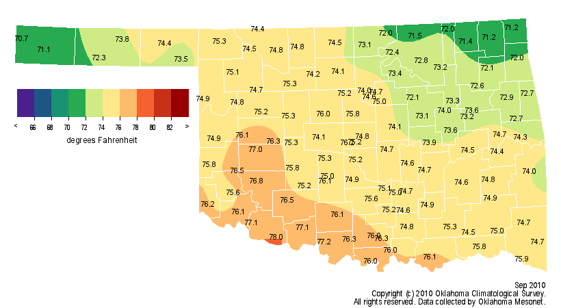
to go with that warmth. The September statewide average temperature, as measured
by Oklahoma?s weather network, the Oklahoma Mesonet, was 74.5 degrees. That marks
September as the 29th warmest since 1895, 2.1 degrees above normal. While the
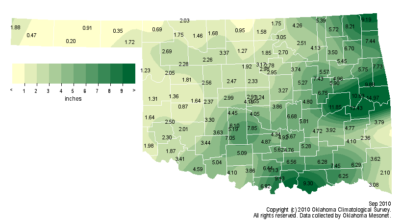
statewide average rainfall of 3.99 inches ranks as the 36th wettest on record at
0.18 inches above normal, much of the state was actually quite dry during the
month.

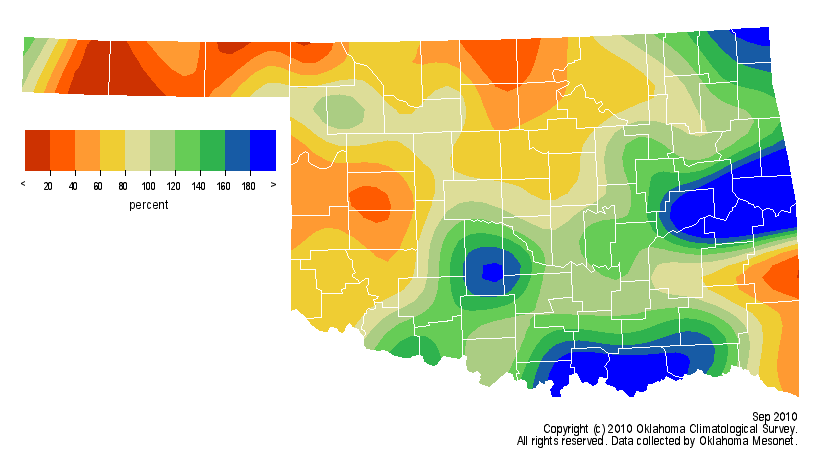
Very heavy rainfall from the remnants of Tropical Storm Hermine provided some
rather gaudy totals in southern and east central Oklahoma. Sallisaw received over
10 inches from the storm to help it finish as the wettest spot in the state with
14.97 inches. That propelled east central Oklahoma to finish with its eighth
wettest September with an average of 8.37 inches, 3.41 inches above normal.
Moisture was much less plentiful in the northwestern half of the state where
totals fell to less than 20 percent of normal in some locations. The Oklahoma
Mesonet station at Goodwell barely wet its rain gauge with a meager 0.2 inches.
Twenty-five Mesonet stations recorded less than 2 inches of rainfall for the
month. Oklahoma City was 0.39 inches below normal with a total of 3.59 inches.


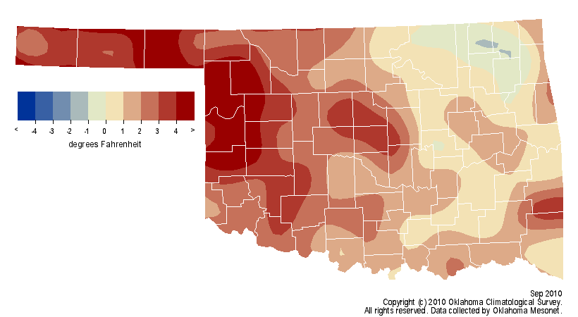
The warmth during the month was much more widespread with only a small portion
of northeastern Oklahoma ending up below normal. Much of the western half of
the state finished 3-4 degrees above normal. The average high temperature
across the state was 86.4 degrees, more than a degree above normal. The average
low was more than 2 degrees above normal at 62.7 degrees. Grandfield had the
highest average monthly temperature at 78 degrees while Kenton was on the cool
side at 70.7 degrees. The highest temperature recorded by the Mesonet was 105
degrees at Beaver twice and once at Erick. The prize for the coldest spot in
the state was won by Oilton with a chilly 36 degrees on the 27th. Oklahoma City
was 2.8 degrees above normal for the month with an average of 76 degrees.


Four of the last six months have been warmer than normal across the state, and
the January-September statewide average now stands at 63.3 degrees. That is the
42nd warmest such period on record at 0.3 degrees above normal. On the
precipitation side, the year stands at nearly an inch below normal with a
statewide average of 27.51 inches, the 53rd wettest January-September on record.

Gary McManus
Associate State Climatologist
Oklahoma Climatological Survey
(405) 325-2253
gmcmanus@mesonet.org
October 1 in Mesonet History
| Record | Value | Station | Year |
|---|---|---|---|
| Maximum Temperature | 99°F | SLAP | 2000 |
| Minimum Temperature | 34°F | KENT | 2009 |
| Maximum Rainfall | 3.52 inches | ERIC | 1998 |
Mesonet records begin in 1994.
Search by Date
If you're a bit off, don't worry, because just like horseshoes, “almost” counts on the Ticker website!