Ticker for June 28, 2010
MESONET TICKER ... MESONET TICKER ... MESONET TICKER ... MESONET TICKER ...
June 28, 2010      June 28, 2010      June 28, 2010      June 28, 2010


Rainy Weekend(s??)

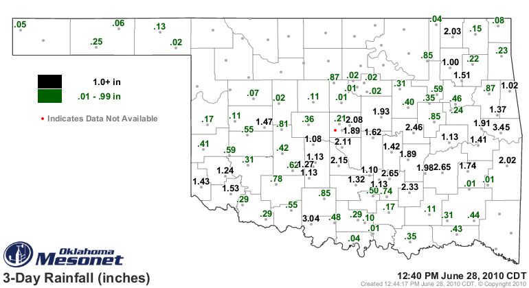
Rains this the weekend provided 2-3 inches of moisture to the southeastern
two-thirds of the state.


You can see several totals above 2 inches, and a couple of those are above 3
inches, and I've listed those below:

Sallisaw	3.45          Washington	2.15
Waurika	        3.04          Norman	        2.11
Ada	        2.65          Spencer	        2.08
McAlester	2.65          Nowata	        2.03
Okemah	        2.46          Wister	        2.03
Centrahoma	2.33

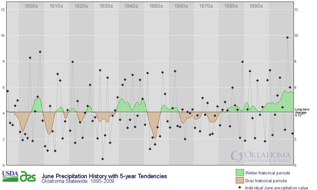
And while this month is going to be remembered for its rain (hello Oklahoma City
North Mesonet site!), the statewide average for the month will probably finish
a tad below normal. As of today, that average is 3.88 inches, 0.08 inches below
normal. However, that's still the 39th wettest such period since 1921. Odd,
right? Well, that's due to the variable nature of June's precipitation
totals. If you look at the climate trends graph, you can see a "darned if you
do and darned if you don't" (hey, this is a family Ticker!) pattern. In other
words, for many of the years, the totals are either really high or really low.


The current normal is based on data from 1971-2000 as well, so that also
influences the oddity of a high ranking despite a deficit.

**********

More rain to come?

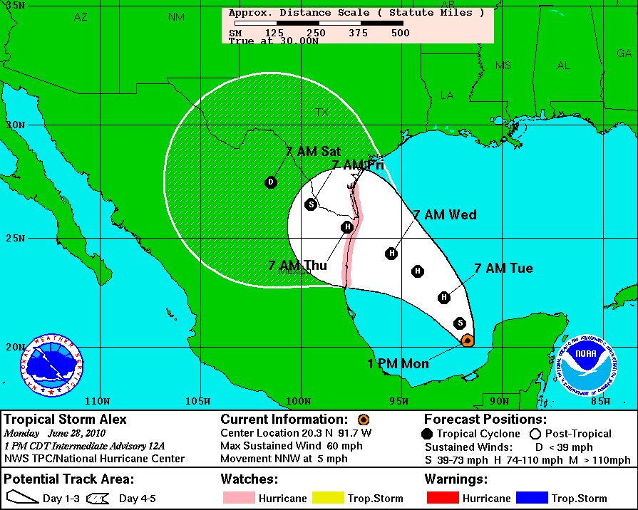
Tropical Storm Alex is currently churning away in the Gulf of Mexico and is
expected to strengthen to Hurricane status in the near future.


After it makes landfall, it weakens into a Tropical Storm again then into a
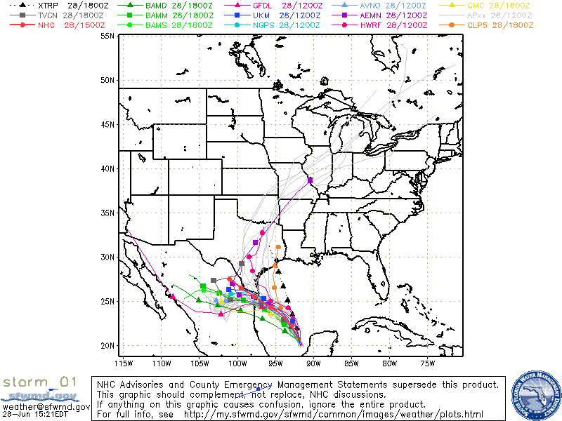
Tropical Depression. What it does after that is of particular concern for
Oklahoma. If it moves up over the state, it could bring heavy rainfall with it.
Some forecast models do exactly that, bringing the remnants of the storm over
central or eastern Oklahoma.


Note the large spread of the model solutions, however, which is an indication
of the large uncertainty in the track of the storm. You can track those
solutions here:


Gary McManus
Associate State Climatologist
Oklahoma Climatological Survey
405.325.2253
gmcmanus@mesonet.org
June 28 in Mesonet History
| Record | Value | Station | Year |
|---|---|---|---|
| Maximum Temperature | 113°F | ALTU | 2023 |
| Minimum Temperature | 48°F | EVAX | 2022 |
| Maximum Rainfall | 3.95 inches | WEST | 2000 |
Mesonet records begin in 1994.
Search by Date
If you're a bit off, don't worry, because just like horseshoes, “almost” counts on the Ticker website!