Ticker for May 20, 2010
MESONET TICKER ... MESONET TICKER ... MESONET TICKER ... MESONET TICKER ...
May 20, 2010 May 20, 2010 May 20, 2010 May 20, 2010
Anybody ready for summer?
Enough with the severe weather, time for some lovely triple-digit temps, scalding
playground equipment and water rationing. A guy can dream, right? Well, all the
latest outlooks from the Climate Prediction Center (CPC) indicate a possibility
of above-normal temperatures for the next couple of weeks. Here are the 6-10
day and 8-14 day outlooks for temperature probability:
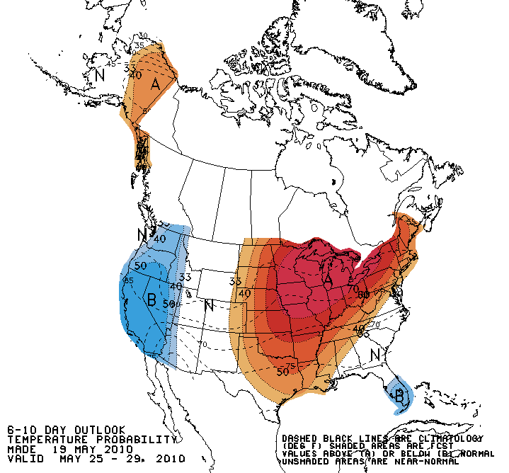
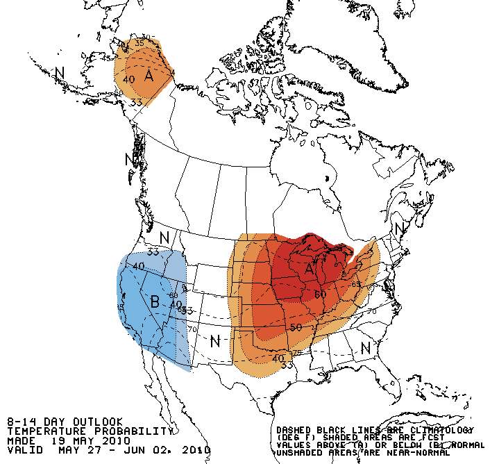
On both outlooks, a 50%-60% chance of above-normal temperatures are indicated for
Oklahoma. Now keep in mind that there is ZERO indication of the magnitude of the
temperature anomalies on this map, just an increased probability. The CPC's
reasoning for that increased chance of above-normal temperatures stem from a
ridge forecasted for the central and eastern U.S. That ridge also means an
increased chance of BELOW-normal precipitation:
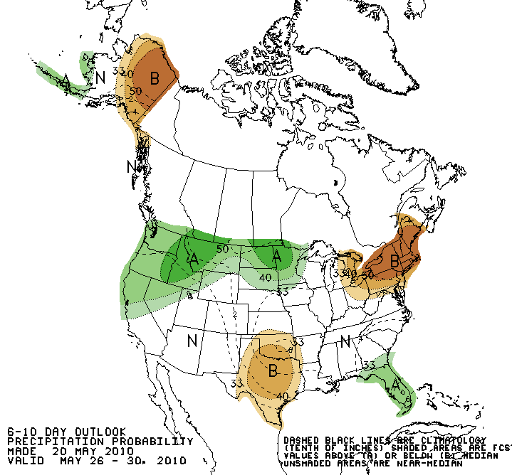
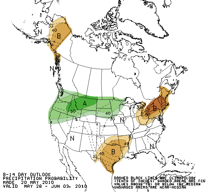
Again, there is no indication of the magnitude of the anomalies, just a
depiction of the probabilities.
Now if we go farther out into the future, for June and then June-July-August,
we see different processes come into play. For instance, we can see an increased
chance of above normal precipitation for June in Oklahoma:
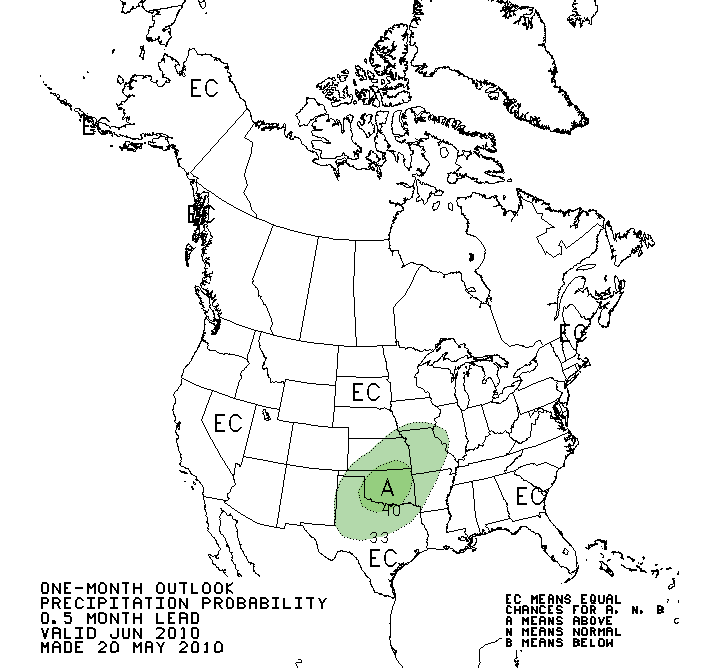
The El Nino of the last year has weakened enough that we are probably seeing
ENSO-neutral conditions now (i.e., neither El Nino nor La Nina). Without that
influence, the biggest driver of this outlook for our area is high soil moisture
values. Moist soils can feed convective systems through evaporation, and that
evaporation also helps to cool the surface. Thus, we see an increased chance of
cooler weather during June as well:
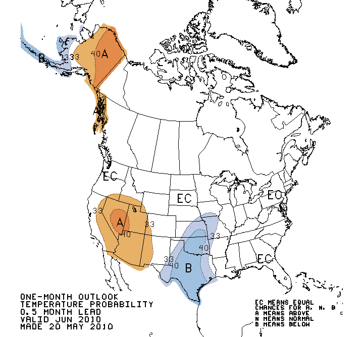
Looking at the summer as a whole, the CPC again indicates an increased chance
for above-normal precipitation and below-normal temperatures for this area:
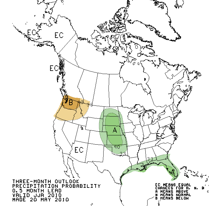
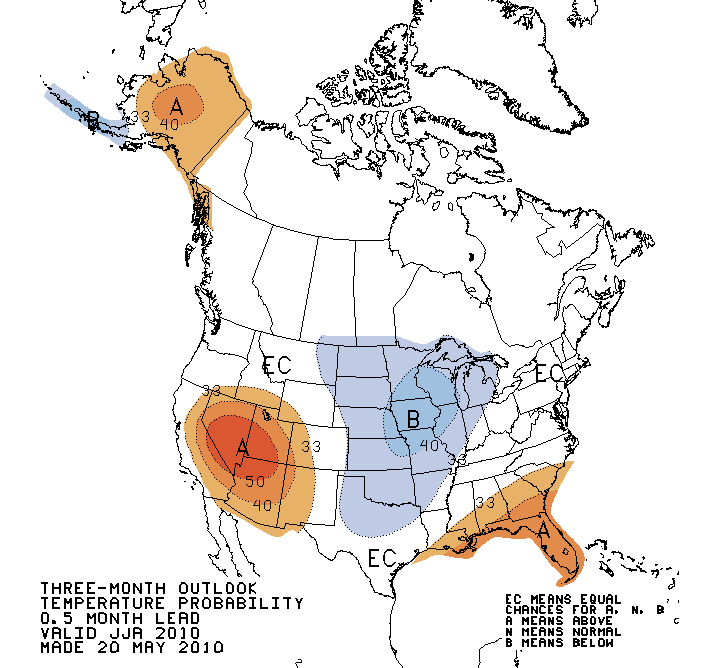
Above normal soil moisture amounts are again a big player in this outlook. The
caveat with these outlooks as we get farther out is that they become less
trustworthy without the influence of El Nino or La Nina conditions, especially
in our neck of the woods where those phenomena aren't huge players anyway.
So there you have it, with my help, I have just guaranteed Oklahoma a brutally
hot and dry summer. Don't say I didn't warn ya!
Looking even farther out, it appears more and more likely that La Nina conditions
will develop in the equatorial pacific for next winter. That can mean a drier
and warmer weather for our area, but again, the influence will be much more
important for points south of Oklahoma.
Gary McManus
Associate State Climatologist
Oklahoma Climatological Survey
(405) 325-2253
gmcmanus@mesonet.org
May 20 in Mesonet History
| Record | Value | Station | Year |
|---|---|---|---|
| Maximum Temperature | 104°F | ALTU | 2006 |
| Minimum Temperature | 35°F | EVAX | 2017 |
| Maximum Rainfall | 6.44 inches | SKIA | 2019 |
Mesonet records begin in 1994.
Search by Date
If you're a bit off, don't worry, because just like horseshoes, “almost” counts on the Ticker website!