Ticker for May 13, 2010
MESONET TICKER ... MESONET TICKER ... MESONET TICKER ... MESONET TICKER ...
May 13, 2010 May 13, 2010 May 13, 2010 May 13, 2010
"Storms to the right of me, storms to the left of me!"
Anybody else beginning to feel like Oliver Hardy in "Saps At Sea"?
http://www.youtube.com/watch?v=AU5AvZmihTc
His problem was with horns, of course (this would also apply to Bob Stoops
lately). It's now time for Mother Nature to give it a rest and allow some
cleanup. Regardless, another night, another bout with tornado warnings and
severe thunderstorms:
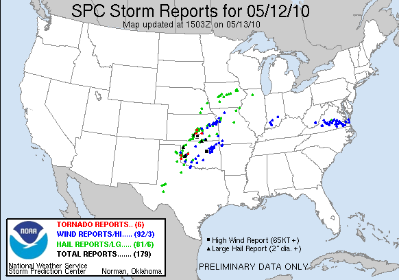
One of those wind gusts was an 80-mph measurement from Bristow in the early
morning hours. Here are some of the higher wind gusts measured by the Mesonet
with the storms last night:
Station Wind Gusts Date Time
Bristow 80 mph May 13 4:35 am
Haskell 62 mph May 13 5:10 am
Hectorville 62 mph May 13 4:50 am
Fairview 62 mph May 12 11:20 pm
Ninnekah 60 mph May 13 3:15 am
Bristow 59 mph May 13 4:30 am
Inola 58 mph May 13 5:25 am
Chickasha 58 mph May 13 3:15 am
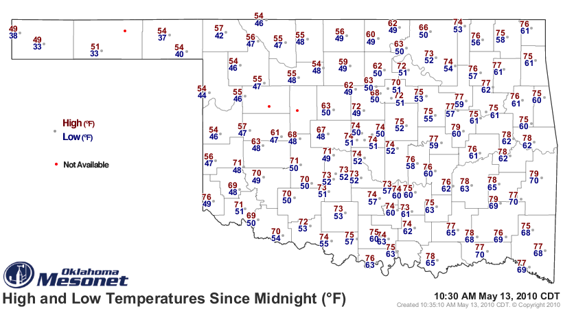
The front that brought us the squall line last night also created some
ridiculously cold conditions up in the Oklahoma Panhandle. Boise City and
Goodwell both dropped down to 33 degrees this morning. Not quite record cold,
but pretty close.
***********************
Tornado Tracks
Some of the NWS damage surveys are revealing more about the tornado paths.
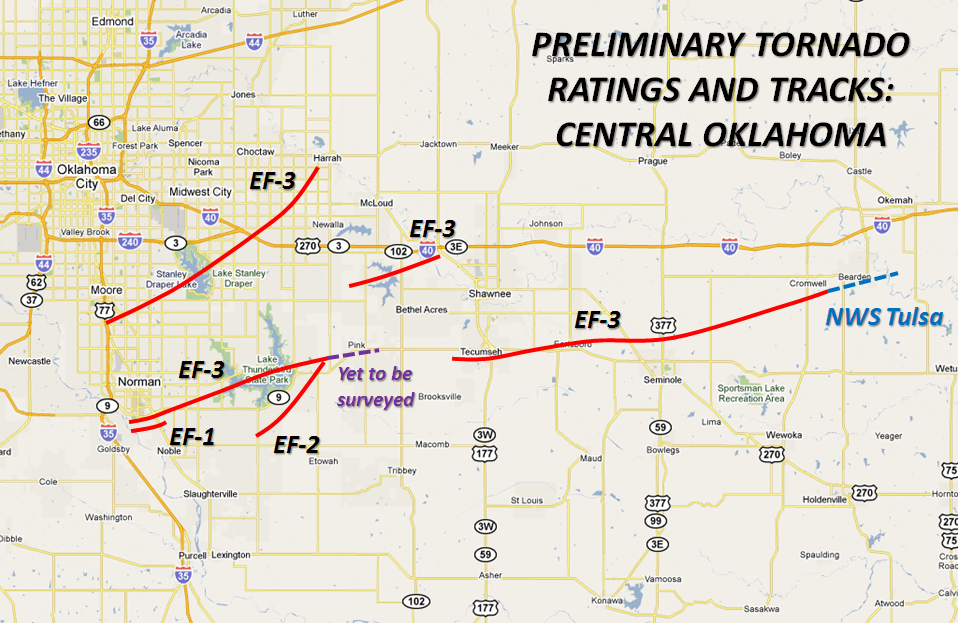
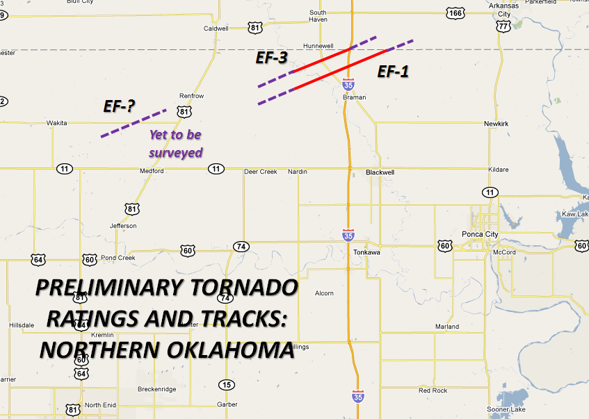
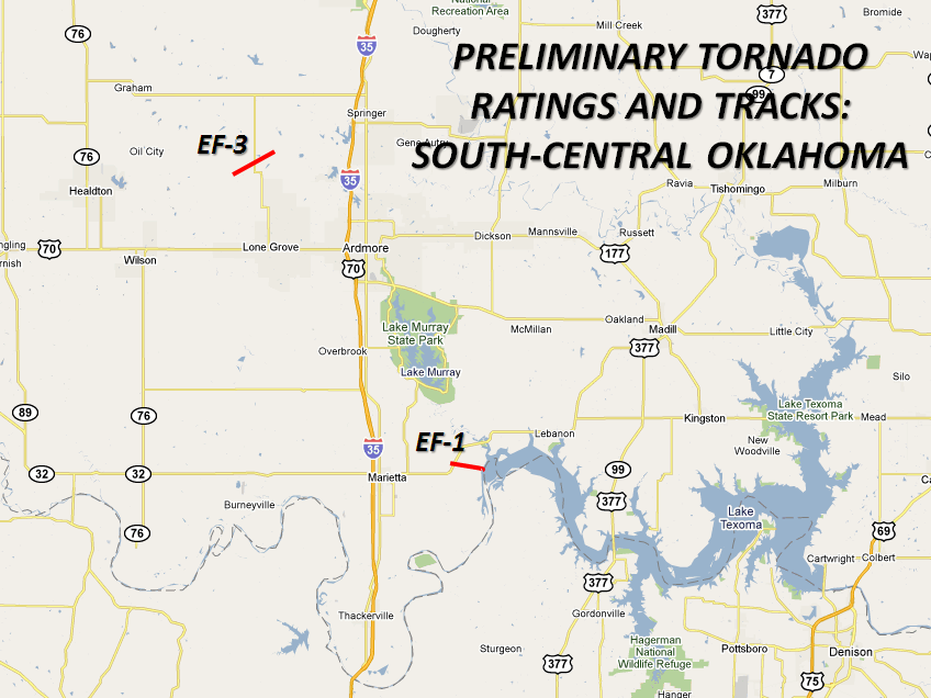
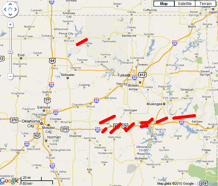
The intensities of the tornadoes surveyed thus far:
Intensity Number
EF0 1
EF1 6
EF2 2
EF3 5
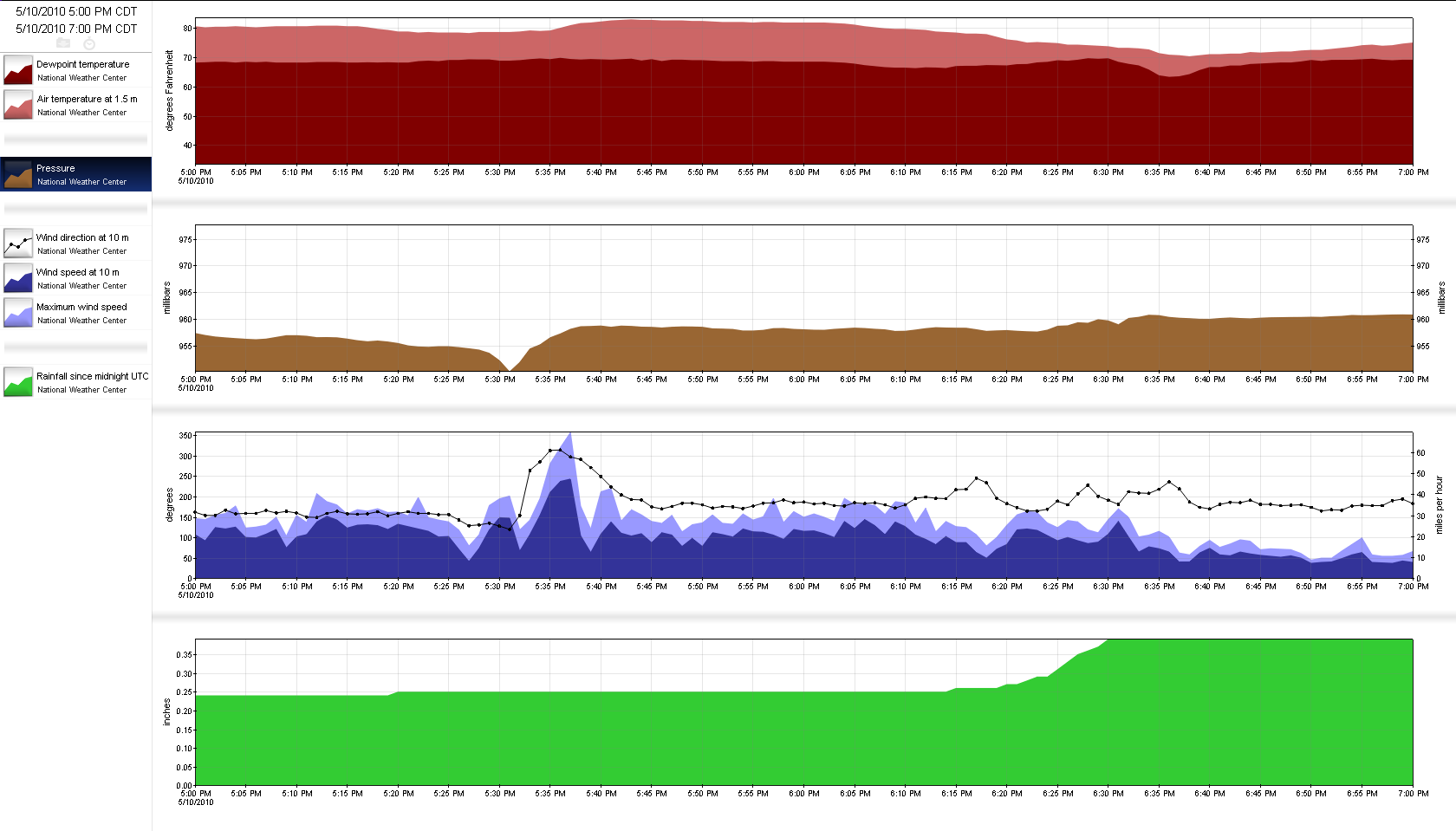
Lots of more surveying left to do, however. Several folks commented on
meteograms across the state that resembled the Burbank one, and here is another
from right in the NWC's own back yard, literally. And this is 1-minute data
as well. The tornado formed just SW of the NWC and eventually reached EF3
intensity as it traveled along Highway 9.
Stay tuned to your local NWS office pages for more on the tornado surveys. And
yes, Laurel and Hardy are superior to the Three Stooges ... had to be said.
Gary McManus
Associate State Climatologist
Oklahoma Climatological Survey
(405) 325-2253
gmcmanus@mesonet.org
May 13 in Mesonet History
| Record | Value | Station | Year |
|---|---|---|---|
| Maximum Temperature | 101°F | ALTU | 2025 |
| Minimum Temperature | 30°F | BOIS | 2000 |
| Maximum Rainfall | 4.41″ | JAYX | 2004 |
Mesonet records begin in 1994.
Search by Date
If you're a bit off, don't worry, because just like horseshoes, “almost” counts on the Ticker website!