Ticker for April 26, 2010
MESONET TICKER ... MESONET TICKER ... MESONET TICKER ... MESONET TICKER ...
April 26, 2010     April 26, 2010     April 26, 2010     April 26, 2010


Whither Tornadoes?

The tornado-chasing community in Oklahoma has certainly been busy the last week
or so, and you can't turn on the television or read the news without hearing
about the tornado outbreak that spread across the southern parts of the country
over the weekend. For this part of tornado alley, however, severe weather has
remained eerily quiet like it has for much of the year.

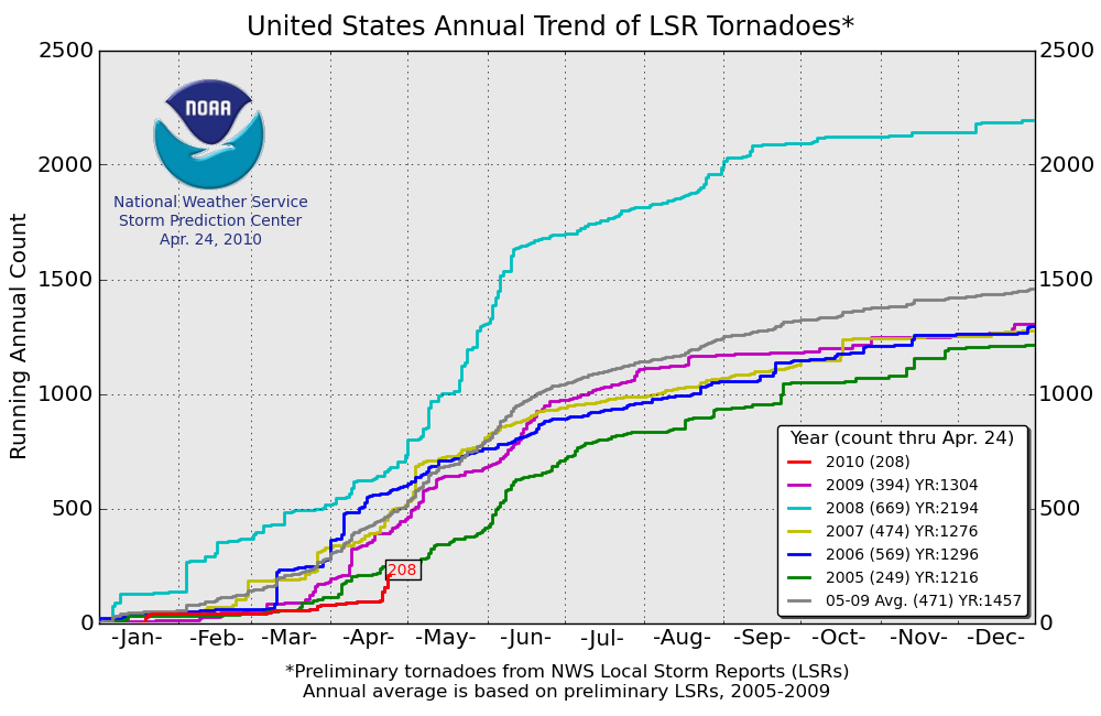
While the tornado count for the U.S. has picked up, it still remains more than
250 below average since the beginning of the year as seen in this graph from
the Storm Prediction Center (SPC):


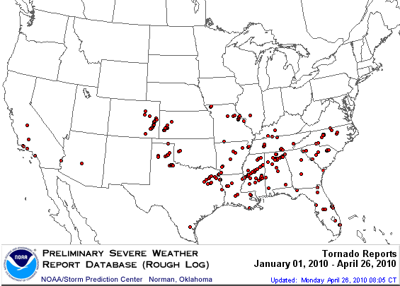
Oklahoma's preliminary total still stands at three, which is about a dozen
fewer that we would have normally seen through the end of April. A note of
caution, however ... April isn't over yet, and things like tornado counts are
highly variable. We could jump to the other side of the scale with one big
outbreak. But, the state definitely dodged the proverbial bullet with the
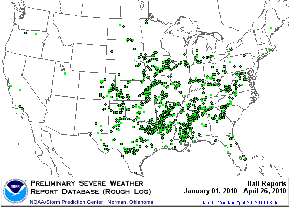
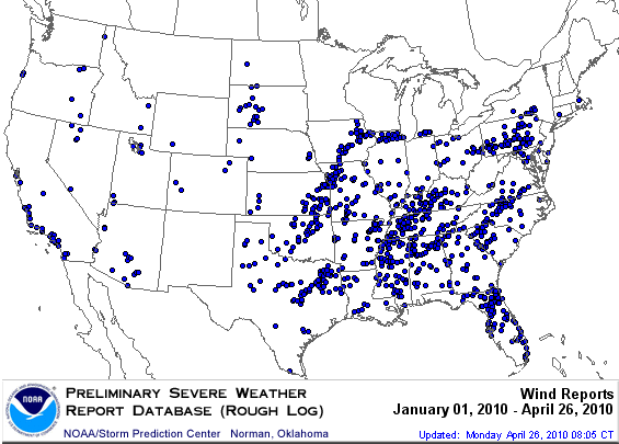
latest outbreak, and really for much of the year. That is reflected in the
preliminary storm report maps from SPC:


Oklahoma has been relatively "dot free" for the year thus far. Now of course if
we added dots for wintry weather, we might see a bit more color. So why the
lack of severe weather across the U.S. and here in Oklahoma? Some are blaming
El Nino as it has worked its magic in shifting storm systems farther to the
south. The abundant cool air due to the influence of both El Nino and the
Arctic Oscillation (as spoken about in previous Tickers) has also played a part
by keeping the Gulf of Mexico a bit cooler. When the Gulf begins to heat up, as
it has recently, then we see more evaporation from its surface and more warm,
moist air traveling our way to feed thunderstorms.

That's the long-term explanation for the year thus far. So why were we
seemingly surrounded by tornadoes over the weekend? Well, it was all in the
timing. However, our luck may not hold out. There is another chance for severe
weather in our area by the end of this week, so stay tuned!

Gary McManus
Associate State Climatologist
Oklahoma Climatological Survey
(405) 325-2253
gmcmanus@mesonet.org
April 26 in Mesonet History
| Record | Value | Station | Year |
|---|---|---|---|
| Maximum Temperature | 95°F | ALTU | 2014 |
| Minimum Temperature | 25°F | BOIS | 2006 |
| Maximum Rainfall | 5.51″ | BOWL | 1998 |
Mesonet records begin in 1994.
Search by Date
If you're a bit off, don't worry, because just like horseshoes, “almost” counts on the Ticker website!