Ticker for March 9, 2010
MESONET TICKER ... MESONET TICKER ... MESONET TICKER ... MESONET TICKER ...
March 9, 2010      March 9, 2010      March 9, 2010      March 9, 2010


Storms Strike State

The two tornadoes reported yesterday near Hammon in far western Oklahoma marked
the first twisters in our state since October 29, 2009, a span of 129 days. The
storm system that spawned the tornadoes also brought heavy rains and small hail
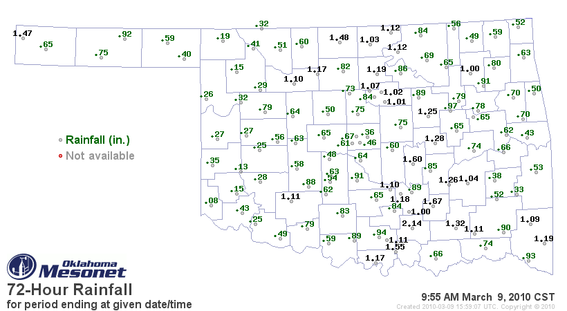
to parts of the state. Here are the top-20 rainfall totals measured by the
Oklahoma Mesonet from the last couple of days:

Tishomingo	2.14"	        Red Rock	1.19"
Centrahoma	1.67"	        Broken Bow	1.19"
Bowlegs	        1.60"	        Vanoss	        1.18"
Madill	        1.55"	        Burneyville	1.17"
Medford	        1.48"	        Lahoma	        1.17"
Kenton	        1.47"	        Burbank	        1.12"
Lane	        1.32"	        Newkirk	        1.12"
Okemah	        1.28"	        Medicine Park	1.11"
Stuart	        1.26"	        Antlers	        1.11"
Bristow	        1.25"	        Ardmore	        1.11"

Here is a map for the statewide look:


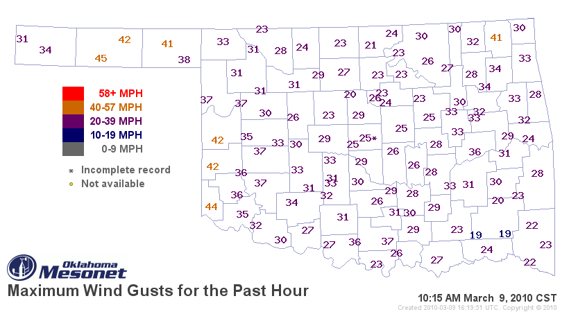
Strong winds kicked up in the wake of the exiting storm system as well. Gusts
up to 55 mph were measured by the Mesonet since midnight, and gusts of greater
than 40 mph are currently being reported in western Oklahoma:


Gary McManus
Associate State Climatologist
Oklahoma Climatological Survey
(405) 325-2253
March 9 in Mesonet History
| Record | Value | Station | Year |
|---|---|---|---|
| Maximum Temperature | 87°F | CAMA | 2017 |
| Minimum Temperature | 9°F | EVAX | 2022 |
| Maximum Rainfall | 3.32 inches | CLOU | 2023 |
Mesonet records begin in 1994.
Search by Date
If you're a bit off, don't worry, because just like horseshoes, “almost” counts on the Ticker website!