Ticker for February 18, 2010
MESONET TICKER ... MESONET TICKER ... MESONET TICKER ... MESONET TICKER ...
February 18, 2010 February 18, 2010 February 18, 2010 February 18, 2010
Strange light in sky frightens residents
Once upon a midnight dreary,
I went to bed and woke up the next morning,
and it was still dreary,
and so on and so forth.
That's about as good as my poems get, so we'll leave that one alone. But that's
certainly the way this winter has felt. Often times our recollections about
weather can lead us astray ... the current weather or climate event is always
the worst in memory since it is so recent. Luckily, we Oklahomans have the
resources to help us confirm our memories. So that begs the question, just how
dark and dreary has this winter been? Let's ask the Mesonet.
First we calculate the theoretical top-of-atmostphere SRAD value at the given
lat/lon coordinates for each Mesonet site, at the given day and time. It is
calculated based on the solar constant, and sun angles determined by spherical
geometry. Then we compare that to what each site's pyranometer actually observed
and voila, we have the percent of possible SRAD (i.e., sunshine) estimated
across the state.
Here are the images for each December 1-February 16 period in Mesonet history:

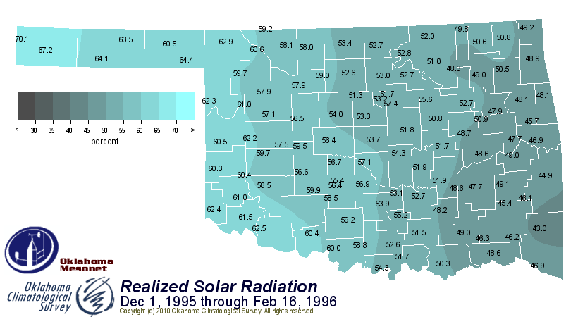
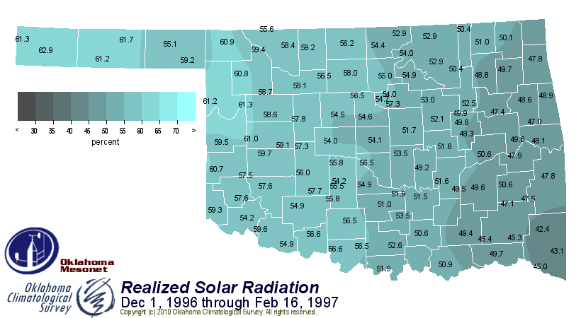
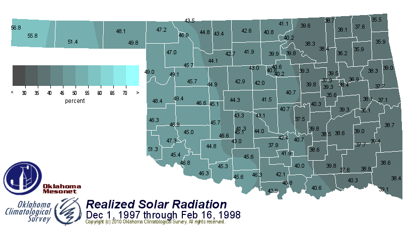

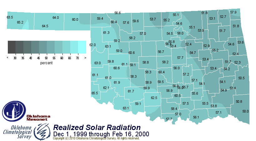

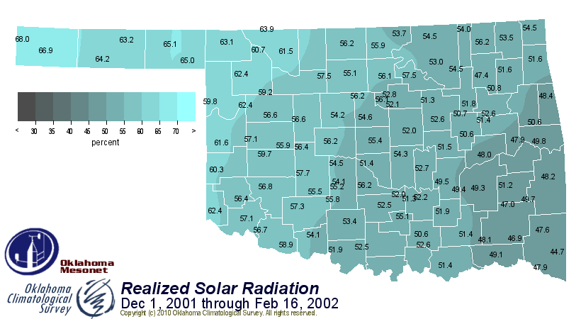
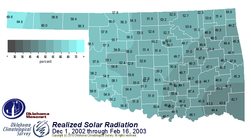
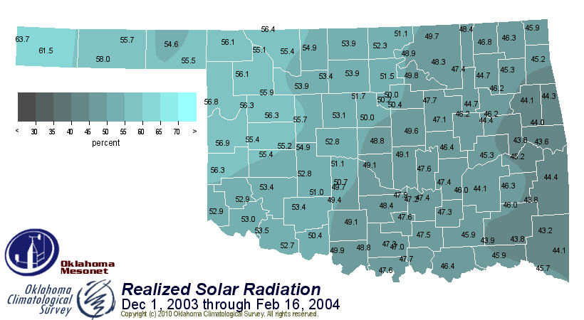
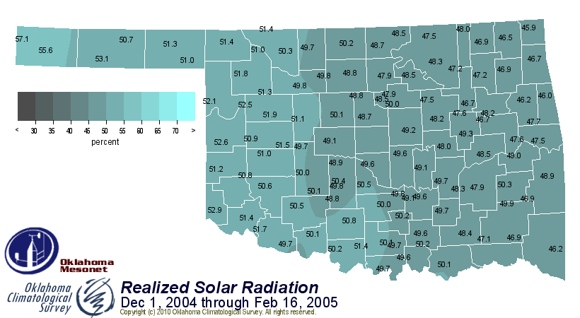
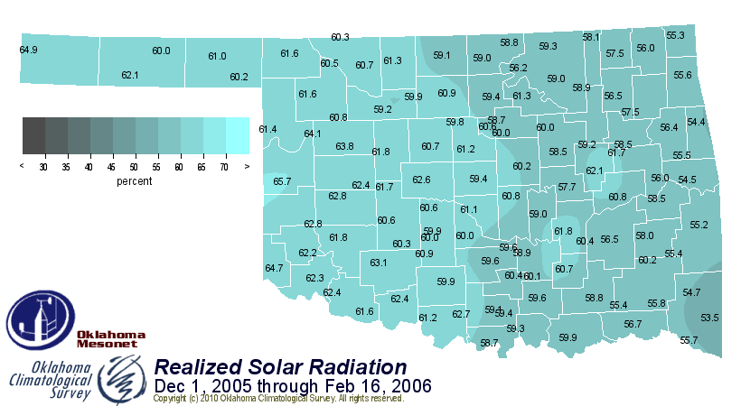
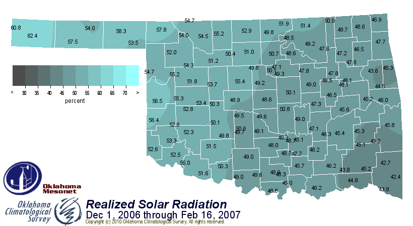

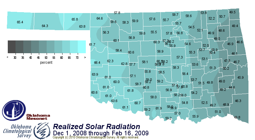
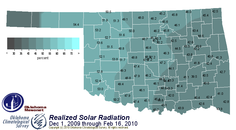
Just at a glance at the color of the maps, the winter thus far during 2009-10
is only surpassed for "gloominess" by one other, that of 1997-98. Now let's
look at the statewide percentages, again for the December 1-February 16 periods
throughout the Mesonet's period of record, and see if our eyes deceive us:
1994-95 48.2%
1995-96 54.3%
1996-97 53.8%
1997-98 42.2%
1998-99 51.0%
1999-00 57.2%
2000-01 48.2%
2001-02 54.5%
2002-03 51.5%
2003-04 49.9%
2004-05 49.5%
2005-06 59.7%
2006-07 54.4%
2007-08 51.0%
2008-09 56.1%
2009-10 46.2%
So there you have it. Maybe we forgot about that lovely 1997-98 winter period.
And maybe we took for granted all the sunshine of 2005-06. However, let's
remember that during 2005-06, all that sunshine came with a price, including
the beginning of a severe drought and also widespread fires throughout winter.

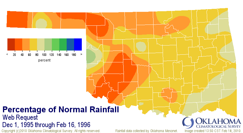
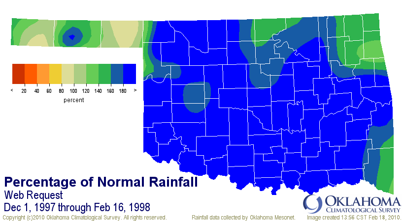
The 1997-98 gloom is not shocking considering the rainfall statistics for that
period:

However, the 97-98 winter was also the 30th warmest on record at that time.
That's a significant difference from this winter, which will no doubt end up
significantly below normal.
So enjoy the sun while you can. If you have any more questions for the Mesonet,
I'll be sure to pass them along.
Gary McManus
Associate State Climatologist
Oklahoma Climatological Survey
(405) 325-2253
February 18 in Mesonet History
| Record | Value | Station | Year |
|---|---|---|---|
| Maximum Temperature | 91°F | BUFF | 2016 |
| Minimum Temperature | -8°F | TIPT | 2021 |
| Maximum Rainfall | 0.78 inches | TIPT | 1998 |
Mesonet records begin in 1994.
Search by Date
If you're a bit off, don't worry, because just like horseshoes, “almost” counts on the Ticker website!