Ticker for February 3, 2010
MESONET TICKER ... MESONET TICKER ... MESONET TICKER ... MESONET TICKER ...
February 3, 2010   February 3, 2010   February 3, 2010   February 3, 2010


Ice and Snowmelt with a Chance of Rain

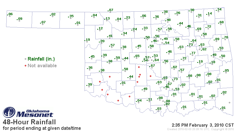
You may have noticed from our rainfall maps that quite a bit of
ice and snow melt has happened during the past few days.  Solar
panels supply our Mesonet sites with a limited amount of power
which means heated rain gauges are out of the question.  So, we
do things the simple way and measure winter precipitation as it
melts and enters the ground.  Several locations in southwest,
central, and northeast Oklahoma have melted over half an inch worth
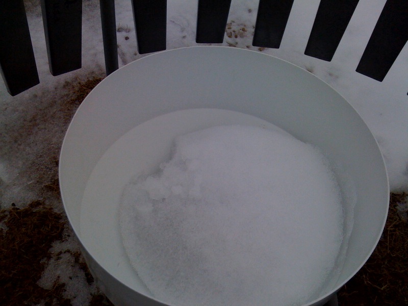
of frozen stuff in the last 48 hours, but we can see here in Norman
that there is still at least an inch of solid ice inside the rain
gauge.


With rainfall moving into the state this afternoon and tonight, the
rain will help melt even more ice.  Why do we care about rain melting
ice?  We want our users to be aware that any precipitation recorded
over the next several days will likely include melt from last week?s
winter storm.  The annual rainfall total will correctly display the
amount of precipitation so far; however, tonight?s ?rainfall? may
appear inflated since it may include rain falling from the sky AND
melting ice from last week?s storm.

Is anyone ready for spring?

Cindy Morgan
Quality Assurance Meteorologist
Oklahoma Mesonet
(405)325-6321
February 3 in Mesonet History
| Record | Value | Station | Year |
|---|---|---|---|
| Maximum Temperature | 89°F | SEIL | 2025 |
| Minimum Temperature | -18°F | NOWA | 2011 |
| Maximum Rainfall | 2.76″ | SEIL | 2012 |
Mesonet records begin in 1994.
Search by Date
If you're a bit off, don't worry, because just like horseshoes, “almost” counts on the Ticker website!