Ticker for January 1, 2010
MESONET TICKER ... MESONET TICKER ... MESONET TICKER ... MESONET TICKER ...
January 1, 2010 January 1, 2010 January 1, 2010 January 1, 2010
2009 Wrap-Up
A most heartfelt "Happy New Year" to you from the entire Ticker staff! The
previous year was certainly tumultuous with two major blizzards, all-time
records broken (24-hour snowfall, Buffalo and Freedom high temperatures,
OKC snow storm total, coldest October), a devastating tornado outbreak in
February, the Burneyville deluge, the southeastern ice storm, etc.
And the details in the etc. are where things get really exciting for
climatologists. I won't bore you with cooler than normal July 4ths, eighth-
warmest Novembers, highest 24-hour average Mesonet temperature, etc.
Okay, on with the show before I "ect." again! Since were at the end of the month
AND the year, I thought a few stats from the Oklahoma Mesonet on where those
periods stood in history would be interesting.
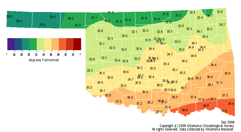
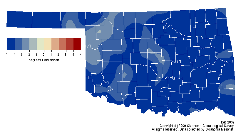
December Temperature
It shouldn't come as a shock to anybody who lived through the 2009 Oklahoma
December that the month was going to end up on the cool side. The proof is in
the pudding (tapioca, please). The statewide average temperature was 34.1
degrees, 4.9 degrees below normal and the 10th coolest December on record
(since 1895). Take a gander at the maps for particulars.
December Precipitation
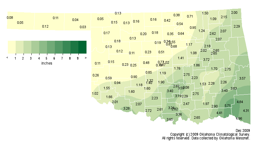
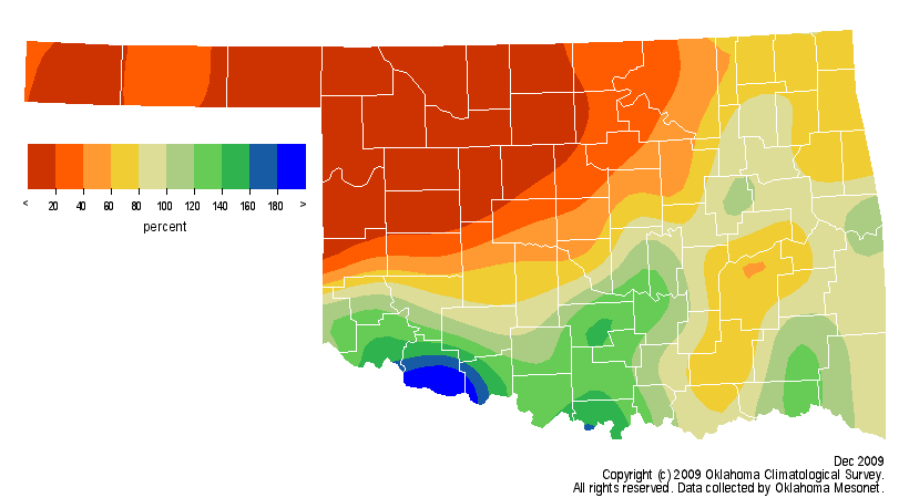
Dry it was, despite the BLIZZARD OF '09!!!!!! (!!!!!! added for effect). The
statewide average precipitation total of 1.51 inches was 0.51 inches below
normal. That only amounts to a ranking of 57th driest for our third-driest
month on the climate calendar. In other words, it has to be REALLY dry to move
up the rankings in a month like December.
2009 Temperature
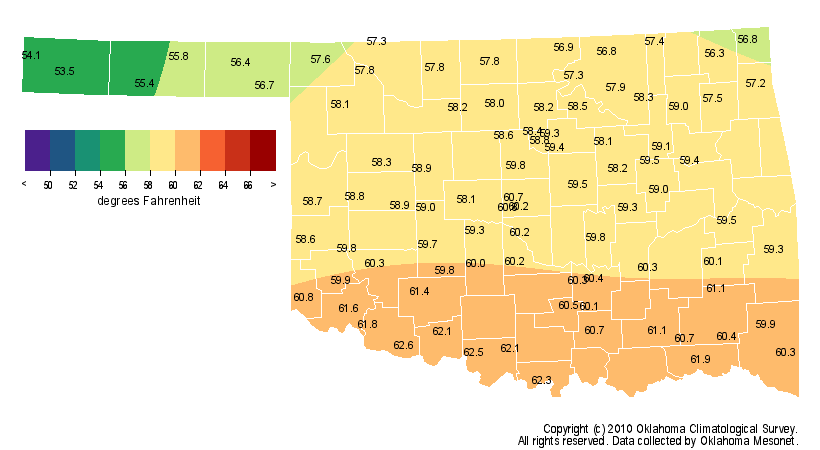
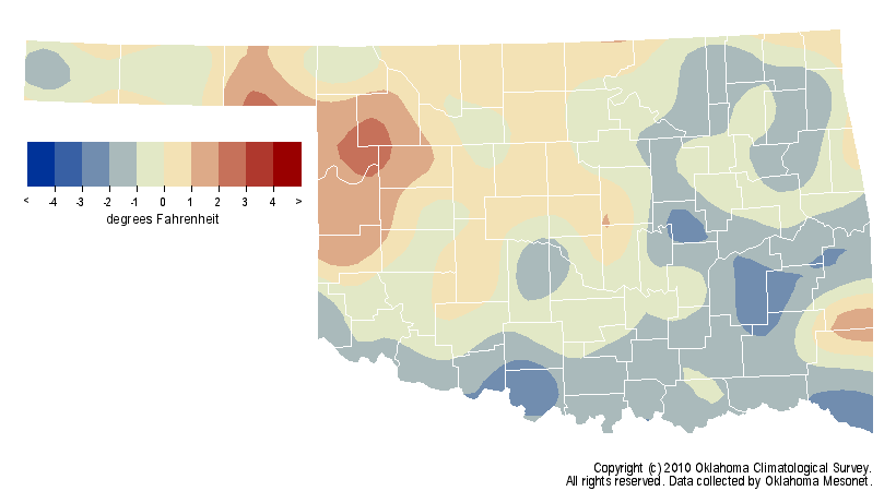
The year finished as the 37th coolest on record with a statewide
average temperature of 59.1 degrees, 0.6 degrees below normal. This was after a
moderately warm first half of the year before things cooled down starting in
July.
2009 Precipitation
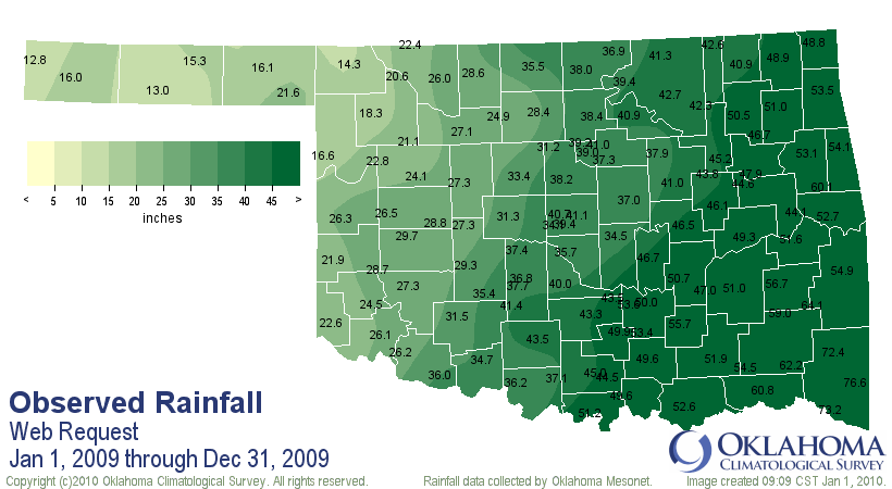
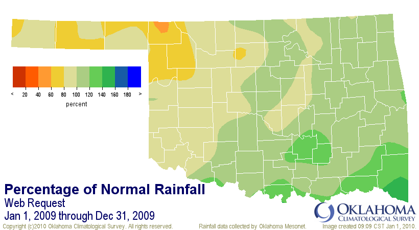
The year was also the 31st wettest across the state with an average of
37.96 inches, 1.27 inches above normal. The southeast led the way per usual and
Broken Bow led the southeast with 76.6 inches of rainfall. The Panhandle was
driest (again, per usual) and Kenton brought up the rear at 12.8 inches of
liquid precipitation during 2009.
Okay, out with the old and in with the new! Here's hoping we have a tad fewer
visits from FEMA this year. And thanks for sticking with the new Ticker staff.
Deke built such a great following with his flowing prose and odes to Frost (and
frost). He's a great writer and I isn't.
At any rate, we hope to be a little more regular with the Tickers this year
(this Ticker brought to you by the makers of Metamucil).
And again, Happy New Year!
Gary McManus
Associate State Climatologist
Oklahoma Climatological Survey
January 1 in Mesonet History
| Record | Value | Station | Year |
|---|---|---|---|
| Maximum Temperature | 81°F | WAUR | 2023 |
| Minimum Temperature | -7°F | EVAX | 2018 |
| Maximum Rainfall | 1.65″ | TALI | 2022 |
Mesonet records begin in 1994.
Search by Date
If you're a bit off, don't worry, because just like horseshoes, “almost” counts on the Ticker website!