Ticker for September 2, 2009
MESONET TICKER ... MESONET TICKER ... MESONET TICKER ... MESONET TICKER ...
September 2, 2009  September 2, 2009  September 2, 2009  September 2, 2009


A Feller Could Get Used To This!

Remember back in the day when August epitomized the Dog Days of Summer? Cloudless
blue skies under a scorching sun, endless days of monotony as high temperatures
soared into the triple digits and nary a drop of rain was to be found...it
actually made us look forward to those cold fronts and rains of late September
and early October. What's the point of labeling those crisp fall days  "football
weather" if August starts turning into late September?

Not that we enjoyed cool weather all month, of course; there were some nice
toasty days scattered in there. The highest temperature of the month, 107
degrees, occurred at Walters on the 25th. On the other extreme, Nowata hit a
chilly 45 degrees on the 31st, a rather remarkable accomplishment in that it
broke Nowata's all-time low temperature record for August of 48 degrees on
August 21, 1950. Keep in mind that we are comparing Oklahoma Mesonet data to
NWS COOP data, so we might need an asterisk on the locker room wall for that
one. That's still a ways off from the all-time state low of 38 degrees, set at
Bartlesville on August 31, 1915.

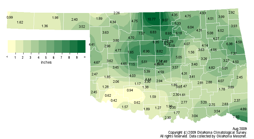
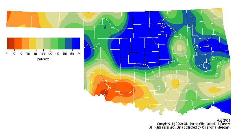
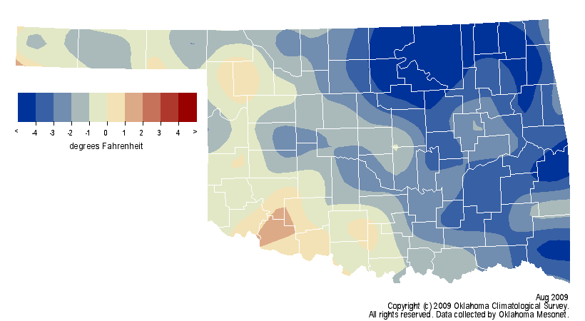
Statewide, the month was wet and cool, ending as the 21st coolest and
25th wettest on record. Those rankings were mainly the result of some bigtime
rains in the north central part of the state to go along with some really cool
weather in the northeastern two-thirds. The statewide average precipitation
total was 3.85 inches, 1.08 inches above normal and the statewide average
temperature was 78.3 degrees, 2.1 degrees below normal.


One oddity about our recent Augusts is what has occurred at Oklahoma City. The
NWS site at Will Rogers has recorded above normal (2.48") precipitation for
seven consecutive years:

2009  5.74 inches
2008  9.96 inches (all-time record maximum)
2007  5.39 inches
2006  4.02 inches
2005  4.46 inches
2004  5.02 inches
2003  4.79 inches

And those amounts came on the heels of consecutive below normal Augusts:

2002  1.58 inches
2001  1.96 inches
2000  0.00 inches (all-time record minimum)
1999  1.35 inches
1998  0.48 inches

So very peculiar matters indeed. As for the cool, wet August...a feller could
get used to this.

Gary McManus
Associate State Climatologist
Oklahoma Climatological Survey
gmcmanus@mesonet.org
(405) 325-2253
September 2 in Mesonet History
| Record | Value | Station | Year |
|---|---|---|---|
| Maximum Temperature | 111°F | TALI | 2000 |
| Minimum Temperature | 49°F | BOIS | 2006 |
| Maximum Rainfall | 2.86″ | CHAN | 2014 |
Mesonet records begin in 1994.
Search by Date
If you're a bit off, don't worry, because just like horseshoes, “almost” counts on the Ticker website!