Ticker for February 4, 2009
MESONET TICKER ... MESONET TICKER ... MESONET TICKER ... MESONET TICKER ...
February 4, 2009 February 4, 2009 February 4, 2009 February 4, 2009
Some Wildfire Artifacts
Today, we have a video and a photo that highlight some weather
impacts on smoke plumes. As you may know, most of Oklahoma
continues to experience very high fire danger conditions.
Caught on Tape: Dangerous Windshift
We were tipped off to this next movie by the Ticker's resident
tipper-offer, QA Meteorologist Cindy Morgan (notice that we very
carefully did not refer to her as our "Ticker-offer"). Anyway,
the radar loop shows the interaction of a cold front with a smoke
plume downwind of a fire in southeastern Harper County:
https://content.mesonet.org/ticker/archive/20090204/plume.mov
The radar echoes are, of course, smoke. Notice that they stream
northeastward in the southwesterly winds, right along the gray line
we added. Then, as the Mesonet winds(blue barbs) turned out of the
northwest, you can see that the plume was pushed off of its original
course (and nearer the surface, so too was the fire).
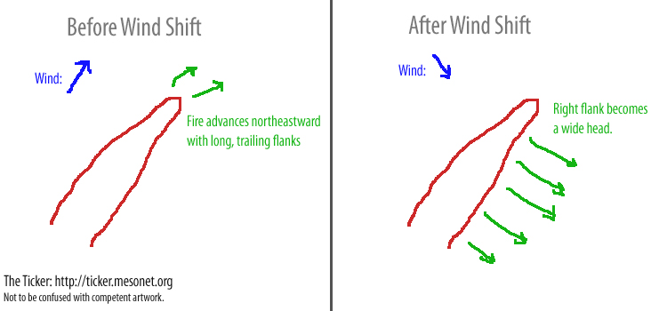
This 90-degree-wind-shift scenario is an extremely hazardous one,
and can quickly turn the flank of a wildfire into a very wide
front of a fire:
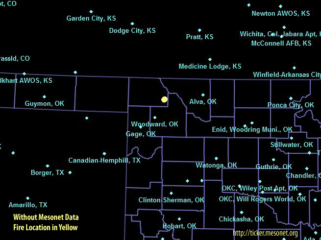
Here's the thing: up in northwestern Oklahoma, without the Mesonet,
a triangle of nearby weather stations (to determine approximate
location of wind shifts would be Woodward (19 mi), Alva (35 mi) and
Dodge City KS (75 mi):
With the Mesonet, the triangle is WOOD (19 mi), FREE (12 mi) and
BUFF (14 mi):
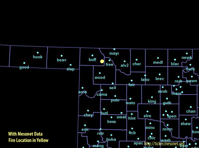
Which scenario would you want, if you had to help locate a wind shift?
Gravity Wave: Isn't That What my Belly Does When I Jump Up and Down?
Today's photo comes from Dr. J.D. Carlson of Oklahoma State
University. Dr. Carlson is the person behind many of the Mesonet's
fire management tools. He snapped several photos of a smoke plume
associated with one of this week's wildfires:
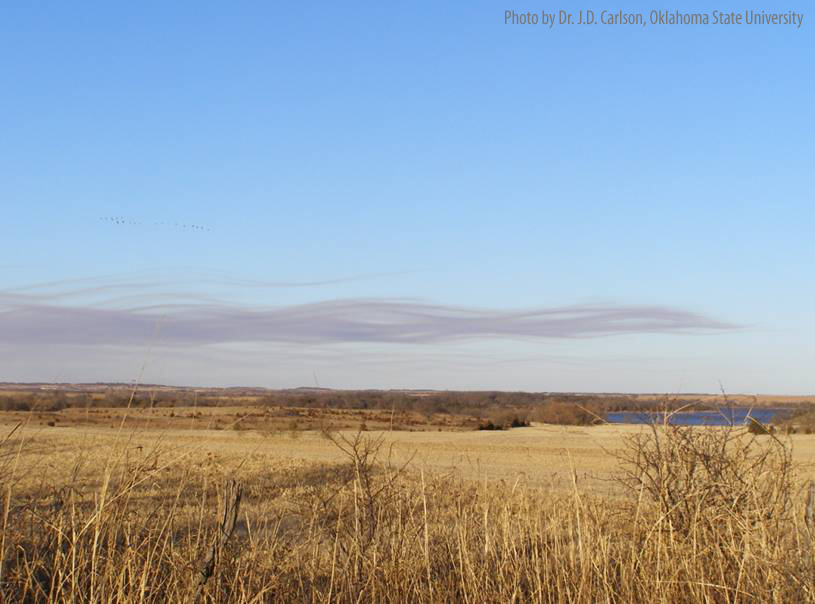
This is the extreme tail end (as in, "furthest from the fire") of
the plume, tens of miles from the actual wildfire. The rippling of
the plume is not only aesthetically enchanting, it also give some
evidence of atmospheric conditions that day. The up-down-up-down
wavelike pattern traced by the smoke is an indicator of ... well,
some up-down-up-down wavelike patterns on top of the boundary
layer (more succinctly called "gravity waves"). There are some
other pics from this set which we'll run tomorrow.
February 4 in Mesonet History
| Record | Value | Station | Year |
|---|---|---|---|
| Maximum Temperature | 84°F | NEWP | 2008 |
| Minimum Temperature | -12°F | KENT | 2022 |
| Maximum Rainfall | 2.37 inches | MTHE | 2020 |
Mesonet records begin in 1994.
Search by Date
If you're a bit off, don't worry, because just like horseshoes, “almost” counts on the Ticker website!