Ticker for September 3, 2008
MESONET TICKER ... MESONET TICKER ... MESONET TICKER ... MESONET TICKER ...
September 3, 2008 September 3, 2008 September 3, 2008 September 3, 2008
Trust Us, You Might Not See This EVER Again
Yesterday, Tropical Depression (nee "Hurricane") Gustav churned his
way across northwestern Louisiana. You can verify for yourself in
the following freeze frames from the Shreveport radar:
5AM: 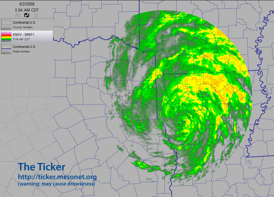
4PM: 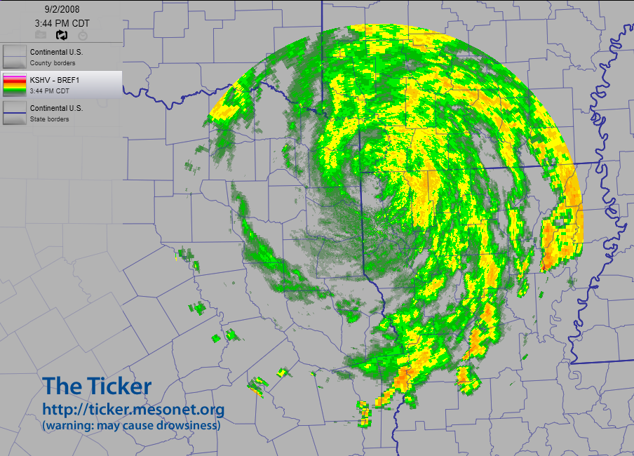
No, that's not the amazing part.
You can also see something neat in the radar's wind field. The winds
at the radar site (the little clear dot center of the graphic) switched
from northeasterly to southwesterly as Gustav passed:
5AM: 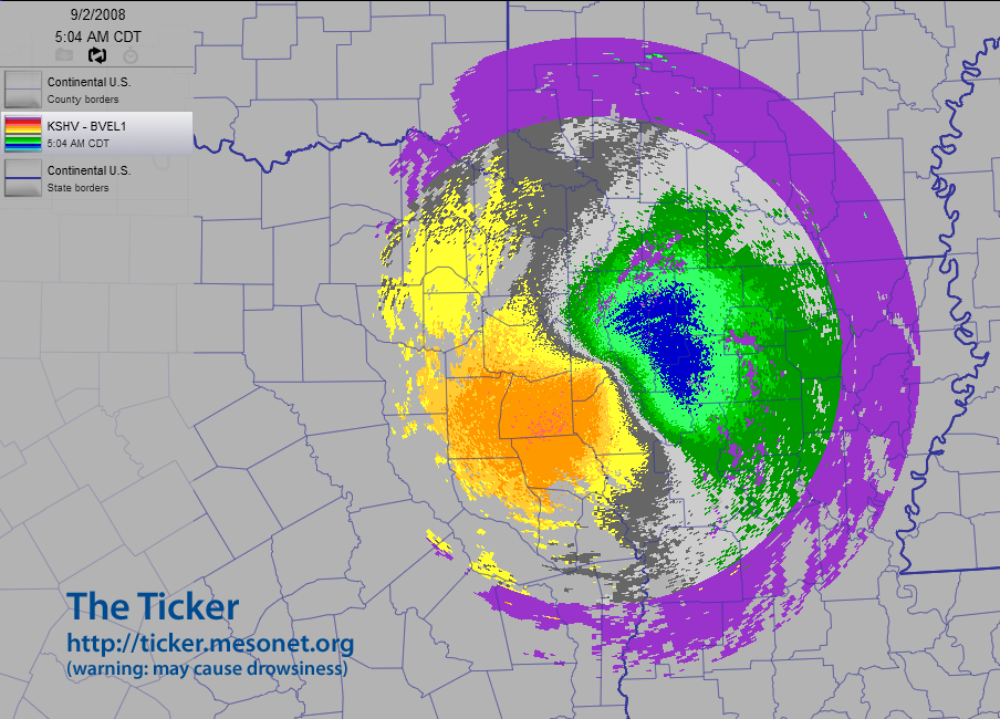
4PM: 
Now, if you're not used to looking at radar velocities, here's the trick.
Greens and blues are particles moving *toward* the radar. Reds, oranges
and yellows represent particles moving *away* from the radar (they are
showing you their "reddish taillights" as they speed away). The purple
areas are locations for which the radar could not make a confident
assessment of inbound or outbound.
In the 5AM image, the reddish colors are to the southwest, indicating
winds from the northeast. In the 4PM image, the reddish colors are
to the northeast, indicating winds from the southwest. Make sense?
You'll also notice that the colors are not as dramatic in the afternoon,
evidence of eleven hours of overland weakening.
No, that's not the amazing part.
Here's something neat. Check out the radar image from exactly 11:32 AM:

The circulation center is right-on, smack-dab, dead-set, on TOP of the
Shreveport radar!
No, that's not the amazing part.
Here's the amazing part. Imagine you were standing in the location
of the Shreveport radar, with a strong tropical depression swirling
around you. No matter which direction you looked, winds would be
blowing from right-to-left, wouldn't they? And these particles would
not be moving toward the radar (no greens), and they would not be
moving away from the radar (no reds).
Well, it happens that the Shreveport radar was standing in the
location of the Shreveport radar, with a tropical depression swirling
all around it. And guess what kind of "Doppler velocities" it saw
at 11:32 AM:

Yep, pretty much "zero" all the way around!
That's amazing!
If you want to see a movie of the process, here you go (warning, they
are pretty big files):
https://content.mesonet.org/ticker/archive/20080903/gustav.bref.short.mov (4 MB)
https://content.mesonet.org/ticker/archive/20080903/gustav.bvel.short.mov (2 MB)
September 3 in Mesonet History
| Record | Value | Station | Year |
|---|---|---|---|
| Maximum Temperature | 111°F | ARDM | 2000 |
| Minimum Temperature | 44°F | KENT | 2010 |
| Maximum Rainfall | 3.51 inches | COOK | 2008 |
Mesonet records begin in 1994.
Search by Date
If you're a bit off, don't worry, because just like horseshoes, “almost” counts on the Ticker website!