Ticker for June 11, 2008
MESONET TICKER ... MESONET TICKER ... MESONET TICKER ... MESONET TICKER ...
June 11, 2008      June 11, 2008      June 11, 2008      June 11, 2008


Yet Another Windy Day

Sometimes, spring can't seem to get the calendar right for
Oklahoma.  We get our mayflies in April, our junebugs in May.
And now we're getting our April winds in June.

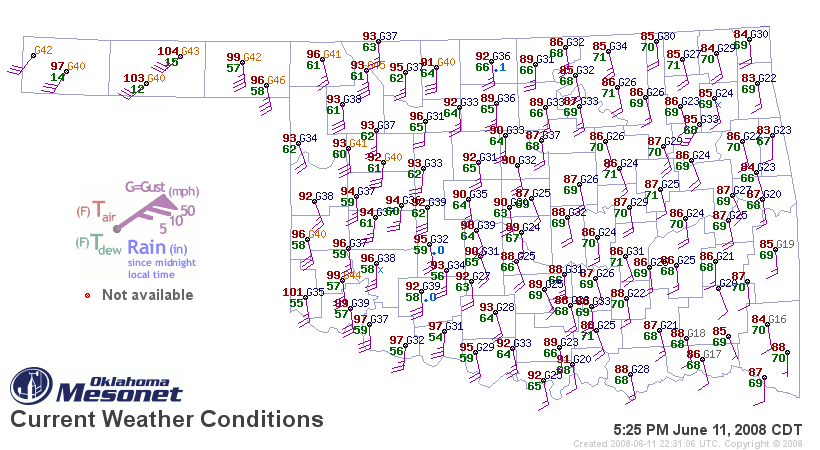
Strong southerly winds have raked much of Oklahoma since sunrise.

So, what gives?

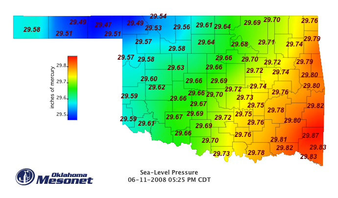
Like all windy days, pressure is the culprit. Well, not so much
the pressure itself. What's more important is the pressure gradient,
which is a measure of how rapidly pressure changes as you move from
one point on the map to another.

the rule of thumb is this: on a windy day,stand with the wind at
your back: you should have higher pressures to your right, and
lower pressures to your left. And that's what is in place today:


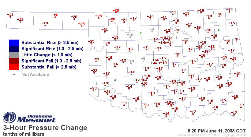
And why have the winds increased even more this afternoon? That
lower pressure to the west has dropped even more rapidly than
those to the east, increasing the pressure gradient:


(this map shows the change in station pressure over a three-hour
period this afternoon)
June 11 in Mesonet History
| Record | Value | Station | Year |
|---|---|---|---|
| Maximum Temperature | 108°F | ALTU | 2022 |
| Minimum Temperature | 44°F | KENT | 2004 |
| Maximum Rainfall | 6.05 inches | COPA | 2007 |
Mesonet records begin in 1994.
Search by Date
If you're a bit off, don't worry, because just like horseshoes, “almost” counts on the Ticker website!