Ticker for November 26, 2007
MESONET TICKER ... MESONET TICKER ... MESONET TICKER ... MESONET TICKER ...
November 26, 2007 November 26, 2007 November 26, 2007 November 26, 2007
An Answer to that Nagging Question
Been sitting around since Thursday night, trying to figure out what
caused the peculiarly strong temperature gradient along the Red River
in extreme southwestern Oklahoma?
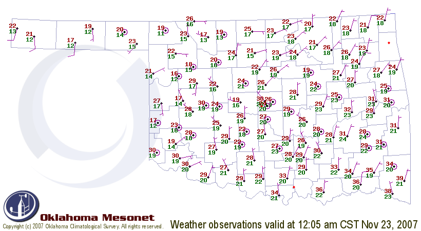
C'mon, admit it: you've been riveted for days, formulating hypotheses,
holding heated discussions with your extended family about nighttime
cooling, shooting pained glances at the heavens, waiting for guidance.
Have you urgently tried to reconcile the midnight cooling at Mangum
and Erick
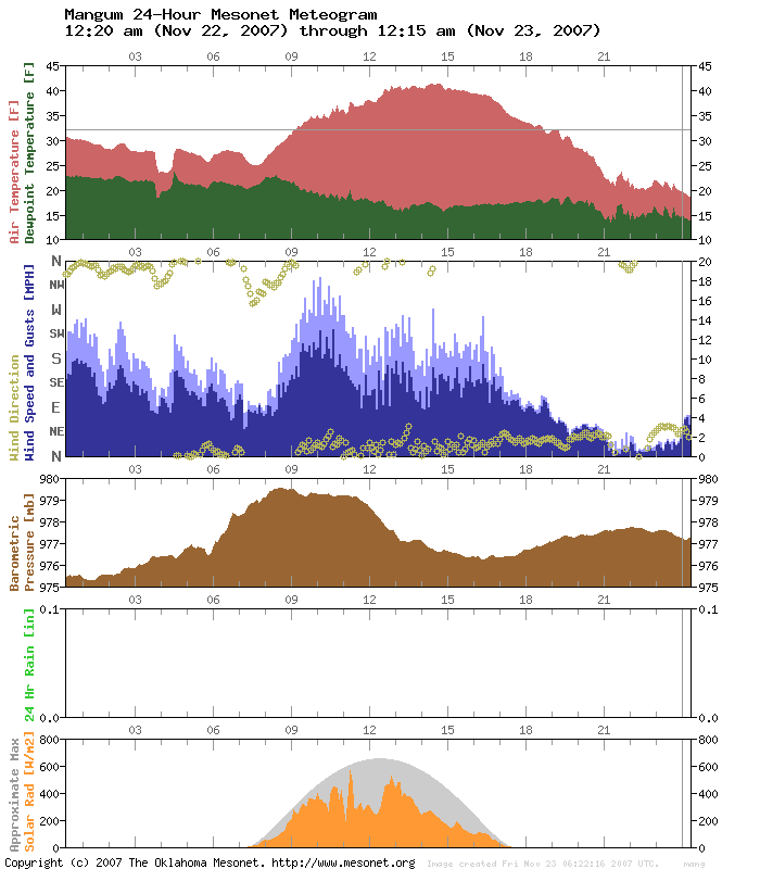
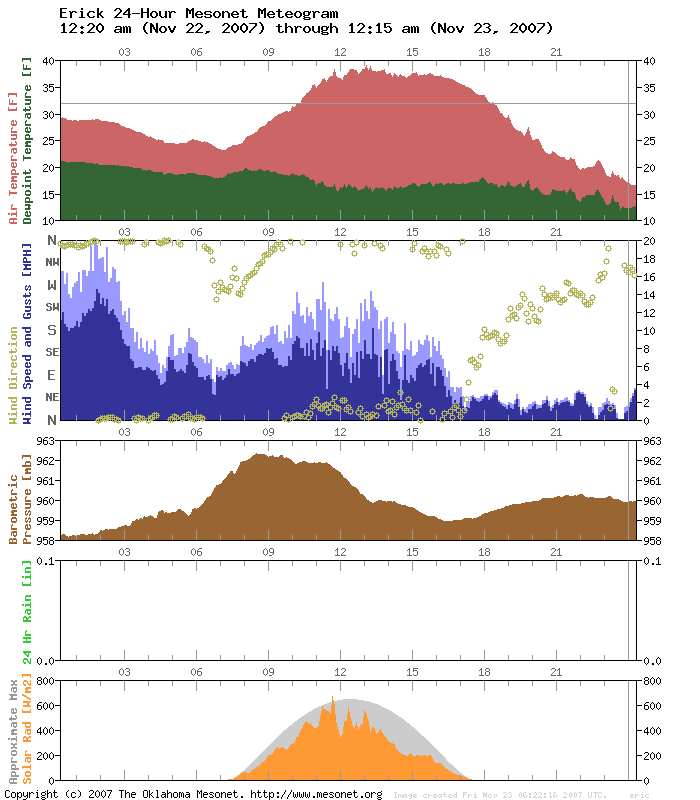
with the warm spike at Altus and Hollis?
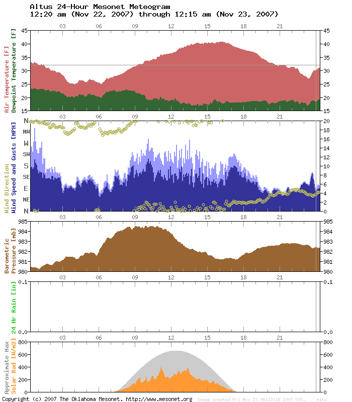
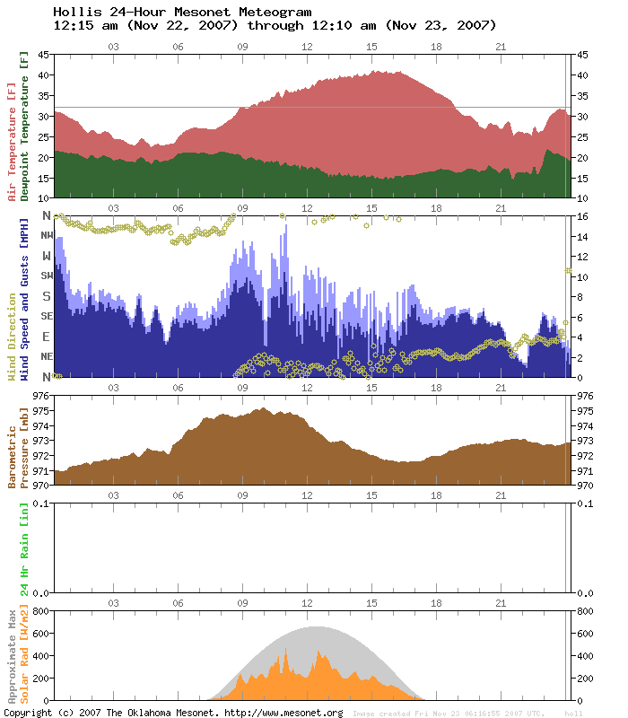
Oh, you say you haven't really worried about it? Surrrre (wink, wink).
Anyway, it appears that a thin stripe of low-level clouds was the
culprit. The clouds (pardon the cliche, but it's an okay cliche, and
cliches get a bad rap anyway) "act like a blanket" by preventing the
spaceward escape of infrared radiation. The low clouds show up as
a barely-discernible light-blue ribbon on the following IR image:
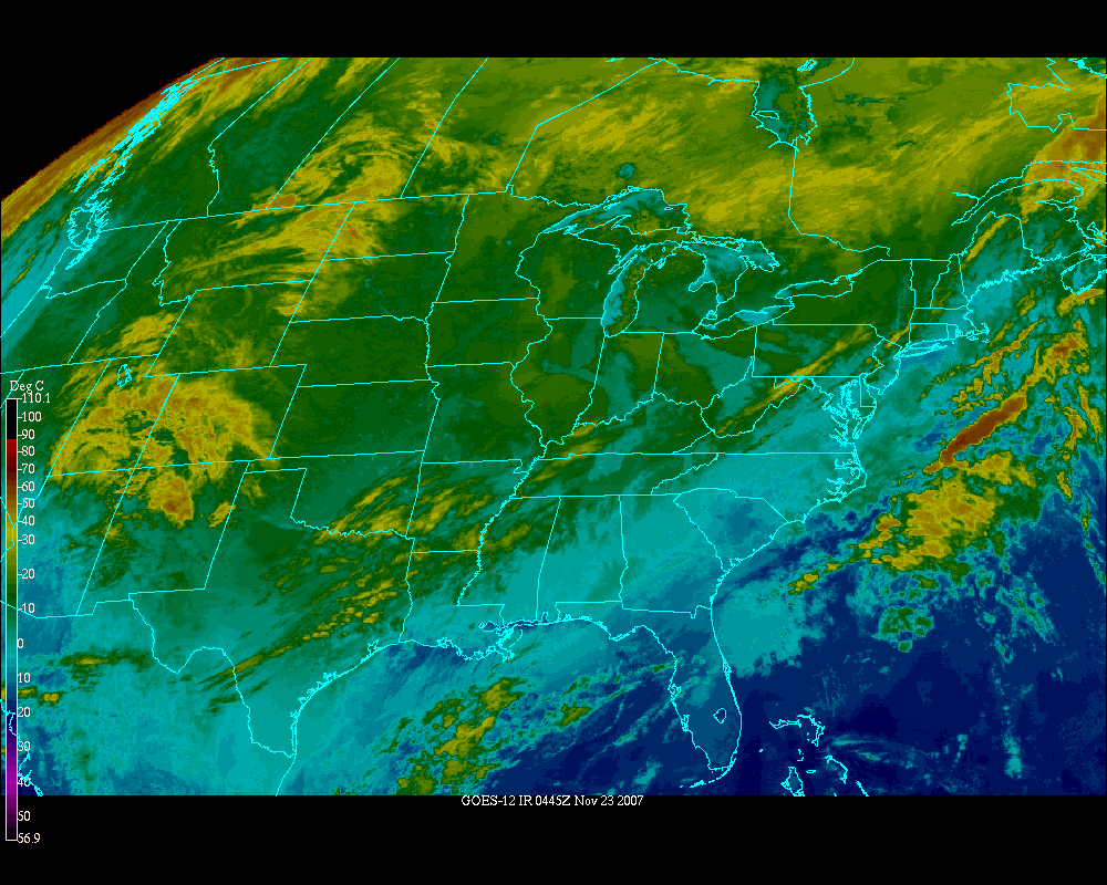
(courtesy of hoot.ou.edu)
Ignore the brighter cloud tops to the east. They represent higher
cloud tops, which have a lesser effect.
Entire Ticker Staff Packs Up, Heads to Boulder
Any Tickers this week will be written remotely from Colorado, as the
Entire Ticker Staff was invited to attend a workshop to develop a
framework to enhance our nation's climate literacy. Apparently, in a
serendipitous mistake, the Ticker was blamed on someone else,
freeing up a spot for us.
November 26 in Mesonet History
| Record | Value | Station | Year |
|---|---|---|---|
| Maximum Temperature | 80°F | NEWP | 2019 |
| Minimum Temperature | 8°F | KENT | 2010 |
| Maximum Rainfall | 2.61″ | COPA | 2015 |
Mesonet records begin in 1994.
Search by Date
If you're a bit off, don't worry, because just like horseshoes, “almost” counts on the Ticker website!