Ticker for September 25, 2007
MESONET TICKER ... MESONET TICKER ... MESONET TICKER ... MESONET TICKER ...
September 25, 2007 September 25, 2007 September 25, 2007 September 25, 2007


2007 Beginning to Lose the Water Horse Race

For most of the year, 2007 has been locked within shouting distance
of 1957 for the dubious title of "Wettest Year In State (and
territorial!) History". An early September burst placed 2007 in
second place in the chase, but recent a recent dryspell caused
this year to slip further behind its half-century senior, dropping
to fourth place:

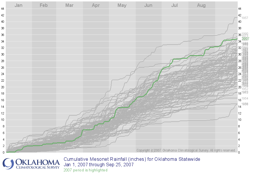
The following graphic shows the results of the stateside horse race
so far. The current year-to-date is the thick green line. All prior
years show up as gray:


A few things to note about the graphic. First, 1957 was a real
phenomenon. The rain started in Mid-May and simply didn't stop.
Second, the statistical distribution of rain in Oklahoma really
jumps out of the screen. Most of the years are bunched in the
middle, with some wet outliers, and some dry outliers. However,
if you squint and/or use your creative eye, you can almost detect
a "wet" normal and a "dry" normal. Seriously, can you see the two
threads in the Big Gray Braid?

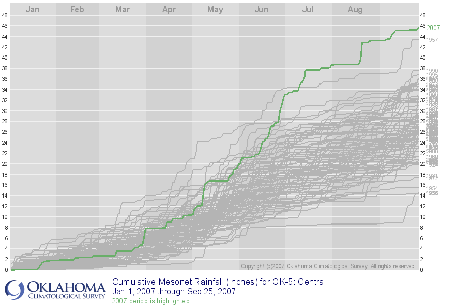
Of course, climate, like politics, is local. So let's look at a few
regions within the state. In central Oklahoma, 2007 is still ahead,
but the 1957 total is charging fast:


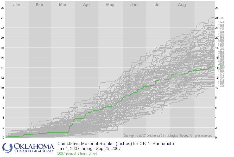
The panhandle continues to limp along with below-average precip:


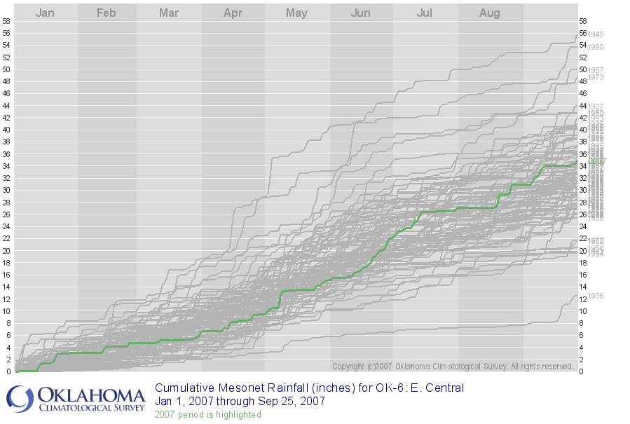
Finally, east-central Oklahoma's graph really drives home the
profound, incomparable dryness of 1936. Astonishing:

September 25 in Mesonet History
| Record | Value | Station | Year |
|---|---|---|---|
| Maximum Temperature | 102°F | SLAP | 2020 |
| Minimum Temperature | 29°F | BOIS | 2000 |
| Maximum Rainfall | 4.95″ | TISH | 2016 |
Mesonet records begin in 1994.
Search by Date
If you're a bit off, don't worry, because just like horseshoes, “almost” counts on the Ticker website!