Ticker for May 22, 2007
MESONET TICKER ... MESONET TICKER ... MESONET TICKER ... MESONET TICKER ...
May 22, 2007 May 22, 2007 May 22, 2007 May 22, 2007
Time The Avenger
Long time, no see! A heavy road schedule has made a mockery of our
"Every Business Day" claim. Nobody's Perfect. Call us Pretenders.
Speaking of Time ...
We're going back in time today to late April, when some neat optical
artifacts were revealed. Set your time machines for April 24, 2007
(cue electronic time-machine music here) ... A cluster of storms
pushed into eastern Oklahoma. Here's the "big picture" view:
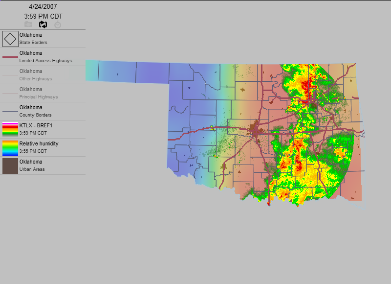
You'll see a mass of storms in eastern Oklahoma, and some curious
features in western Oklahoma. Let's zoom in:
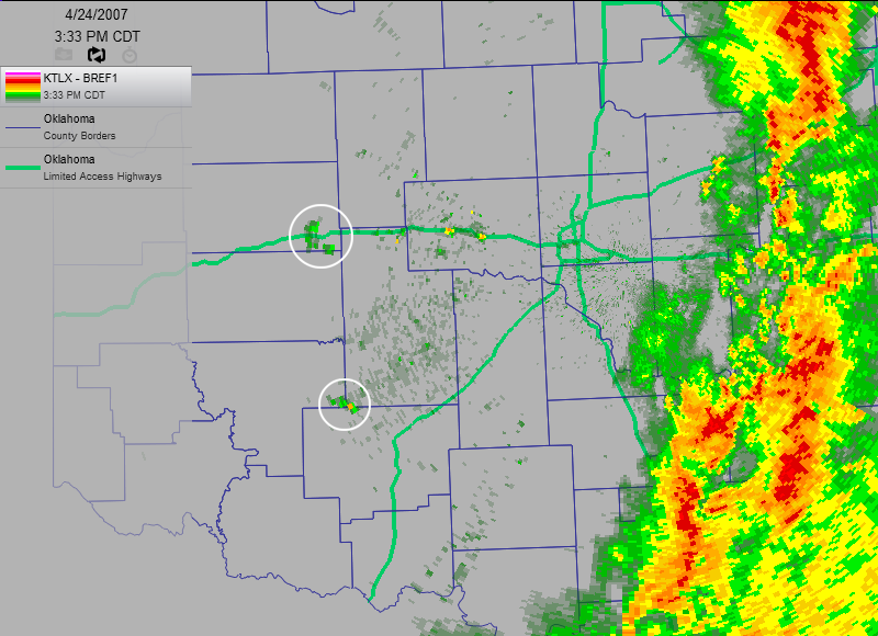
See those two blobs, circled so expertly by the Ticker Art Department?
The look like they might budding storms, but they're not. The radar
thinks they're about 8000 feet up in the air, but they're not. So, the
questions are:
1. What are those features? and
2. How does the Ticker Staff know they're not 8000 feet in the air?
First things first: take a look at the next 30 minutes of radar data.
You can click through frame by frame, or if you have Quicktime, you
can watch actually watch the movie:
Frame 1: 
Frame 2: 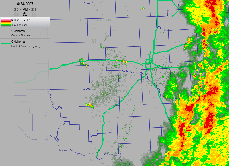
Frame 3: 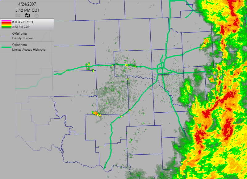
Frame 4: 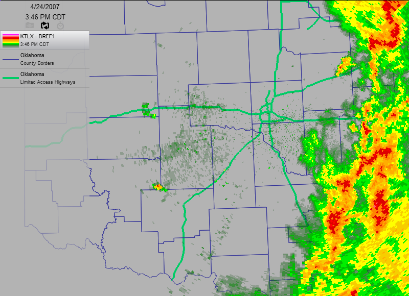
Frame 5: 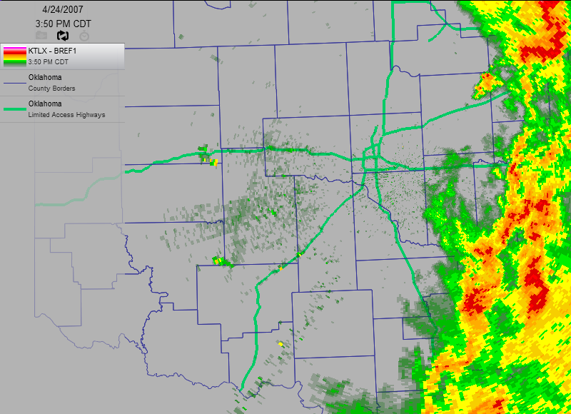
Frame 6: 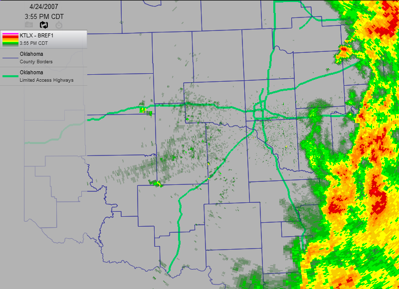
Frame 7: 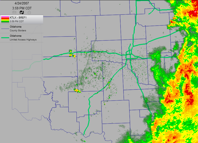
Movie: https://content.mesonet.org/ticker/archive/20070522/feature.mov
Notice that the two "budding storms" don't move. At all. One might say
they are fixed in place. And, one would be right. That's because these
are not atmospheric features. They are, in fact, quite terrestrial.
They are two clusters of objects that look a lot like this:
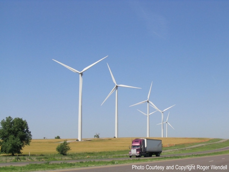
(photo graciously provided by Roger Wendell)
Indeed, the echoes on the radar images come from two very prominent
wind farms in western Oklahoma. That's why they are stationary in the
movie (if these things move from west to east at 40 mph, there are
some screwy tectonics in action!).
Now, the second question: why did these towers, only a couple hundred
feet high, show up on a radar beam that was supposedly 8000 feet off
the ground? The answer shows up really well in frame 7:

That thin line just to their east marks an outflow boundary, or the
western extent of the rain-cooled air deposited by the mass of storms
east of I-35. Cooler air is denser, so it hugs the ground in a thin
layer. When two fluids with different densities hang out one on top
of another, it does goofy things to the propagation of light waves.
You can verify this by sticking a pencil into a fish tank and observing
the "broken pencil" at the boundary between very dense water and
not-so-dense air. You can also drive around on a sunny day and see
mirages caused by a layer of very hot air near the surface underneath
not-as-hot air just above it. Radar beams are just as susceptible to
this type of bending as light waves.
So, to get to the point: the thin layer of rain-cooled air refracted
(bent) the radar beam to very near the ground and picked up the wind
farms near Weatherford and Lawton.
By the way, layers of cold air also bend sound waves, as we detailed
in a previous Ticker:
http://ticker.mesonet.org/select.php?mo=10&da=14&yr=2002
May 22 in Mesonet History
| Record | Value | Station | Year |
|---|---|---|---|
| Maximum Temperature | 104°F | ALTU | 2000 |
| Minimum Temperature | 32°F | EVAX | 2019 |
| Maximum Rainfall | 3.92″ | HOLL | 2016 |
Mesonet records begin in 1994.
Search by Date
If you're a bit off, don't worry, because just like horseshoes, “almost” counts on the Ticker website!