Ticker for October 13, 2006
MESONET TICKER ... MESONET TICKER ... MESONET TICKER ... MESONET TICKER ...
October 13, 2006   October 13, 2006   October 13, 2006   October 13, 2006


First Freeze

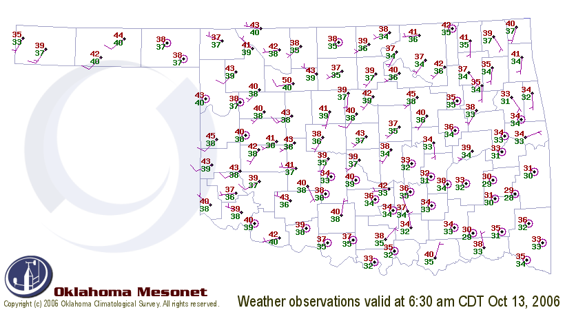
Clear skies and very light winds amplified the recent passage of a cold
front and brought Oklahoma's first sub-freezing temps of the season
this morning. Here's a snapshot from 6:30 am:


Several locations in the southeast had dipped below the freezing mark
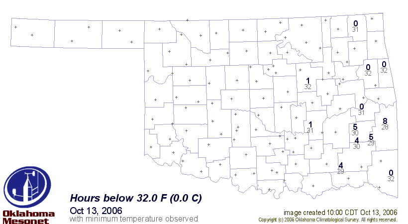
by sunrise. If you're concerned about the depth and duration of the
overnight freeze, here's a map that shows how long temps stayed below
freezing (blue numbers), and just how low the temperature dipped (gray
numbers):


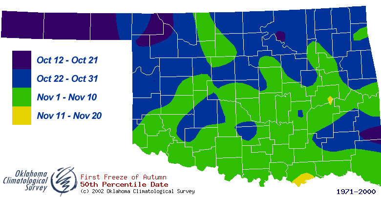
Finally, for those parts of southeast Oklahoma that got frost this
morning, it's a tad early compared to average ... but it's really not
out of the norm for the region. The following map shows the median date
of the first freeze of fall for the state:


Notice the early onset - compared to neighboring regions - in parts
of southeast Oklahoma. The protected valleys tend to get in situ
cooling and/or "cold air drainage" that lead to earlier and deeper
freezes. Since people and thermometers tend to settle in valleys, that's
where the records are taken!
October 13 in Mesonet History
| Record | Value | Station | Year |
|---|---|---|---|
| Maximum Temperature | 93°F | FREE | 2015 |
| Minimum Temperature | 24°F | KENT | 2019 |
| Maximum Rainfall | 4.60″ | OILT | 2012 |
Mesonet records begin in 1994.
Search by Date
If you're a bit off, don't worry, because just like horseshoes, “almost” counts on the Ticker website!