Ticker for April 7, 2006
MESONET TICKER ... MESONET TICKER ... MESONET TICKER ... MESONET TICKER ...
April 7, 2006 April 7, 2006 April 7, 2006 April 7, 2006
The Usefulness of Unintended Uses
One of the Ticker's recurring themes during the last few months has
been the ability of radar to see non-precipitation phenomena. And
that's appropriate, because there hasn't been much precipitation
to see during the last few months.
Anyway, last night brought terrible storms to eastern Oklahoma, and
one stage of their evolution is obvious in the eastern half of this
image from the NWS's Oklahoma City radar at 6:21 pm:
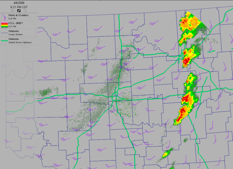
However, if you look away from the bright colors in eastern Oklahoma,
you can see some interesting features that are emphatically unrelated
to precipitation. In fact, they are probably anti-related to
precipitation, if there is such a term.
The first of these is in the most westward reaches of the map, where a
plume emanates from Roger Mills County. This is the radar reflection of
smoke particles from a large and long-lived wildfire near Cheyenne.
County map: 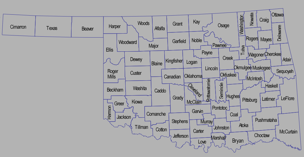
The other notable feature is a big, fuzzy swath draped over the OKC
metro area from southwest to north. A similar feature also shows up on
the simultaneous image from the Frederick radar, but it appears to be
farther southwest of the OKC radar's indication:
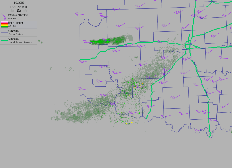
Well, it's actually the same phenomenon, but because it is near the
earth's surface, the radars only see it near the radar. Farther away,
beam is too high to detect it. However, pasting the OKC and Frederick
radars atop each other shows it's a continuous feature:

It's a dust plume, swept from the arid reaches of far western Texas and
eastern New Mexico and borne on the very strong winds associated with
the synoptic storm system still evolving in the Central Plains. If you
were in the western two-thirds of Oklahoma yesterday, you probably
chewed on this dust at some time during the day.
An hour later, the radar at Frederick had switched into clear-air
mode and showed some additional non-precipitation phenomena:

The dust plume is still evident directly over the radar site, and the
smoke plume from Roger Mills County is nearly 100 miles long. Focus on
the tiny speck of echoes in western Greer County. Twenty minutes later,
that tiny speck exploded into an echo that filled half the county:
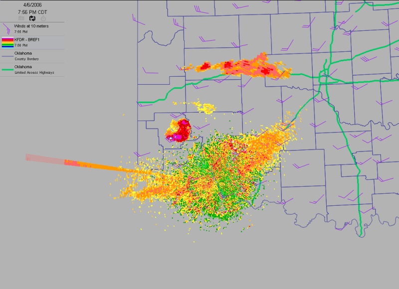
We at the Ticker are almost certain the exploding echo in Greer County
represents colonies of cave bats emerging at sunset (the spike extending
almost due west from the radar is caused by the setting sun). After some
extensive, thorough research, we believe these are Cave Myotis bats
(myotis velifer) lurching into the dusk for a nocturnal feeding frenzy
on Greer County's finest insects (they like moths best).
Full disclosure: Don't take our word for it. The last life science
course the Ticker Staff took was in 1987, and our "thorough, extensive"
research consisted of a 15-minute perusal of internet search engines.
And we are oh-for-two on identifying species in our history, anyway.
Who can forget the American Kestrel debacle of February 2004, or the
egregious Purple Martin episode of last August?
Anyway, to close this non-precipitous Ticker, we show you the OKC radar
from 9:39 pm:
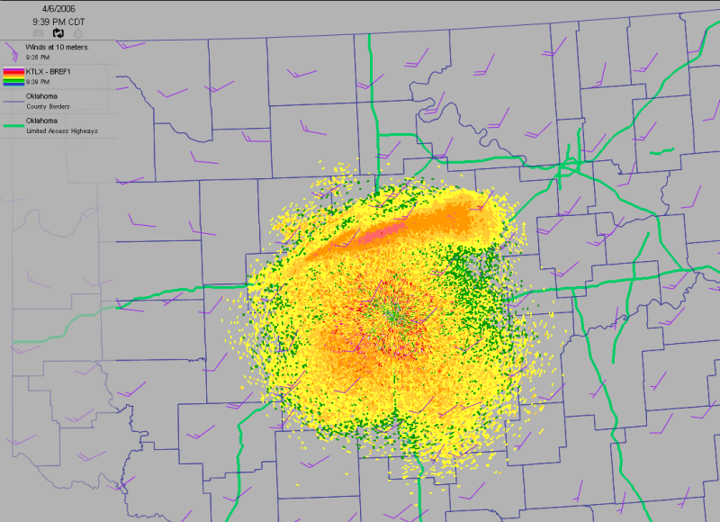
The enhanced reflectivities are remnants of the Roger Mills County
smoke plume, nearly 150 miles away. Portions of that fire are still
burning.
April 7 in Mesonet History
| Record | Value | Station | Year |
|---|---|---|---|
| Maximum Temperature | 96°F | HOLL | 2015 |
| Minimum Temperature | 16°F | CAMA | 2009 |
| Maximum Rainfall | 6.03 inches | ANTL | 2002 |
Mesonet records begin in 1994.
Search by Date
If you're a bit off, don't worry, because just like horseshoes, “almost” counts on the Ticker website!