Ticker for November 3, 2005
MESONET TICKER ... MESONET TICKER ... MESONET TICKER ... MESONET TICKER ...
November 3, 2005 November 3, 2005 November 3, 2005 November 3, 2005
Fire Danger Model Updated Hourly
These days of elevated fire danger call for a tool to assess the
situation. Thankfully, we have one of those lying around.
The Oklahoma Fire Danger (OKFD) Model is an outstanding by-product
of the OSU/OU partnership facilitated by the Oklahoma Mesonet. It
provides a number of detailed, statewide assessments of several
fire-danger variables (we provide examples from the noon data below).
The model begins with fuel models that represent vegetation in various
parts of the state. It uses special satellite data to make a weekly
assessment of the vegetation's fire susceptibility. Finally, hourly
Mesonet data is sprinkled in to keep the model accurate on an
up-to-the-hour basis.
Here's an example of the noon-time Mesonet data from today:
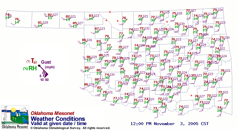
You can see that conditions are very warm, dry and windy across most
of the state. Notice the very low relative humidities in far western
and far eastern Oklahoma.
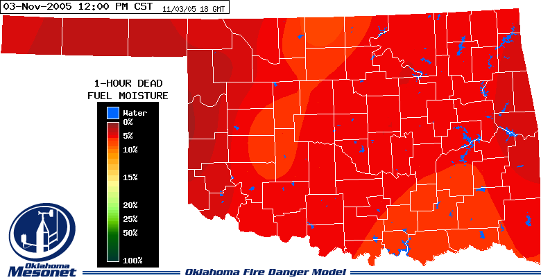
The OKFD model takes the current weather data and estimates the
moisture content of dead/dormant vegetation that could be fuel for
today's wildfires. At noon, the entire state was very dry, but
especially so in the east and west:
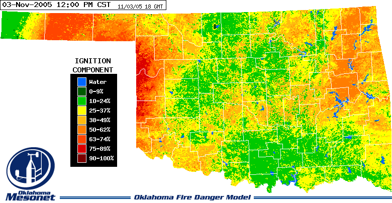
This information can also be used to assess the chance that a
reportable wildfire will result from careless activity:
Finally, to help fire professionals prepare for any unfortunate call,
the model gives an estimate of a wildfire's forward speed and the
height of the flame at the head of the fire. Both of these variables
impact decisions on how to fight fires should they occur.
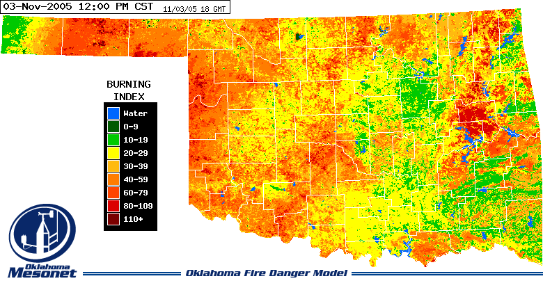
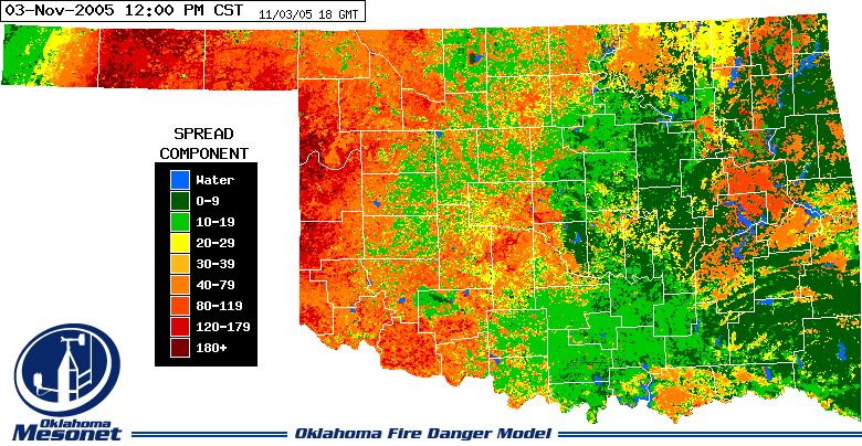
The noon-time data suggests flame lengths exceeding six feet in some
areas, with a forward speed approaching 180 feet per minute!
The OKFD Model is updated hourly during afternoons at:
http://agweather.mesonet.org/models/fire/modeloutput.php
For more information about the model, check out its home page:
http://agweather.mesonet.org/models/fire/default.html
Or, you can jump right into the gory details of the model here:
http://agweather.mesonet.org/models/fire/description.html
November 3 in Mesonet History
| Record | Value | Station | Year |
|---|---|---|---|
| Maximum Temperature | 93°F | MANG | 2005 |
| Minimum Temperature | 10°F | KENT | 2004 |
| Maximum Rainfall | 6.69″ | TISH | 2024 |
Mesonet records begin in 1994.
Search by Date
If you're a bit off, don't worry, because just like horseshoes, “almost” counts on the Ticker website!